
Spotted on Sandy Lake
Click on image for larger version
UPDATE Sep 4, 2023: There is still – a month and more after the Big Precipitation Events – a lot of water being held back by the intact landscape. See below
———
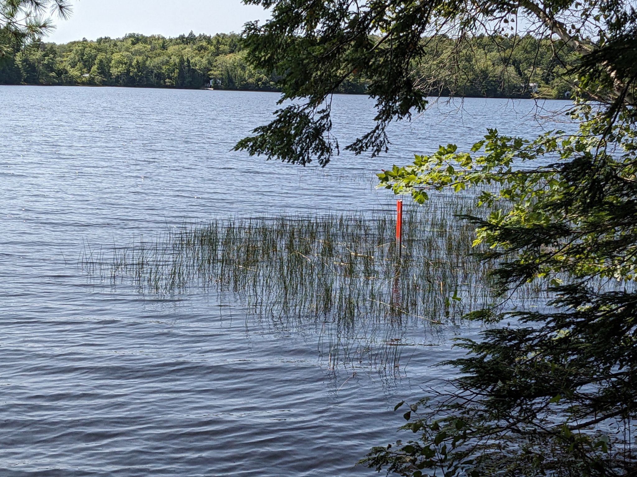
Sandy Lake fan and top Sandy Lake iNaturalist reporter Sybil Nunn recently spotted the red-topped post at right in the water at Sandy Lake, just below the big parking lot.
She wondered what it’s for and speculated it’s for monitoring water levels. That seems logical as there was massive flooding of the lake and many low areas withon in the Sandy Lake watershed in late July and early August and further downstream in Bedford. Two residents close to Sandy Lake estimated that the lake rose 5-6 ft above previous levels, and said it only started to come down a couple of weeks back.
Perhaps there is now some effort now being made to determine how significant the Sandy Lake sub-watershed is in reducing flooding downstream- and how proposed new development on up to 56% of the subwatershed area might increase the flooding. Inexplicably, the impact of possible new development of lands by Sandy Lake should have been modelled as part of the Sackville Rivers Floodplains Study (2017). But it wasn’t.
What we do know is that all that precipitation earlier this summer had significant effects on lake chemistry/water quality (see last post).
In 2019, the opposite happened when in August, the water level dropped precipitously. Coincidentally or not (I think not), there was a massive but short lived algal bloom which made the lake un-swimmable – see Post Aug 7, 2019
So there’s lots of interest in those water levels!
Thx for the report, S.N! ‘Will let you know if I learn anything about it!
Update Sep 4, 2023
I was at Sandy Lake Beach Park area yesterday. A few observations:
– Sandy Lake water level was still very high and the water very brown:

Click on photos to view larger versions
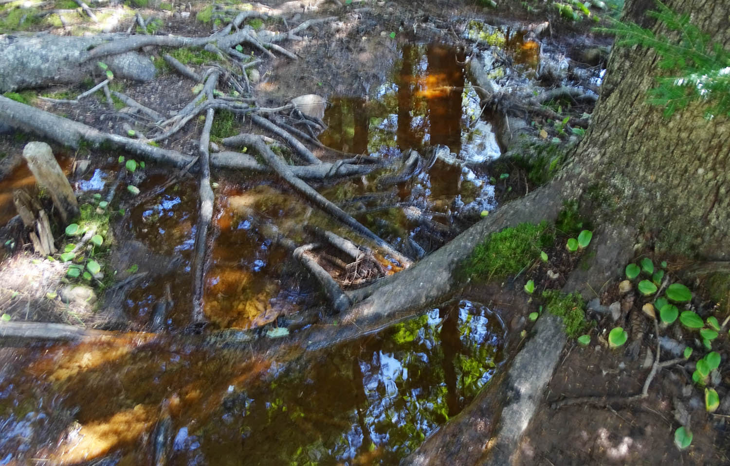
– In the lower areas of the landscape by streams (we rarely see them in the uplands), there was still a lot of water being held in and moving through, floodplain areas:
– There clearly had been massive water flow along the old forestry roads, and associated rill erosion:

– Within intact forest a little higher up, there was no sign of disruption (e.g. rill erosion) from the heavy rain events:
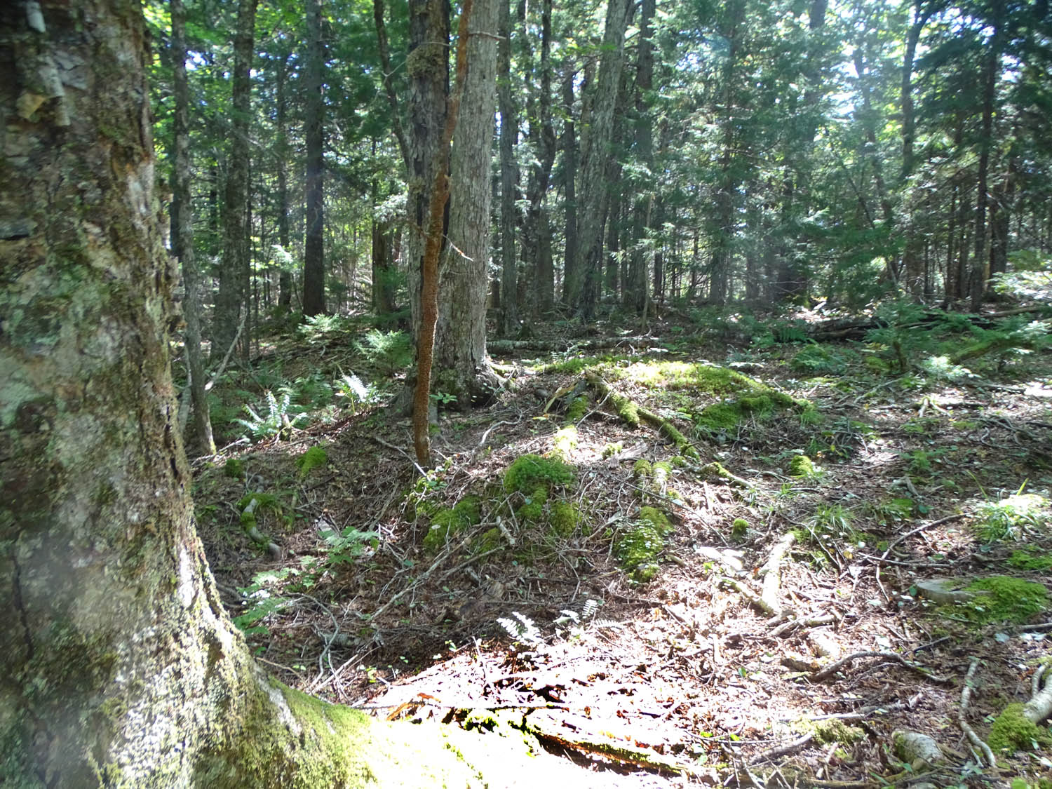
All of which shows there is still – a month and more after the Big Precipitation Events – a lot of water being held back by the intact landscape.
It would be difficult, if at all possible, to replace large portions of this landscape with settled areas and NOT greatly increase volume and speed of runoff during extreme precipitation events.