
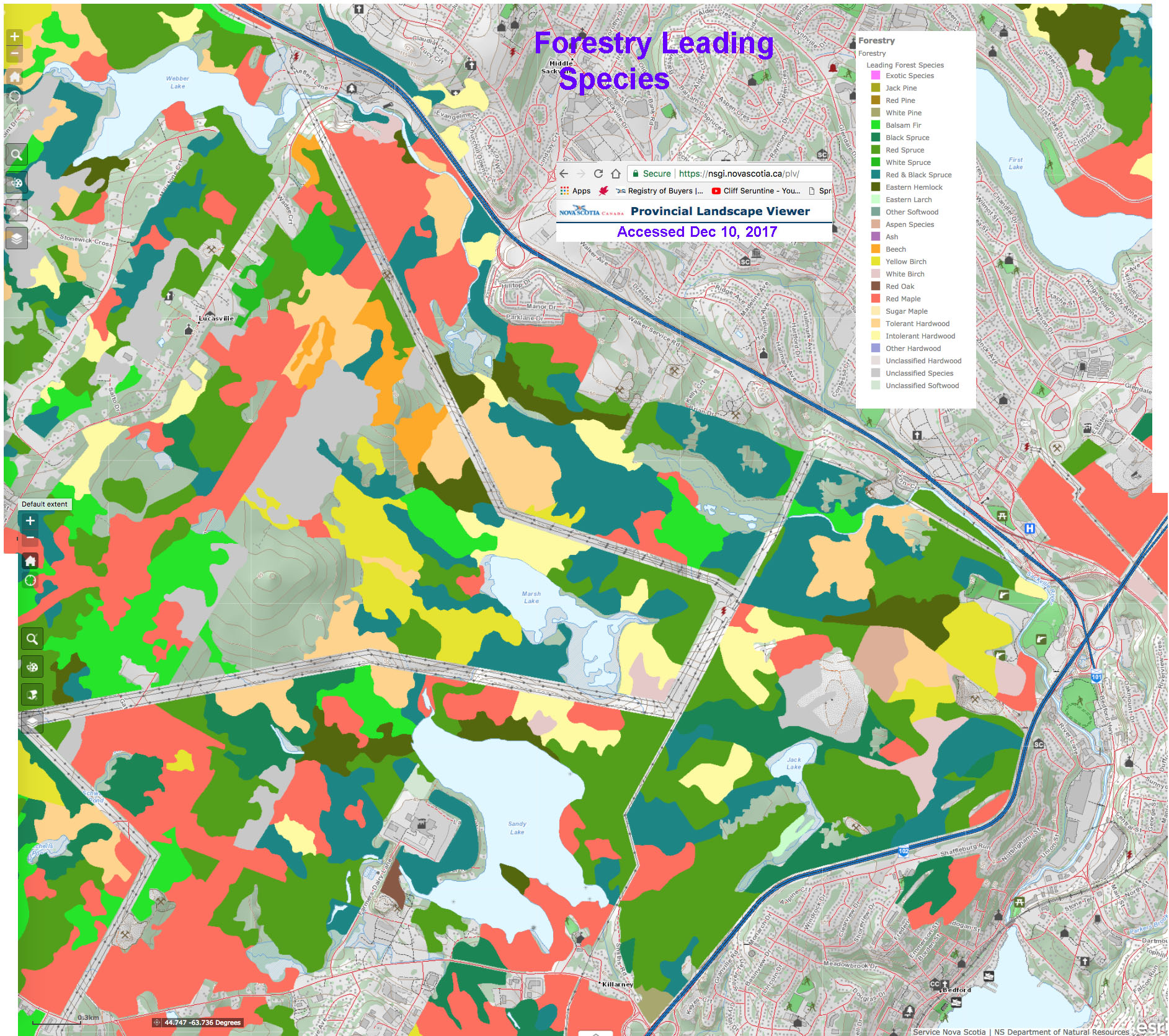
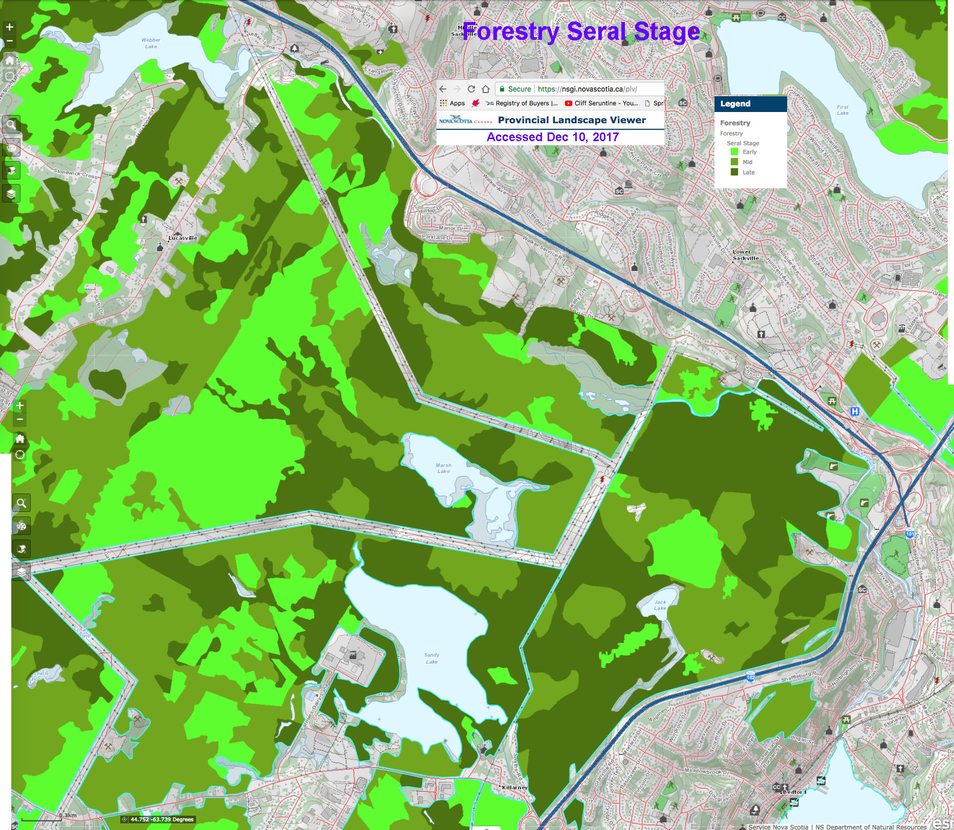
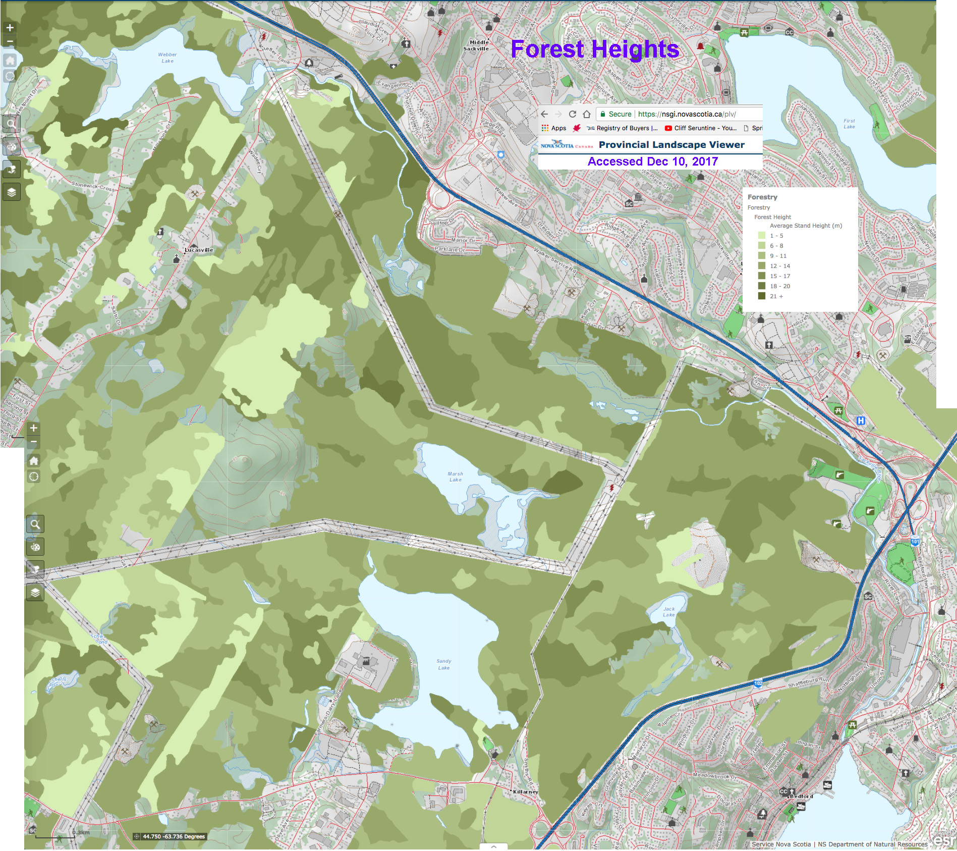
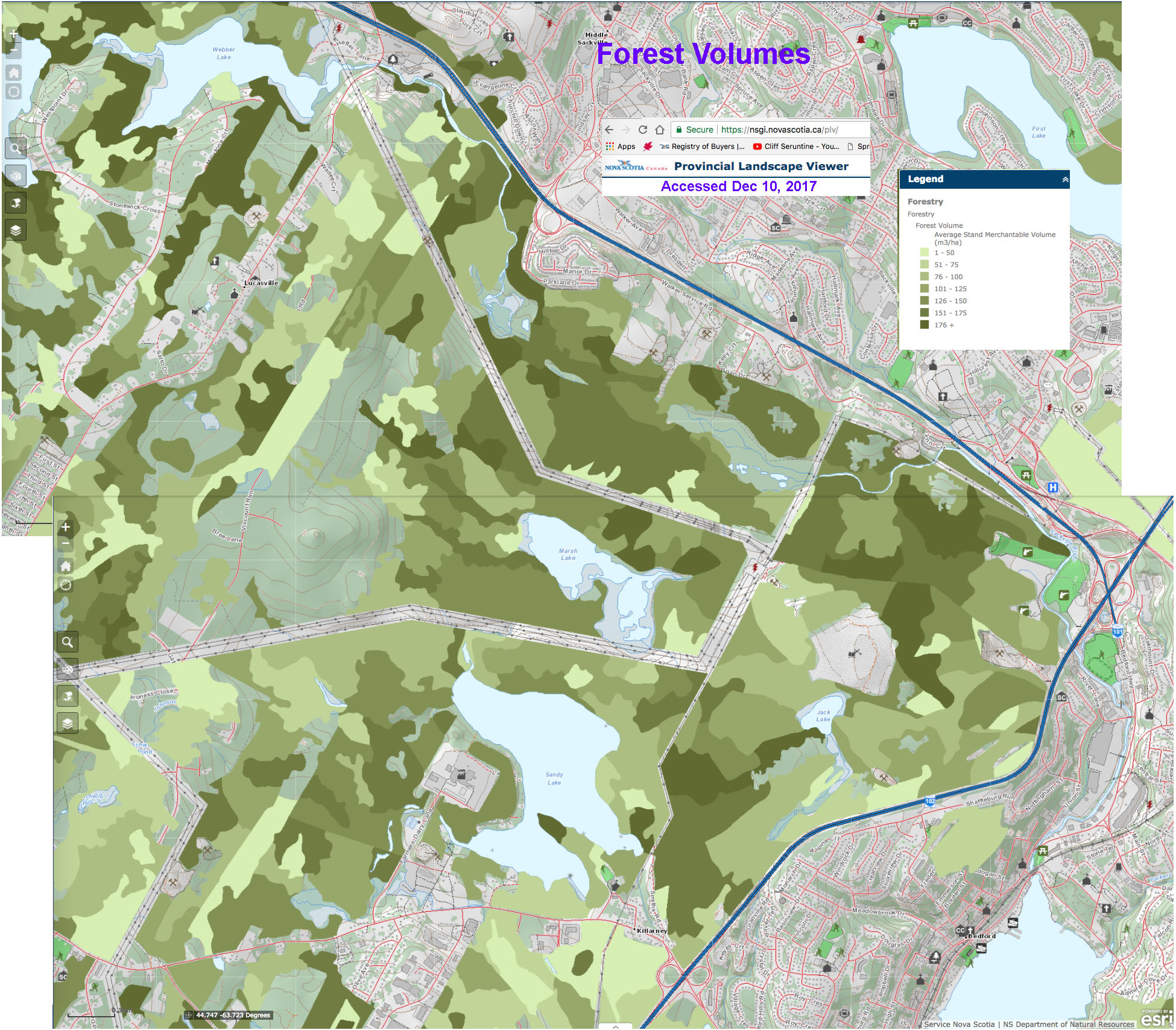
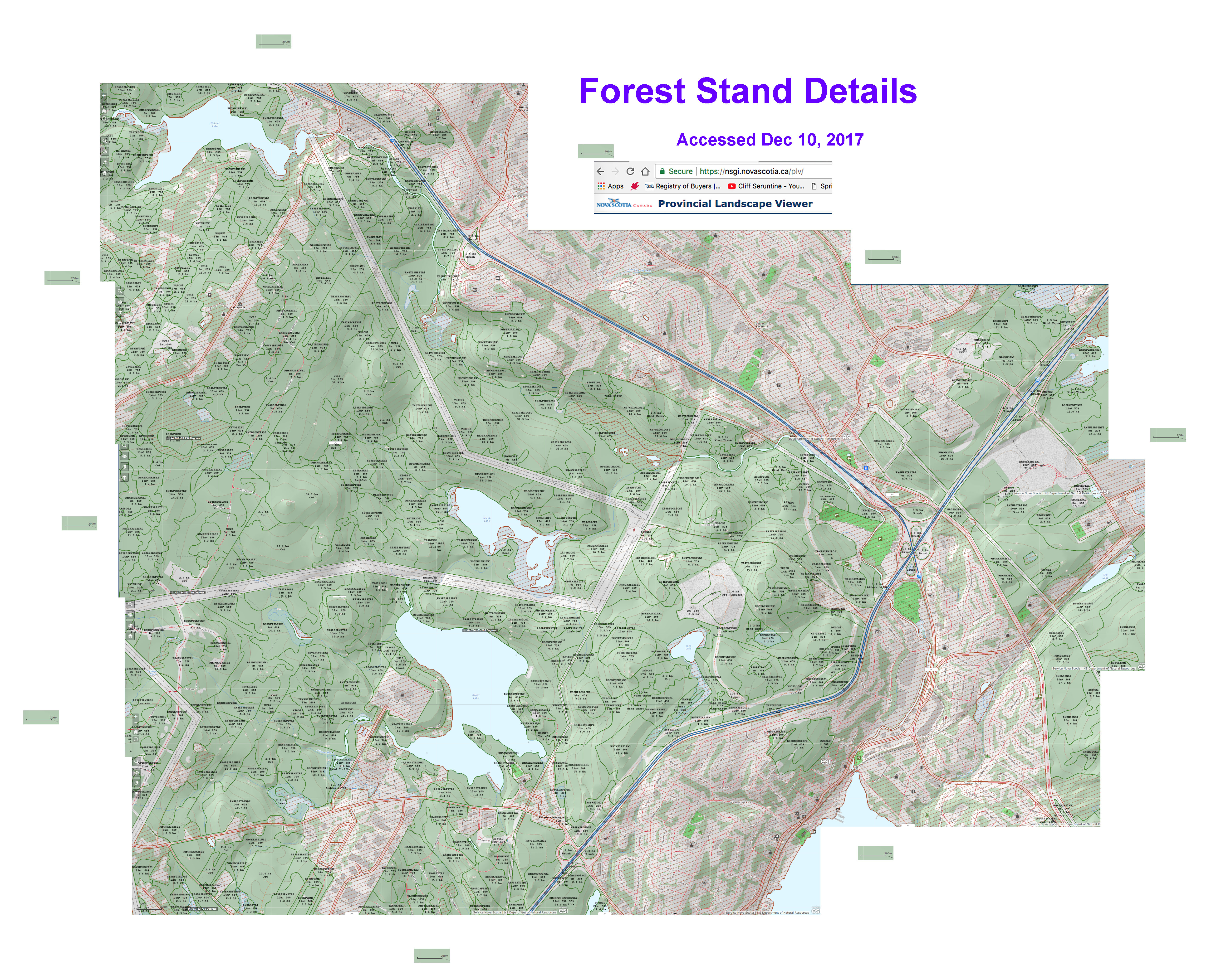
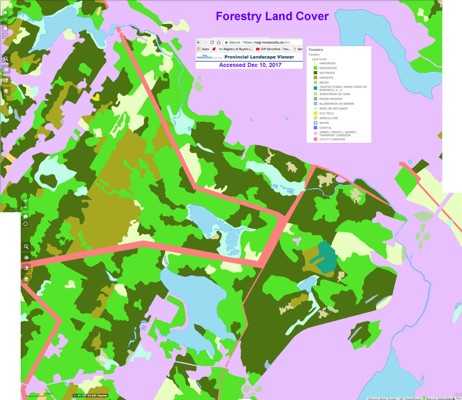
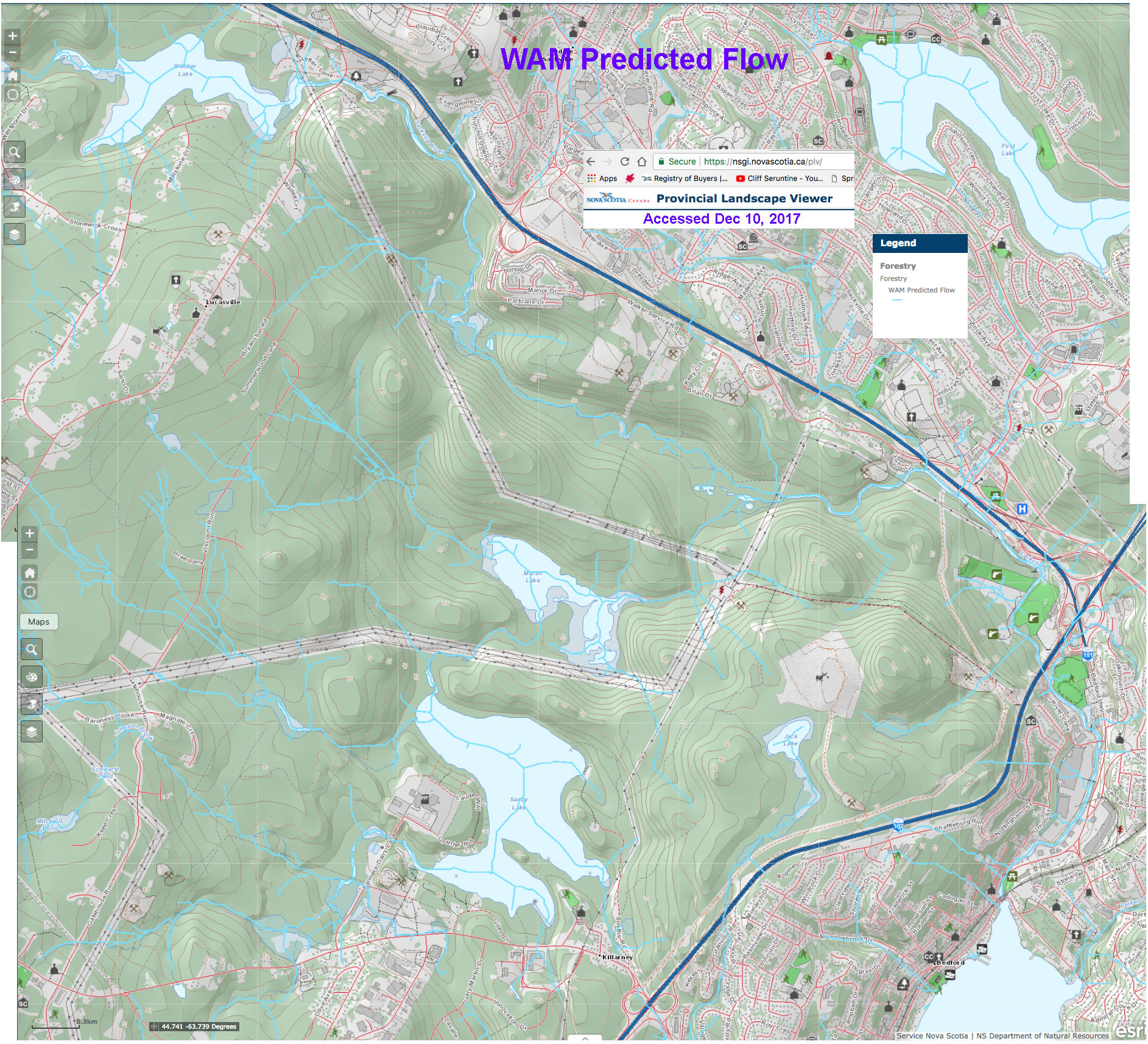
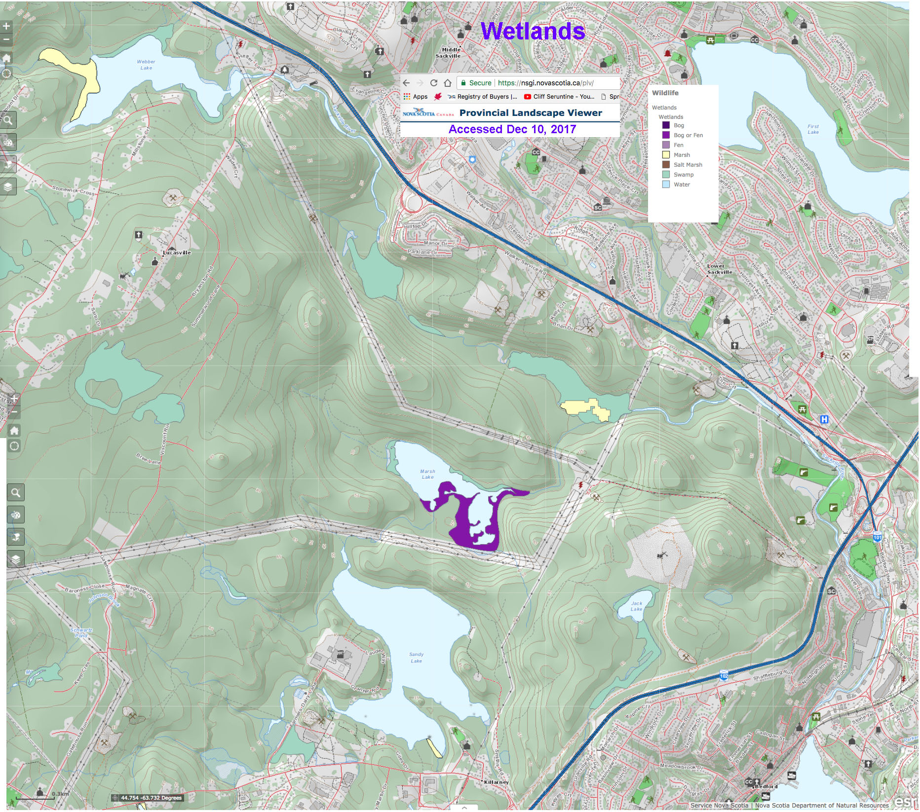
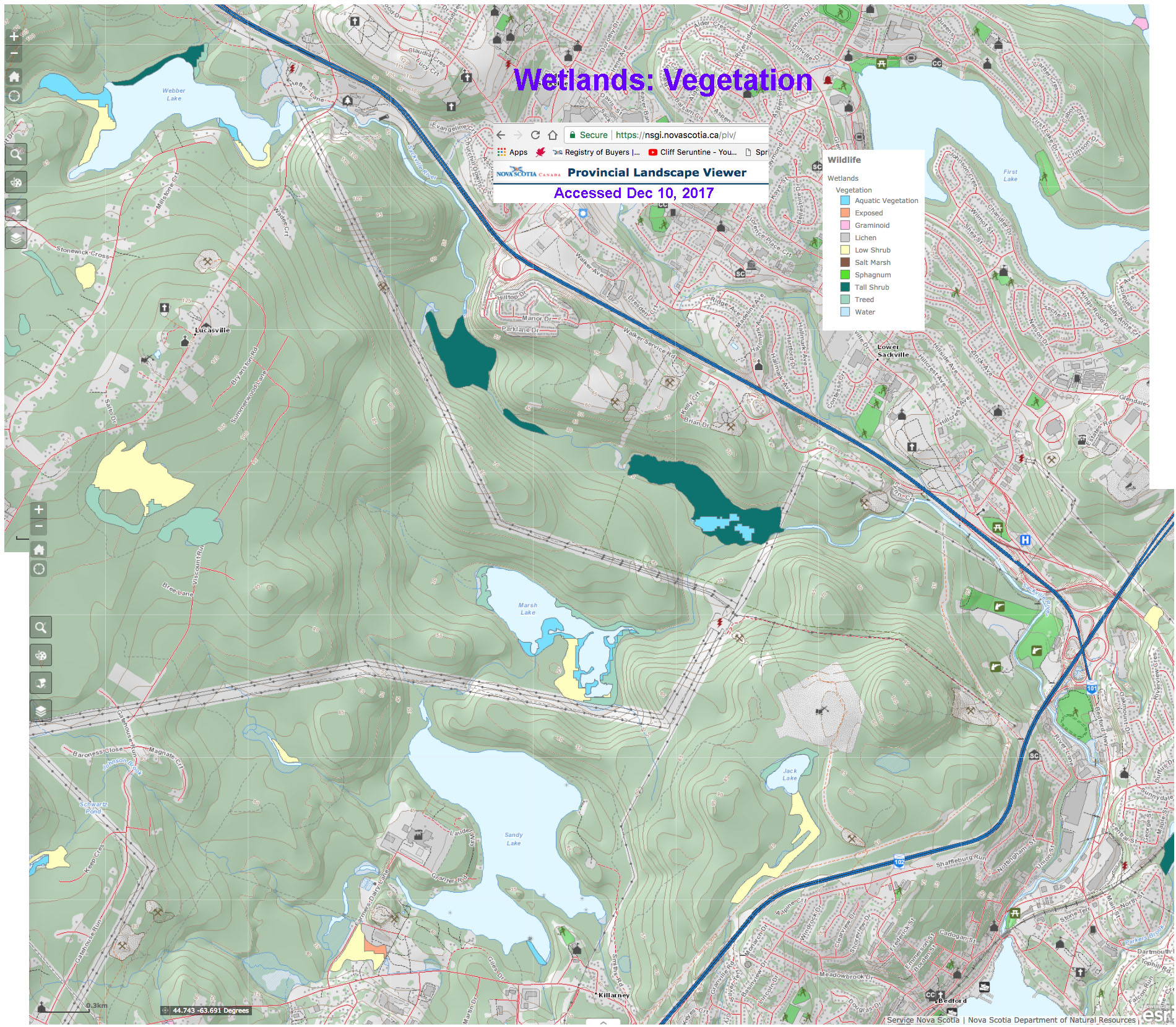
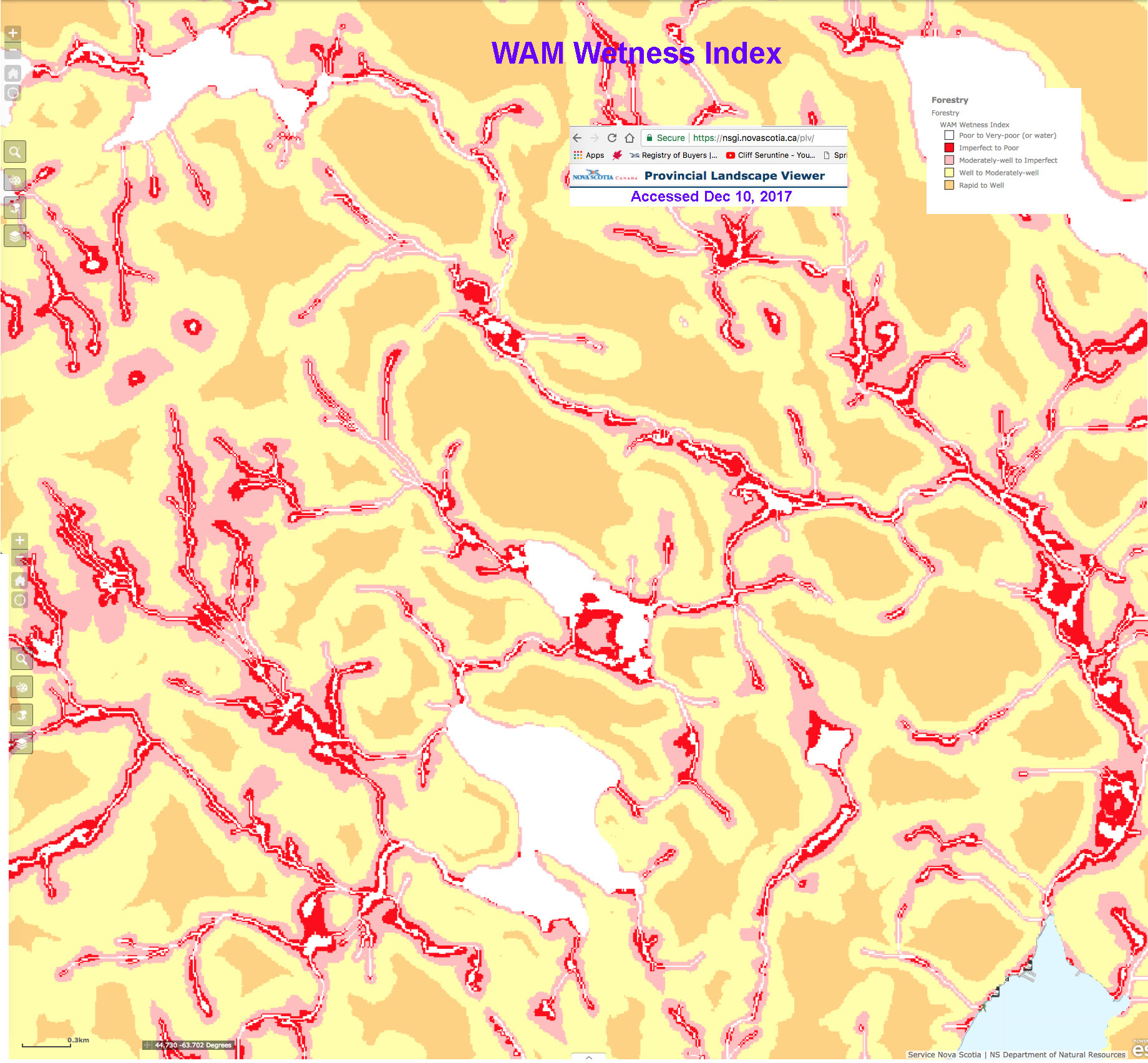
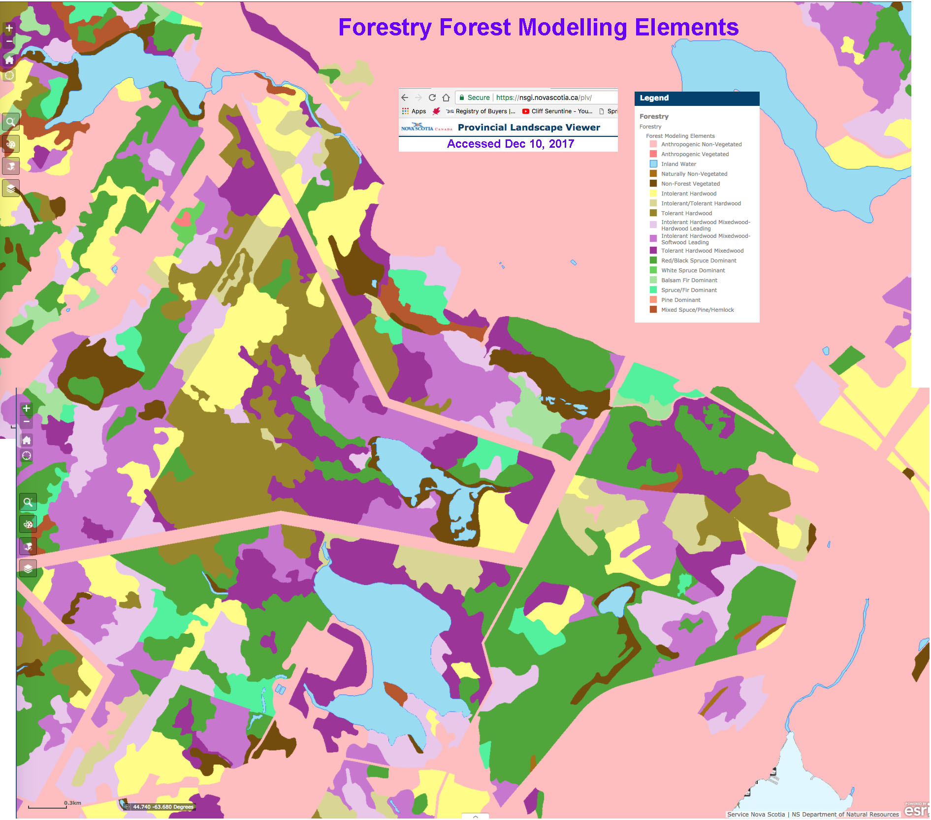
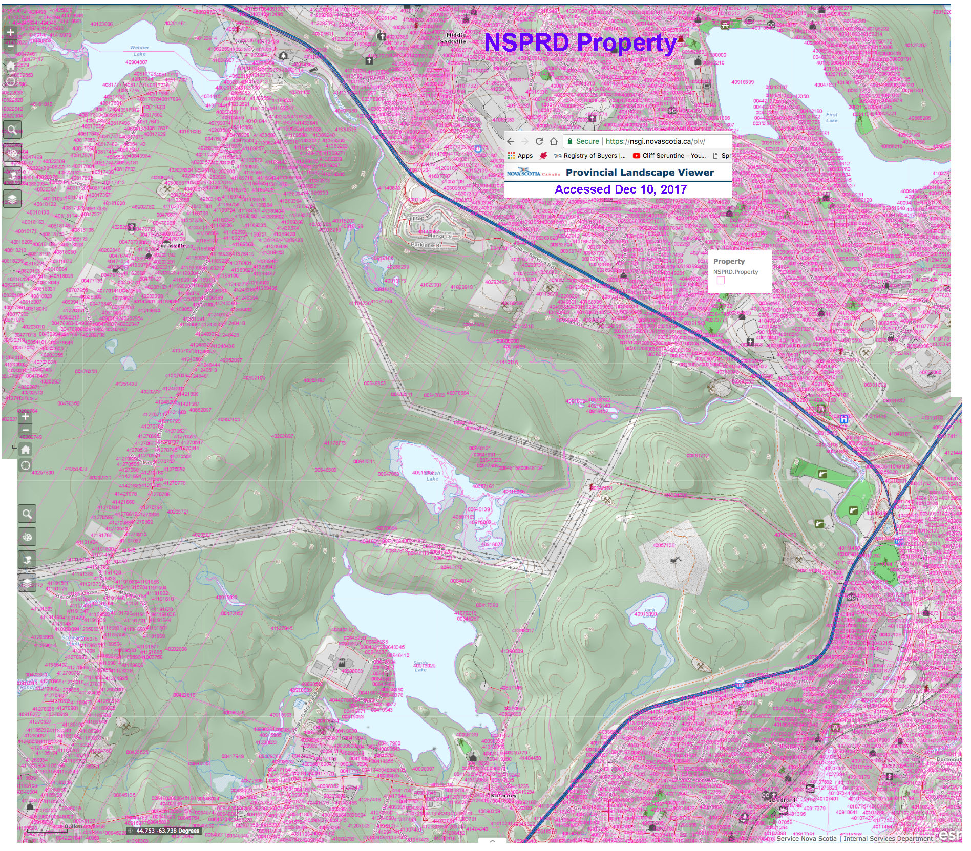
“The Provincial Landscape Viewer is a mapping tool developed by the Nova Scotia Department of Natural Resources (DNR) to provide easy access to ecological landscape data, along with forestry and wildlife information for natural resource planning and management.”
For convenience, I have made screen capture of layers that are especially useful in relation to the natural history of Sandy Lake and Environs. Of course one can go directly to the map viewer, and select the appropriate layer to see the same thing.
These maps are based on data obtained by aerial photography. For species composition, volumes etc., they are a first approximation; some differences may be found on the ground.
To see the maps at 100%, use ctrl+ (PC) or command+ (Mac) to enlarge the map that comes up in the browser when you click on a link below; to make the browser smaller again, use ctrl- or command-.
Also view: Ecological Land Classification for Sandy Lake
and Ecological Land Classification for Nova Scotia Map (PDF)