
Woody debris washed down from the 2013 clearcut via Karen’s Brook forms a fan of dark woody surficial deposit on the lake bottom extending outwards from the mouth of the brook and may have led to some shallowing/increased growth of emergent aquatics in the shallows by “the Beach” at the northwest corner of the lake. These deposits are now mineralizing and adding to the nutrient load on Sandy Lake and downstream. As Johnson’s Brook also crosses the clearcuts, it seems likely that there were flows of woody debris from the clearcut into the southern inlet as well.
Karen’s Brook (also referred to as “NW Brook”) enters Sandy Lake at its northwest corner, and not far from the outlet to Peverill’s Brook; Conrad et al. 2002 referred to the inlet as the “Northern Inlet”, one the two major inlets to Sandy Lake and the one carrying the lesser amount of water:
Sandy Lake is fed by two main inputs, the first being a small stream (termed the Northern Inlet entering the lake from the north, the second being a small river entering the lake from the south through the southern inlet. The lake is drained through the outlet on the north end, just east of the Northern Inlet. We suspect that much of the flow from the Northern Inlet “short-circuits” the lake by flowing directly across to the northern outlet and leaves the lake, with relatively low impact.
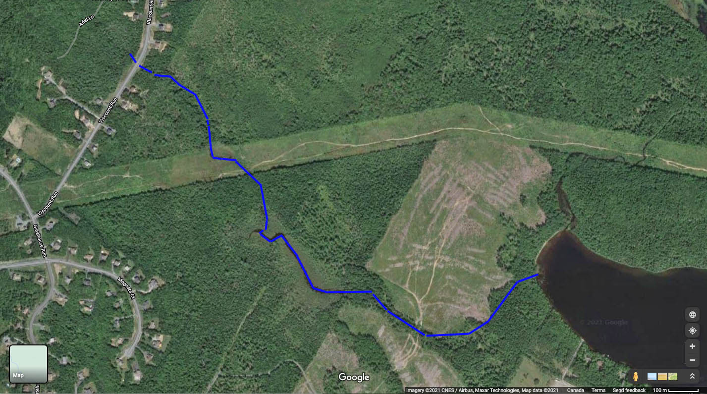
Img 1: Google Map image (Sep 5, 2015) showing Karen’s Brook passing through 2013 clearcut area and entering Sandy Lake at the northwest corner of the lake. Click on images for larger versions.
There is low density settlement at the upper reaches of Karen’s Brook which also lie at the edge of acid slates (bedrock with acid-generating potential). Conrod et al.,2002 recorded a pH of 3.38 in the brook which they attributed to these acid slates. It’s likely that strongly acidic water is generated only when there is severe disturbance of the bedrock, so it may have been related to disturbances associated with construction/road building. I observed a pH value of 5.7 at the Northern Inlet on Aug 21, 2017.
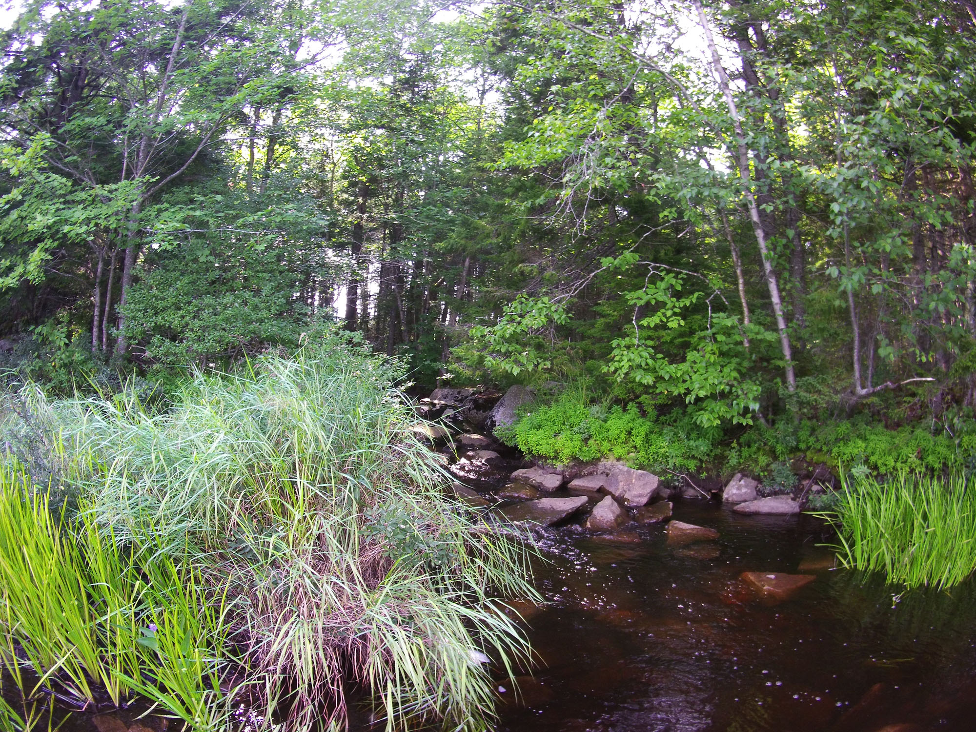
Karen’s Brook crosses the area that was clearcut in 2013, and when I walked that area on June 21, 2017, I noted a significant break in the treed riparian where logging vehicles had crossed Karens’s Brook:
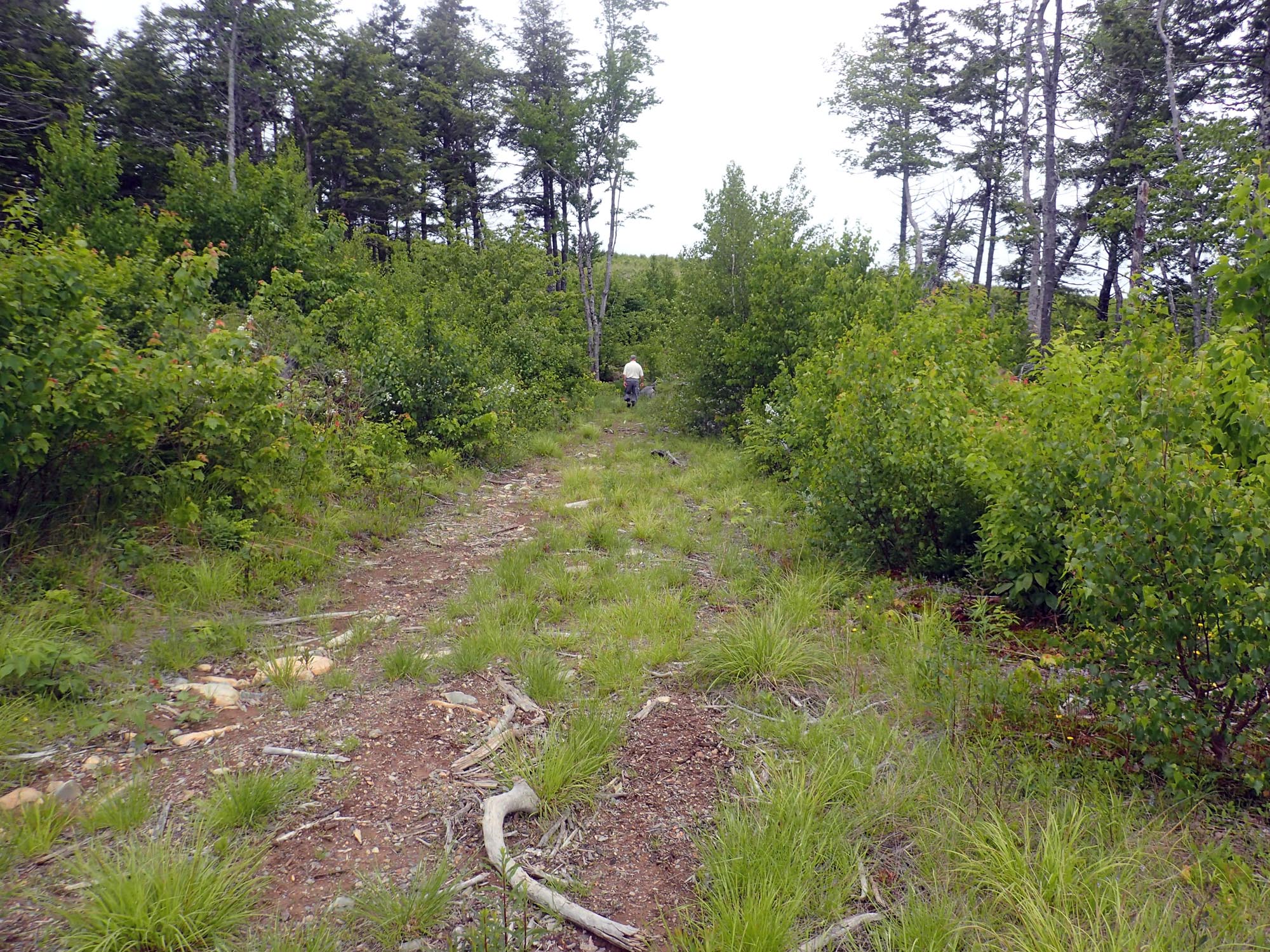 Img 2 Logging route for 2013 clearcut interrupted treed riparian buffer where the road crosses Karen’s Brook |
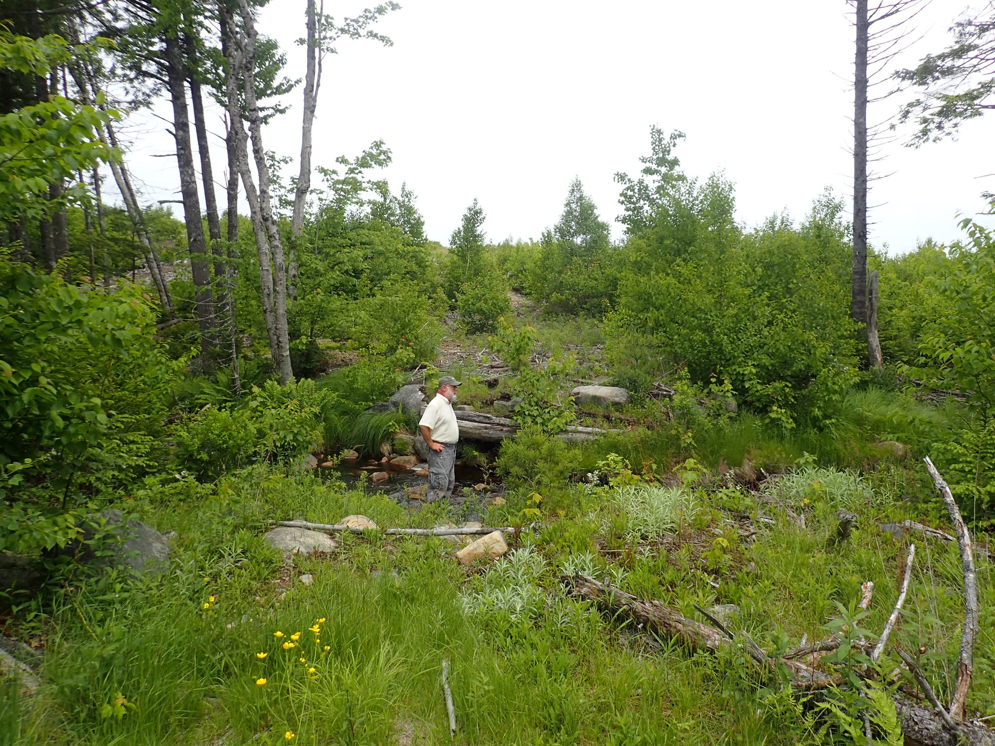 Img 3. Closer up |
The route can be clearly seen on the Google Map image above (Img 1).
View more pics of the Clearcut viewed on June 21, 2017.
So it was not surprising later on to observe fans of woody debris around the mouth of Karen’s Brook on Sandy Lake.
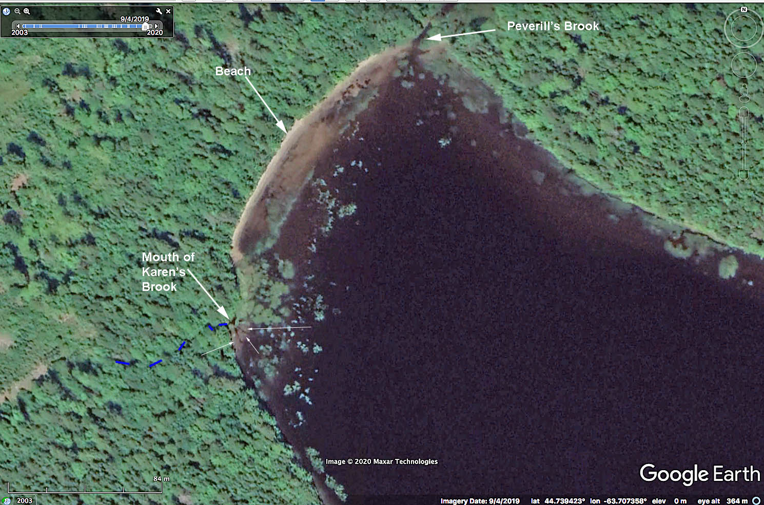
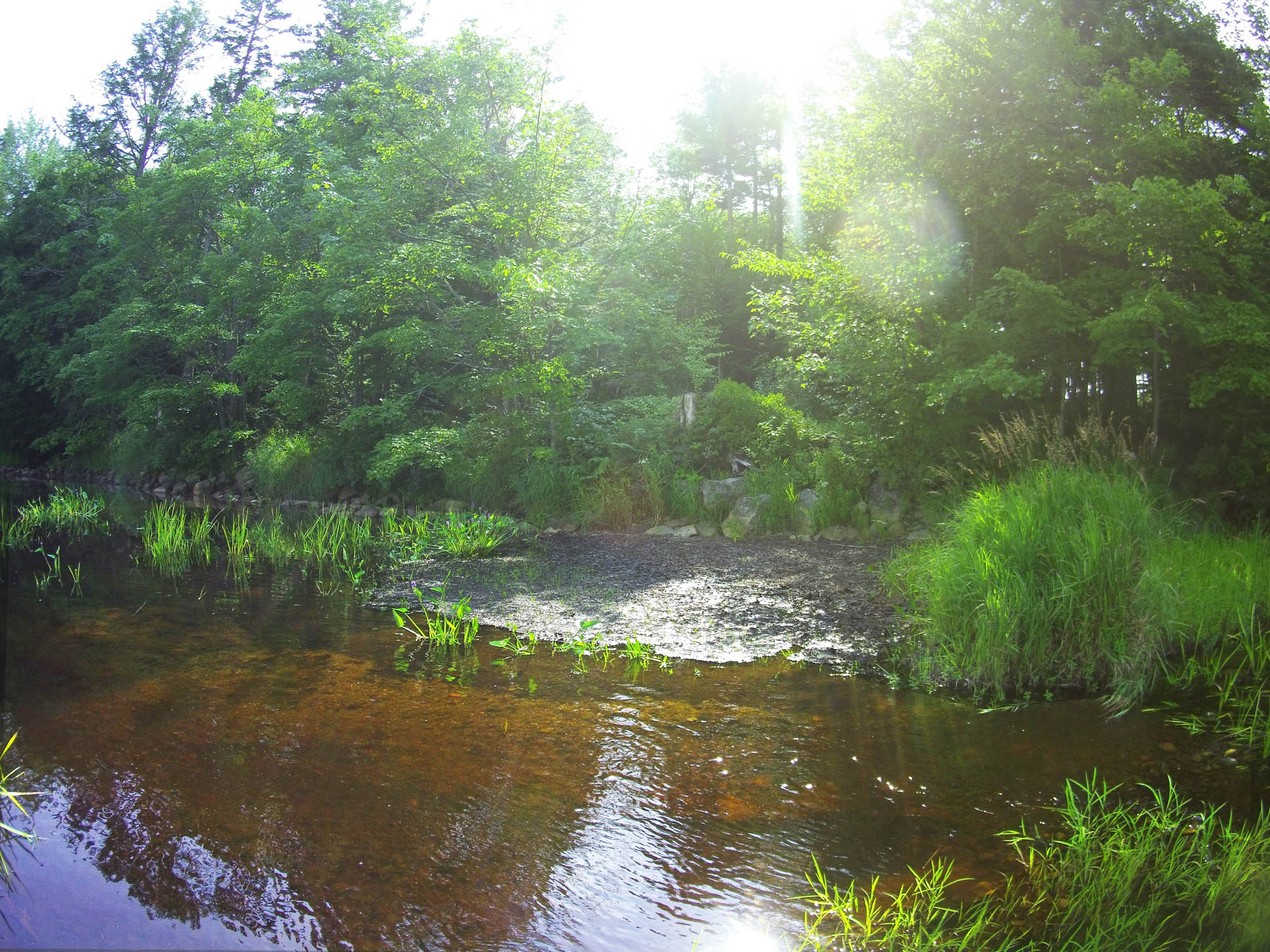
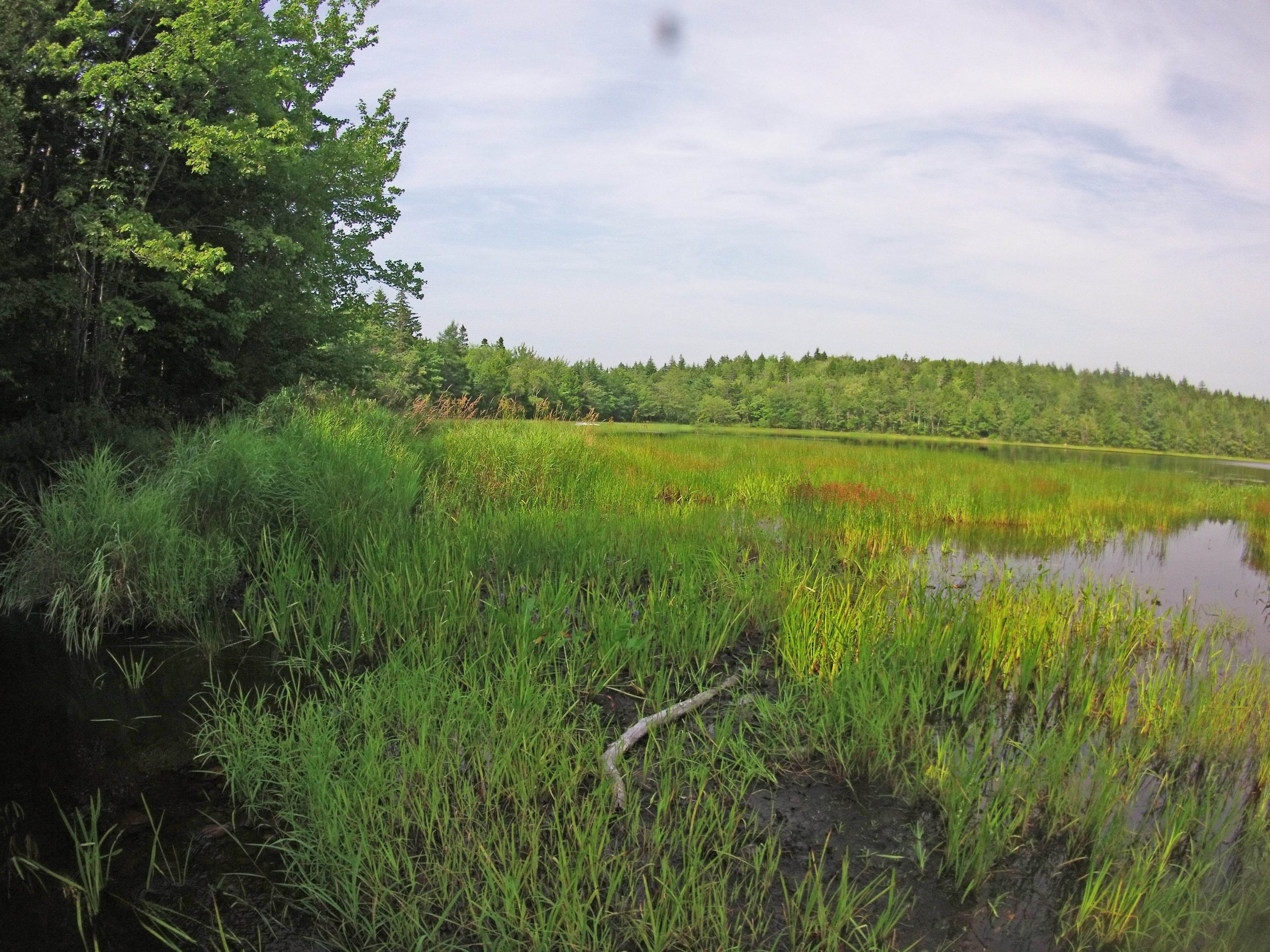
Img 4: Google Earth image of the northwest corner of Sandy Lake Sep 4, 2019. Small arrows point to fans of woody debris washed down Karen’s Brook from clearcut area. The long stretch of light coloured sand labelled “Beach” was reportedly once a popular beach with local residents (cottages, camps) but since the 2013 clearcut, the water there are many more marsh plants bordering the beach.
 Img 5: The mouth of Karen’s Brook. Aug 21, 2017. Water was rushing out of the brook; there had been significant rainfall on Aug 19 (2.7 cm recorded for Aug 19 at Stanfield International Airport). EC (Electrical Conductivity) in the running water was 106 uS/cm; 20.0 deg C; pH 5.7
|
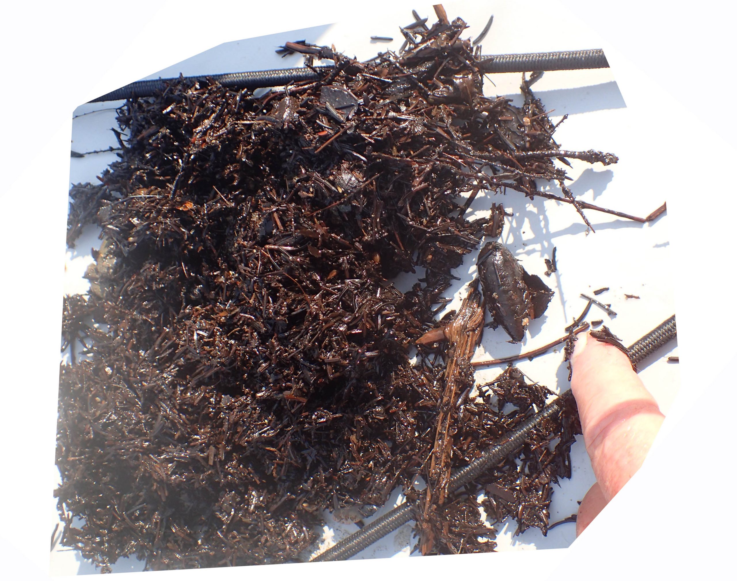
 Img 6: Mouth of Karen Brook is just to the right (north). Aug 21, 2017. There is a light area about 2 m wide Where water was rushing out of the brook; to either side are deposits of woody debris from the 2013 clearcut.Deposits closest to shore were exposed (above the lake level) on this day. |
EC in the exposed debris shown in photo at right above (Img 6) was 235 uS/cm; 27 deg C, pH 5.7; water in the flowing water in front of it was 100 uS/cm, 23.6 deg C. Open lake water was circa 170 uS/cm on Aug 10.
Wood chips typically “immobilize” nitrate- and ammonia-nitrogen when they start decomposing, but after about 2 years begin to “mineralize” (release) nitrogen1. The high EC value for the exposed debris compared to water flowing over it and to open lake water suggests it was likely mineralizing nitrogen rather than immobilizing it2 at this stage, which was 4 years after the clearcut. Other nutrients in the chips would also be released along with the nitrogen. Another possibility: the high concentration of organic matter is creating anaerobic conditions and release of phosphorus 3; possibly both processes are occurring. Either way, it’s likely that the woody debris is adding to the nutrient load on Sandy Lake, as well as to oxygen consumption.
Because this inlet is fairly close to the outlet from Sandy Lake, the impact on the larger lake may not be as large as it would be were the debris coming in the south (main) inlet. However, it’s likely that a lot of wood debris also entered the lake via the southern inlet as Johnson’s Brook likewise crosses the clearcut.
________
1. Nitrogen immobilization by wood-chip application: Protecting water quality in a northern hardwood forest P.M. Homyak et al., 2008. Forest Ecology and Management 255:2589-2601
2. On-farm measurements of pH, electrical conductivity and nitrate in soil extracts for monitoring coupling and decoupling of nutrient cycles. DG Patriquin et al., 1994 Biological Agriculture and Horticulture 9: 231-272.
3. Internal phosphorus loading in Canadian fresh waters: a critical review and data analysis
Authors: Diane M. Orihel* et al., 2017. Canadian Journal of Fisheries and Aquatic Sciences 74: 2005-2029
 Img 7: Light area/channel |
 Img 8: The woody debris |
 Img 9: Looking across the lake from Karen’s Brook area |
 Img 10: Looking north along the shore from the mouth of Karen’s Brook |
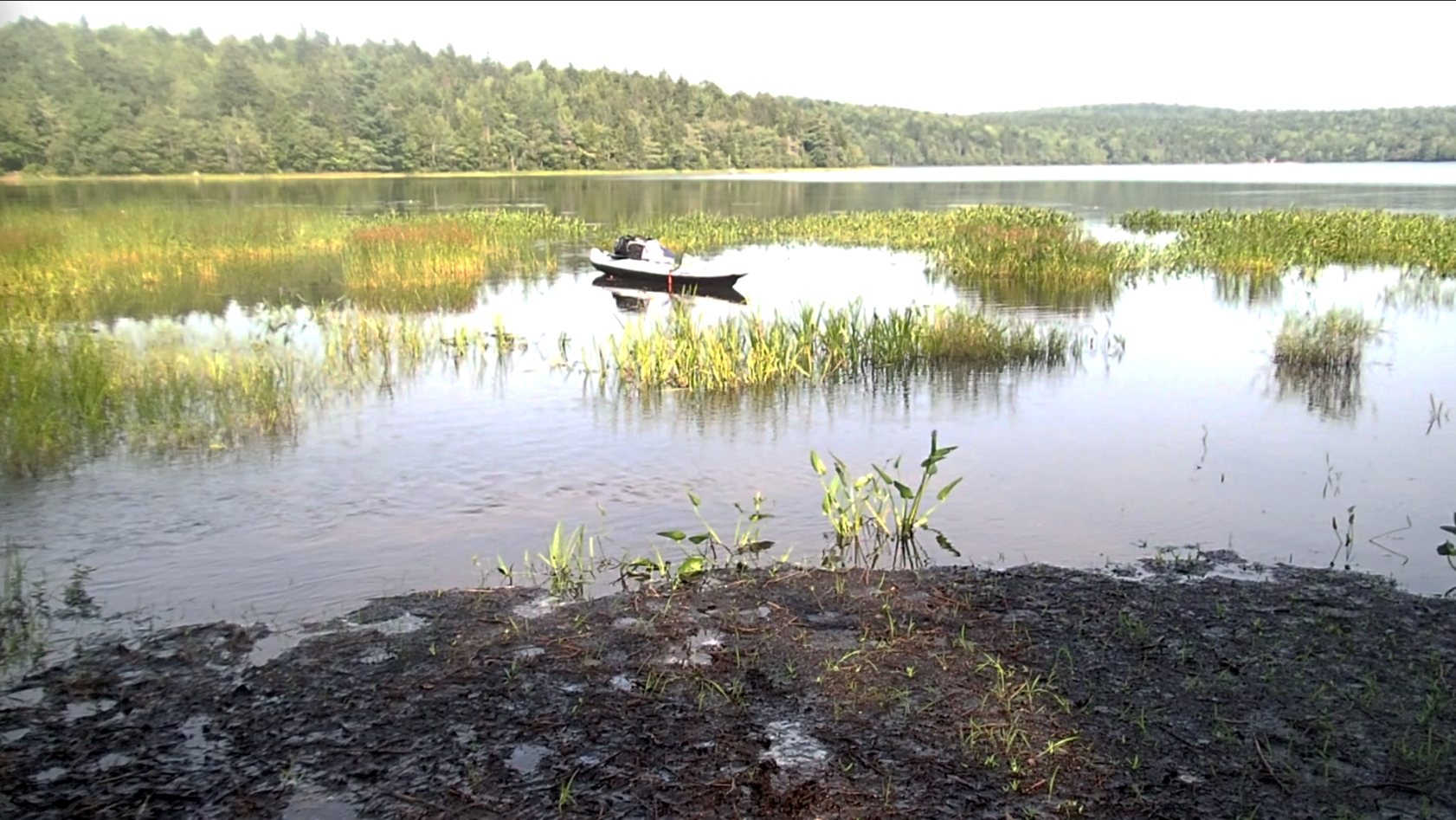
Looking across the lake from Karen’s Brook area (Img 7 above),
& walking from shore straight ahead (as in pic), these observations were recorded
0-7 paces: exposed debris
7-10 paces: channel rapidly moving water, no surfical debris deposit
10 paces + : layer of debris over lake sediment
13 paces: water 25 cm depth; debris layer approx 15 cm thick
36 paces: 48 cm depth, debris layer about 5 cm thick
41 paces: outer edge of pickerel weed (and end of emergent aquatic plants), 80 cm depth; debris mat continues1 pace~ 1 meter. Estimated distance shore to edge of emergent aquatics: 41 m (distance o edge of emergent aquatics in Img 2 above, 45-52 m).
So the woody debris extends more than 40 m from shore here.
The intrusion of this material may have led to some shallowing and increased growth of emergent aquatic plants in the shallows extending outward from “the Beach” (see Img 2 above) to the north of the inlet.
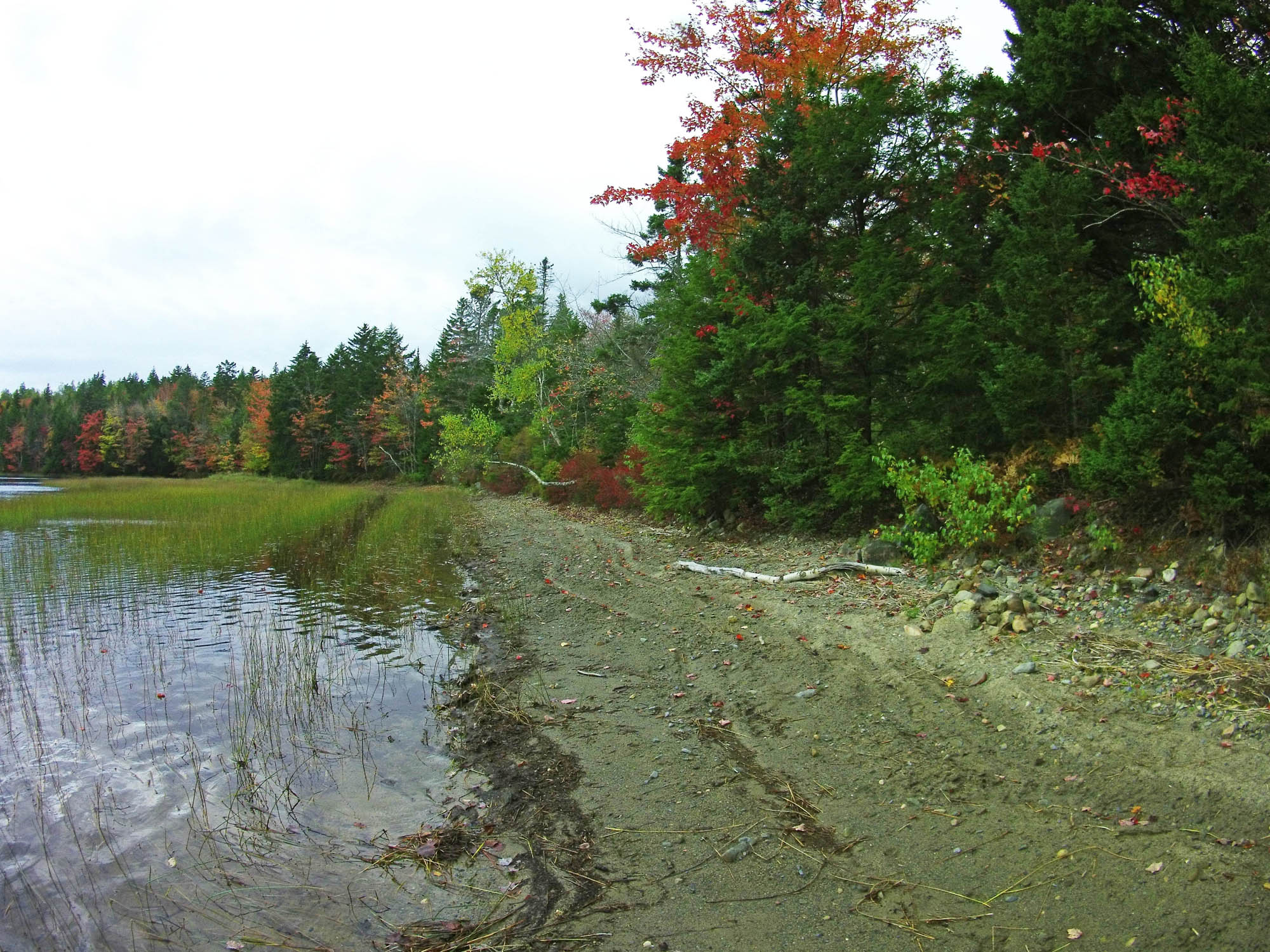
Img 11 View looking south mid way on “the Beach” on Oct 18, 2017
A local resident says there was very little marsh in front of the beach 10 years ago.
Comparison of Goggle Earth Images for different years, below is suggestive of considerably more emergent aquatic plant growth in front of “the beach” in 2019 compared to 2015, 2010, 2014:
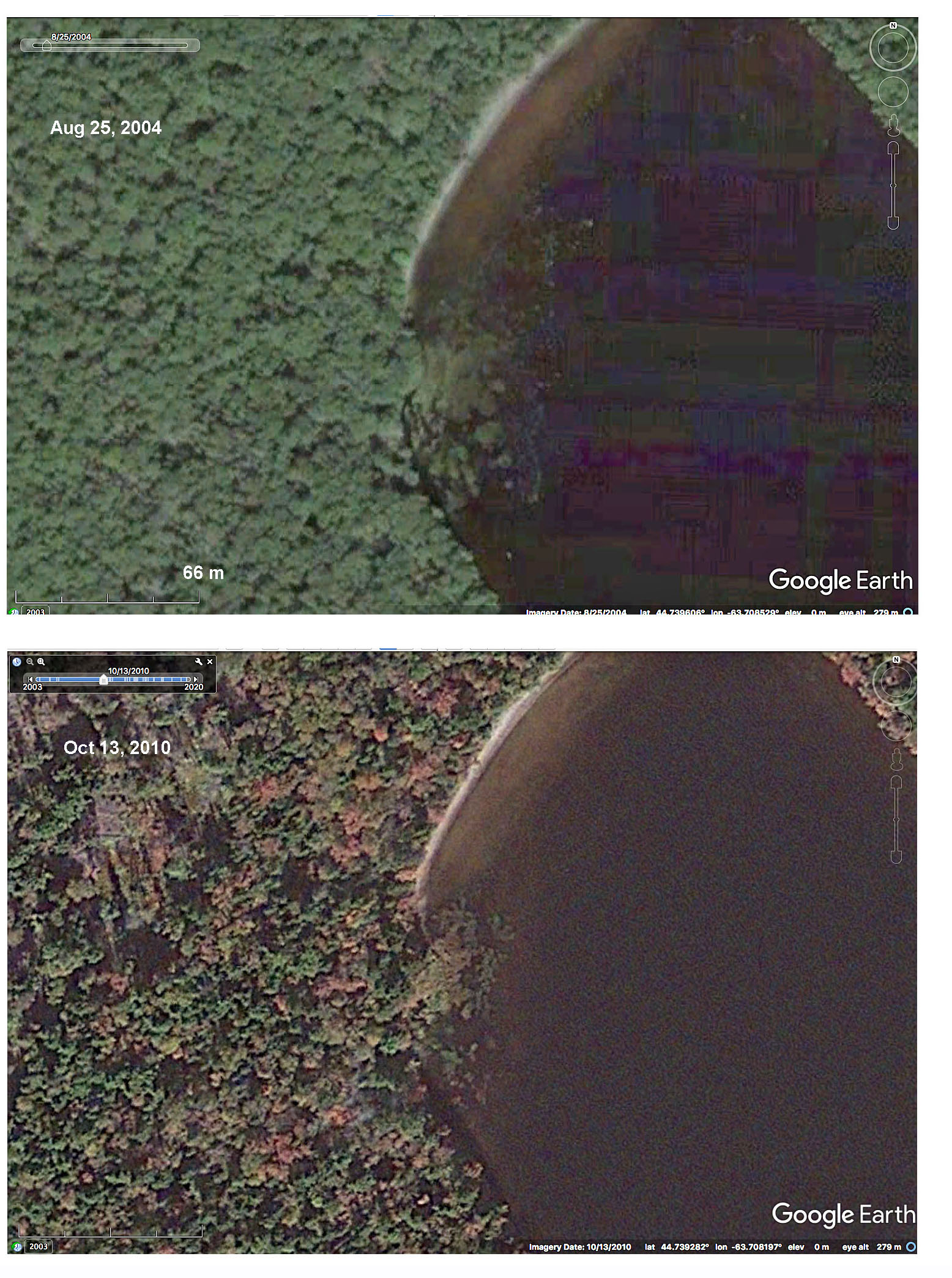 Img 12 Google Earth images for 2004 and 2010 |
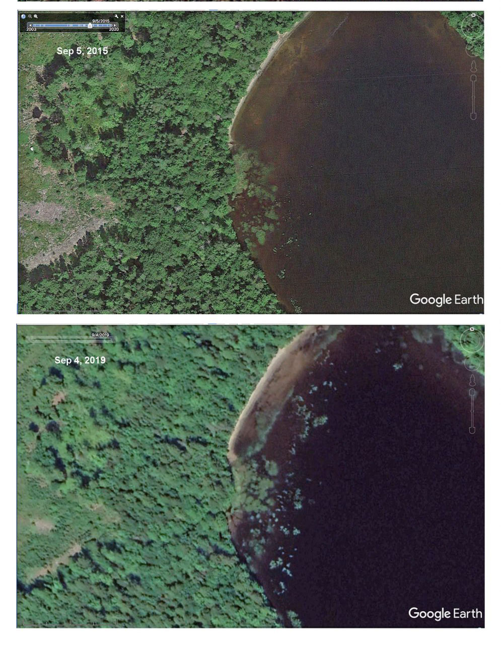 Img 13 Google Earth images for 2015 and 2019 |