
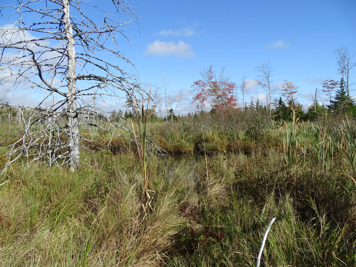
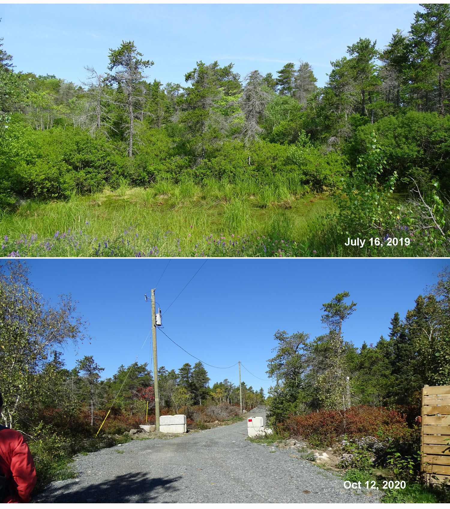
A wetland southwest of Sandy Lake, just north of Hammonds Plain Road
Click on image for larger version
An article in HalifaxToday tells us “Flooding in Halifax [peninsula] shouldn’t be a surprise” as historical maps of the city show it was built over dozens of wetlands, bogs and streams… View
Flooding in Halifax shouldn’t be a surprise, says archaeologist, by Chris Stoodley in Halifax Today Oct 10, 2020
It begins:
After Halifax saw heavy rainfall earlier this week, an archaeologist says people shouldn’t be surprised about flooding.
On Oct. 5, flooding trapped at least one car on the south end of Barrington Street in downtown Halifax.
Jonathan Fowler, a Saint Mary’s University archaeologist, says it’s bound to happen as historical maps of Halifax show numerous brooks, streams, bogs and wetlands running throughout the peninsula.
“These have basically all been filled in and covered up, and the rivers have been stuffed in pipes,” he says. “So, out of sight, out of mind but Mother Nature is still working in the background. And particularly in the era of climate change when we get these supercharged rainfall events, that water has to go somewhere.”
There ‘s lots more in the article which also cites these informative sources:
– a 2012 Graduate Project Report by Mike Reid: Better Planning from Better Understanding: Incorporating Historically Derived Data into Modern Coastal Management Planning on the Halifax Peninsula
– a NS Environment page on wetland loss: Historic Wetland Loss in Nova Scotia
– a GPI Atlantic report: Nova Scotia’s Water Resource Values and the Damage Costs of Declining Water Resources and Water Quality by Sara Wilson in 2000
Click on image for larger version
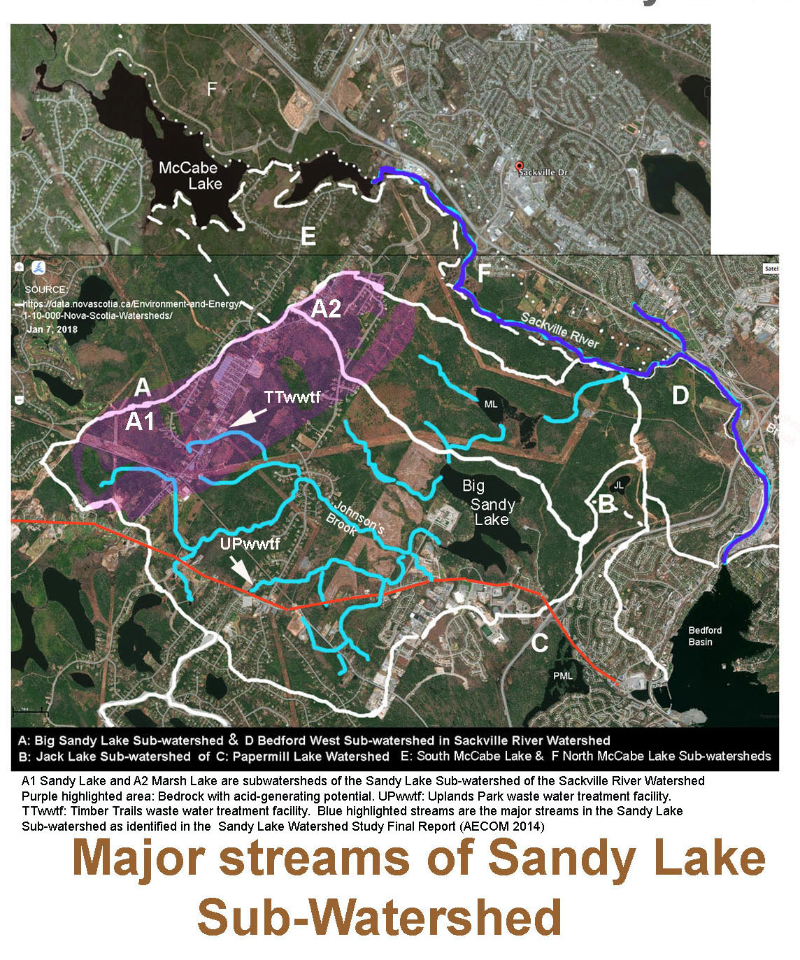
There should be at least some precautionary notes in it all for Sandy Lake & Environs where there is pressure to develop along Hammonds Plains Road and to the west of Sandy Lake – that’s an area of significant wetlands and streams with forested floodplains that converge on Sandy Lake at its south-west corner.
In principle, the risk of flooding downstream, especially in the Bedford Mall area, from possible new development of lands by Sandy Lake should have been modelled as part of the Sackville Rivers Floodplains Study (2017). But it wasn’t.
I attended a public presentation of the Sackville Rivers Floodplains Study on Sep 22, 2018 and asked one of the consultants involved why the Sandy Lake Sub-Watershed wasn’t included in the modelling as it is the largest or 2nd largest sub-watershed in the Sackville River watershed, depending on how the watercourses are aggregated.
He said they they were following instructions from HRM, and those did not include modelling of the Sandy Lake watershed. I asked if he knew why. He said they must have assumed there would be no significant new development in the watershed over the next 100 years which was the timeframe of the modelling.
Oh dear. Besides the wetlands to the west and southwest of Sandy Lake, there is the Marsh Lake complex to the north which absorbs a large volume of the water that comes with heavy precipitation events. Fortunately, there is no imminent threat to that area. But development along Hammonds Plains Road will or could involve* a lot of hardscaping, increasing the peak flows and the potential for flooding downstream.
_____________________________
*“will” – development south of Hammonds Plains Road is approved; “could” – on north side of Hammonds Plains Road to the west and southwest of Sandy Lake, if developed.
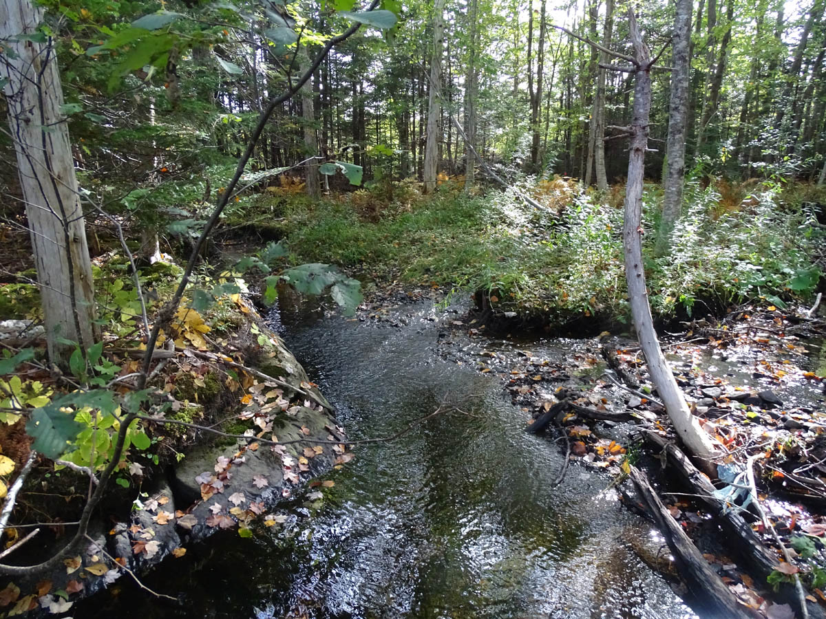
Stream with forested floodplain southwest of Sandy Lake, just north of Hammonds Plain Road
One problem peninsular Halifax doesn’t have after losing its streams and wetlands: salt loading of lakes from the use of road salt in winter, and fertilizers on gardens and lawns in other seasons. It doesn’t have the problem because there are no lakes and the storm water collection system goes directly to the much saltier ocean.
But over much of HRM, the storm sewer system goes into lakes, Sandy Lake being one of them. Virtually all lakes in settled areas of HRM are showing increasing concentrations of salts over the years, revealed by Synoptic Water Quality Study of Selected Halifax-Area lakes:
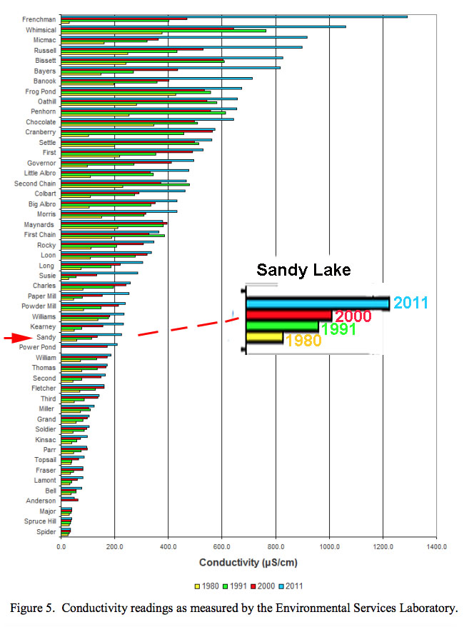
From Clement, P.M. and D.C. Gordon. 2019. Synoptic water quality survey of selected Halifax-area lakes: 2011 results and comparison with previous surveys. Can. Manuscr. Rep. Fish. Aquat. Sci. 3170: xi + 98 p. Electrical Conductivity (EC) is a measure of the salt content (view conversion factors).
The Electrical Conductivity has to get quite high, in the region of 1000-2000 uS/cm, to begin to have direct deleterious effects on aquatic organisms. But if concentrations of about 800 uS/cm and higher develop in bottom waters of deeper lakes, they can make the water heavy enough to impede seasonal turnover which is important for oxygenation. Sandy Lake has a deep area which is important for salmonids (trout, salmon), and is already experiencing some concentration of salt in deeper layers, so this is a concern. HRM has not yet begun to look at ‘the salt issue’ comprehensively. View more about the salt issue here, and under EC-pH and subsections.
The bottom line: The Halifax Peninsula story reminds us that we have reason to be concerned about ongoing and possibly new development within the Sandy Lake watershed to the west and southwest of Sandy Lake.
———–
Click on image for larger version.
Post-script (Oct 15, 2020): It isn’t only big developments that threaten the integrity of wetlands and riparian areas. I was shocked recently to discover that a small but significant wetland in the Backlands was completely obliterated by a new driveway, along with some of the precious and rare Jack Pine-Broom Crowberry barrens behind it. Apparently, that is all quite legal in HRM and Nova Scotia.
Related:
– sandylakebedford.ca/Lakes
Page on this website, view also the subpages.
– Saving the Sandy Lake-Sackville River Regional Park
Suzanne Rent in the Halifax Examiner, Oct 8, 2020.
– Sandy Lake Watershed Study Final Report
AECOM for HRM, 2014. 131 pages. History, maps etc.
– For the record: On Sep 22, 2020 Council passed progressive by-law that will help protect lake water quality
Post on this website Sep 23,2020
– A Citizen’s Guide to Wetland Conservation in the Halifax Regional Municipality
Prepared by East Coast Environmental Law In partnership with the Ecology Action Centre with support from the Sage Environmental Program 20 February 2014