
Map 1:
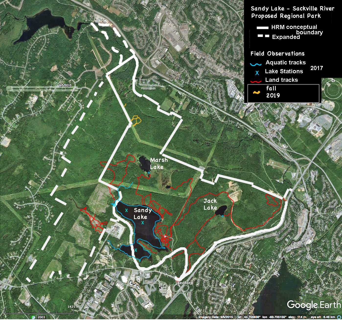
Map 1: Approximate tracks for the whole area 2017-9
Click on map for larger version
Map 2:
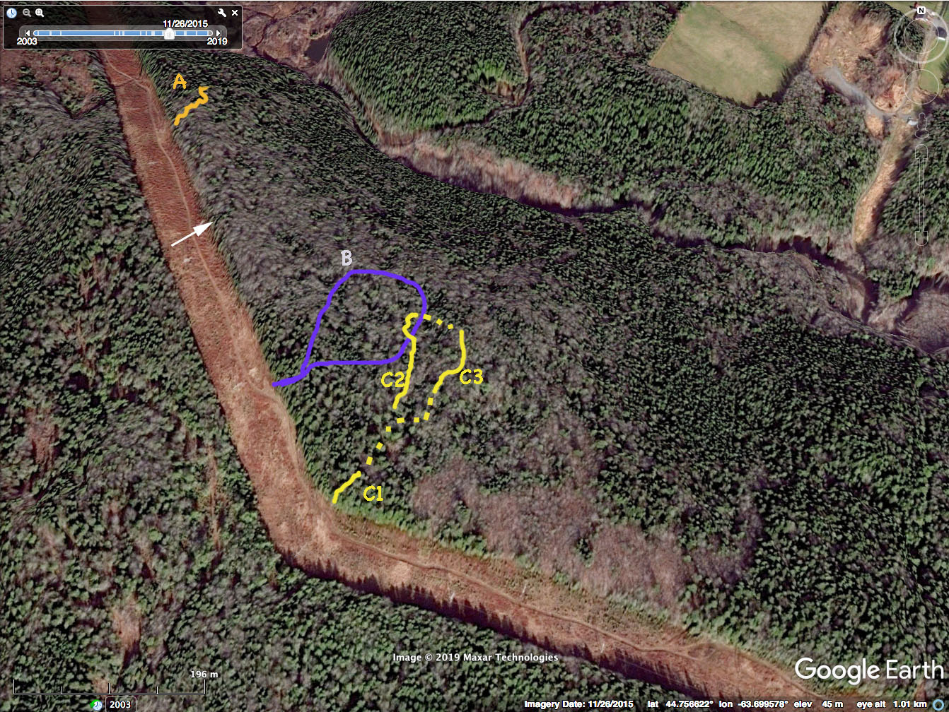
Approximate tracks on Sep 20 and 22, 2019
Sackville River roughy 2/3 up from bottom on right.
Click on image for larger version
Map 2 provides some 3D perspective, showing slope on side of drumlin going down towards the Sackville River. The lighter, grayish patches are hardwoods, the dark green, softwoods (Google Earth image is for Nov. 11, 2015) .
A, B and the C-series tracks are approx. routes taken from powerline into the forest. C1, C2, and C3 are sections of the C route where there was some concentration of Big Trees and for which I documented all Big Trees readily visible from my route (approx 10 m on either side in more closed forest (C1); approx 20-25m m for more open mixed and hardwood forests (C2 and C3).
For Reference: the Property Lines
Map 3:
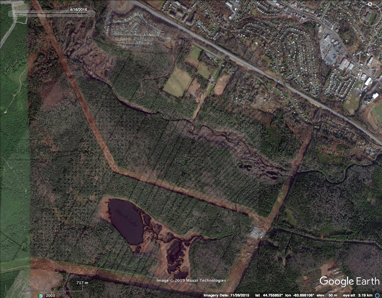
Goggle Earth Map with approx. property lines superimposed. See next map below for source,
Map 4:
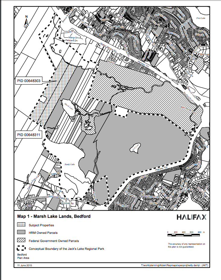
HRM Map. SOURCE