
NAVIGATION
This page is a sub-page of Vauxhall Reef.
Vauxhall Reef is a sub-page of MPA/MR, a top-level page on
the website Barbados Fringing Reefs and Seagrass Beds
(www.versicolor.ca/barbados).
Drafting…
I have viewed 3 wrecks on the Fringing Reef, or just seaward of the Fringing Reef I call Vuaxhall Reef (Reef #34 in the MPA). All appear to have been barges.
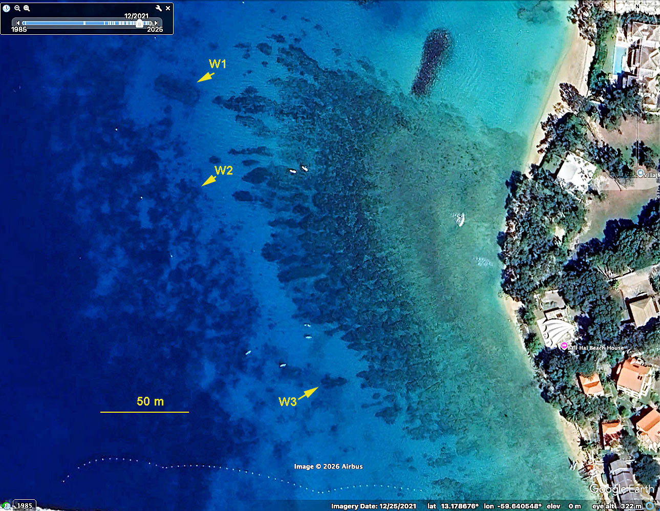 Fig. 1. Location of the 3 wrecks on a Google Earth Image. Wrecks W1 and W2 can be recognized by the distinct linear outlines in some GE images (as above). Wreck W3 does not present the same way in GE images; it’s location is based on a site visit and GPS-tagged photos. Click on images for larger versions |
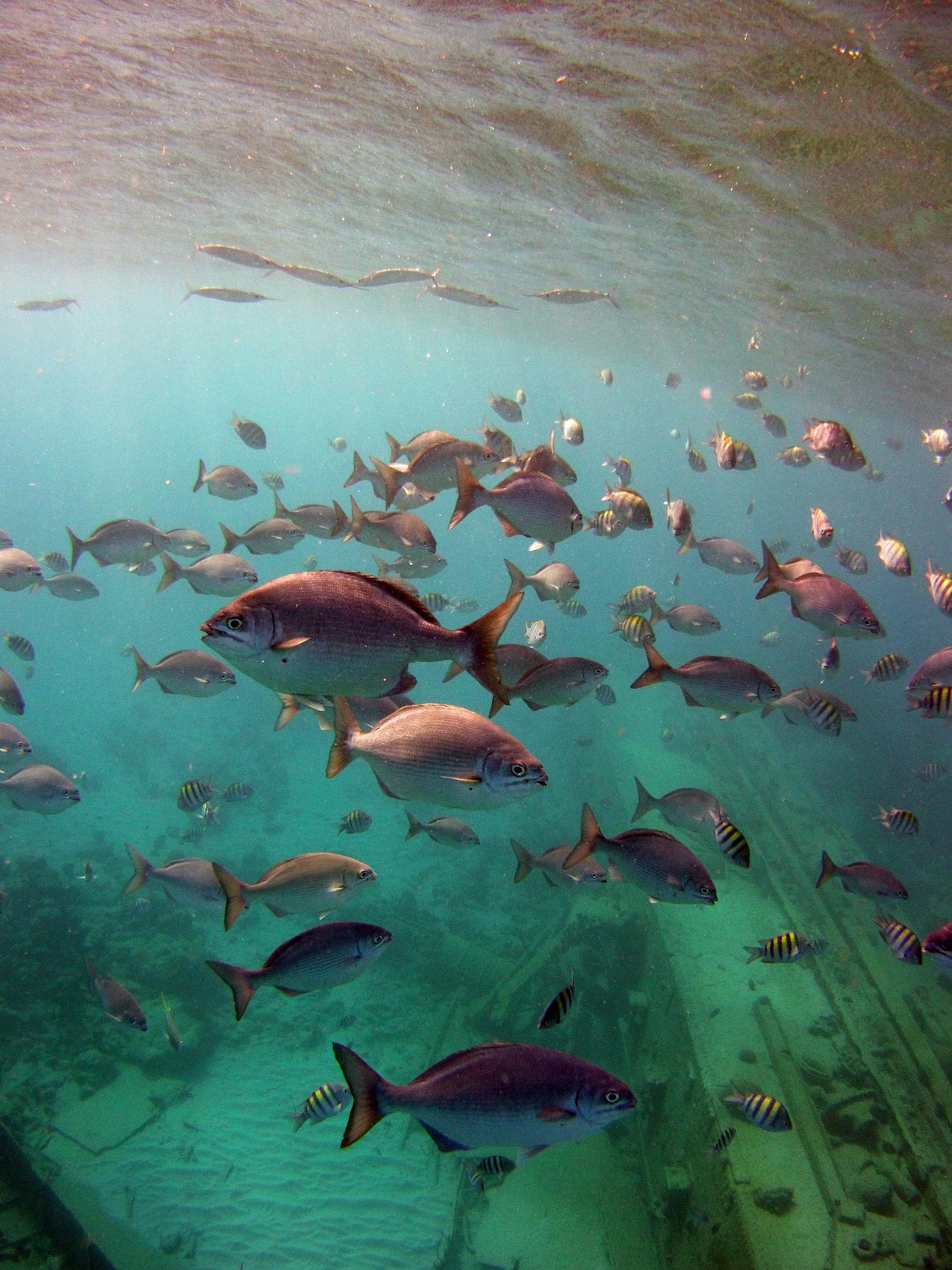
Fig. 2. Approaching Wreck W1 on Mar 7, 2015
Wreck W1 is the best known and most commonly visited by boat-based snorkelling ventures; on some days there may be up to a dozen boats moored in the area (there are fixed moorings). The photo at left illustrates typical aggregation of fish by the wreck, with abundant Chub, Sargeant Majors and, near the surface. Balyhoo.
Both W1 and W2 are described and pictured in the Reef Smart Guide: Barbados Scuba Dive, Snorkel, Surf by Ian Popple, Otto Wagner & Peter McDougall, 2017, Distributed in Barbados by Miller Publishing Co., Edgehill, St. Thomas. (View Sample Page from the Guide).
| Some text extracts from the Reef Smart Barbados Guide, pp 84-91 (Dive and Snorkel Sites: Holetown Wrecks):
Access Description ECO TIP Route SAFETY TIP |
‘Lot’s more info in this guide about this site including Species Commonly Observed in the categories Turtles, Dangerous Species, Fish & Invertebrates. ‘Highly recommended as a guide to places to snorkel and dive in Barbados, conditions, species etc.
Wrecks 1 and 2: Monitoring coral health over time
I don’t have a particular interest in wrecks per se, but W1 and W2 have served as sites I have revisited over time and could readily re-locate – in my photographs – individual coral colonies to assess changes over time, e.g. in relation to development of SCTLD (Stony Coral Tissue Loss Dusease), and to extreme warming, examples below.
Example 1. Progression of disease on corals on Wreck-1 illustrated by photos in 2015, 2023 2024.
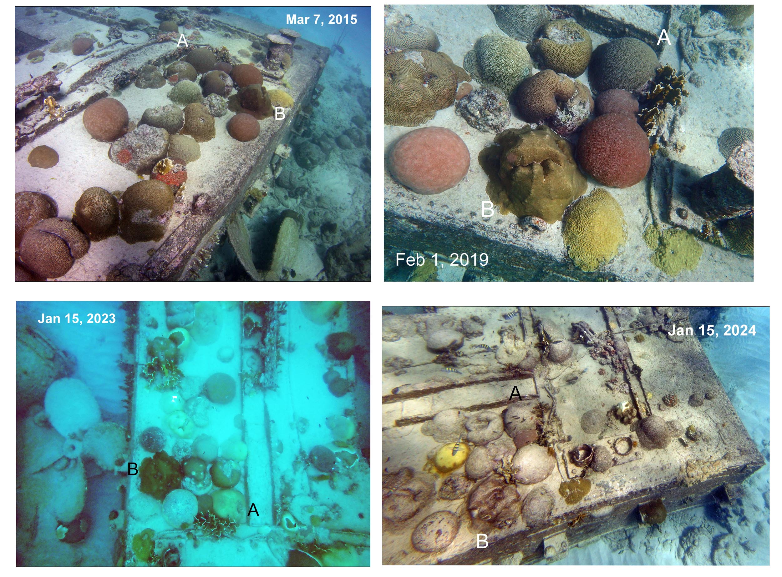
Fig 3. Photos of the same Corals on Wreck #1 in 2015, 2019, 2023 and 2024 illustrate declines associated with arrival Stony Coral Tissue Loss Disease in late 2022. For details see Presumptive SCTLD on Vauxhall Reef & Environs in 2023 and Reports to AGGRA #15, 17, 18
Example 2: Deterioration of Acropora cervicornis on Wreck 2 between 2023 and 2024
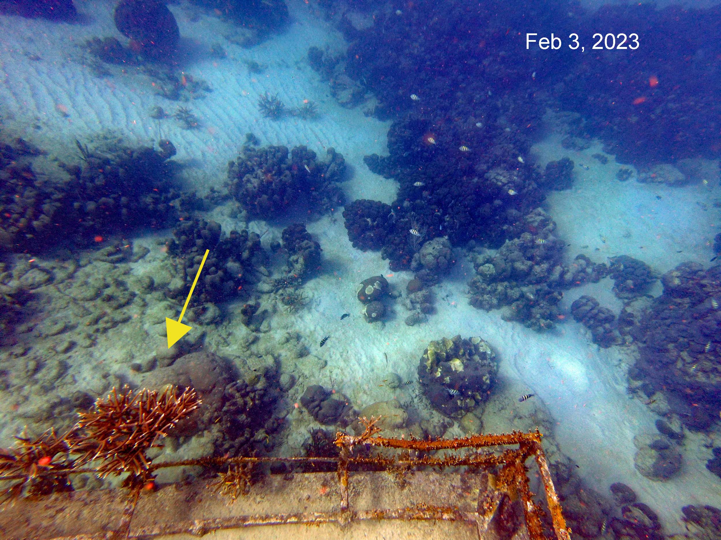
Fig. 4. Arrow points to a healthy colony of Acropora cervicrnis on Wreck 2 Feb 3, 2023
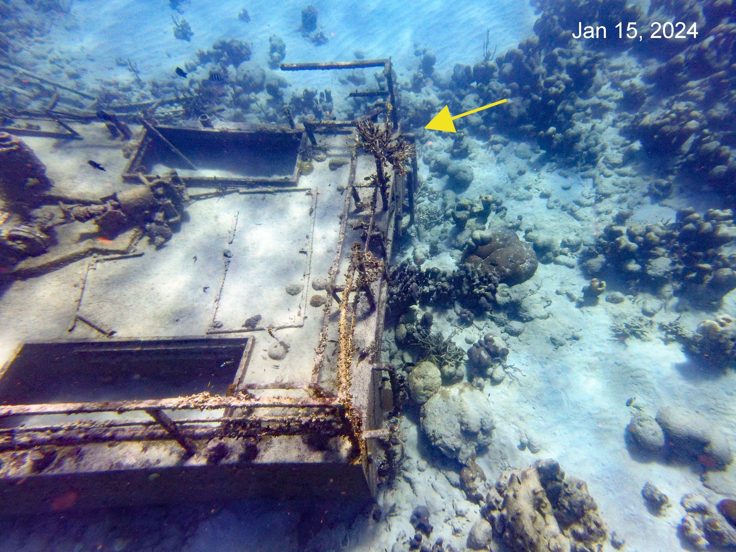
Fig. 5. The same colony, dead and covered with epiphytes in early 2024. The mortality is attributable to extreme warming events in the fall of 2023.
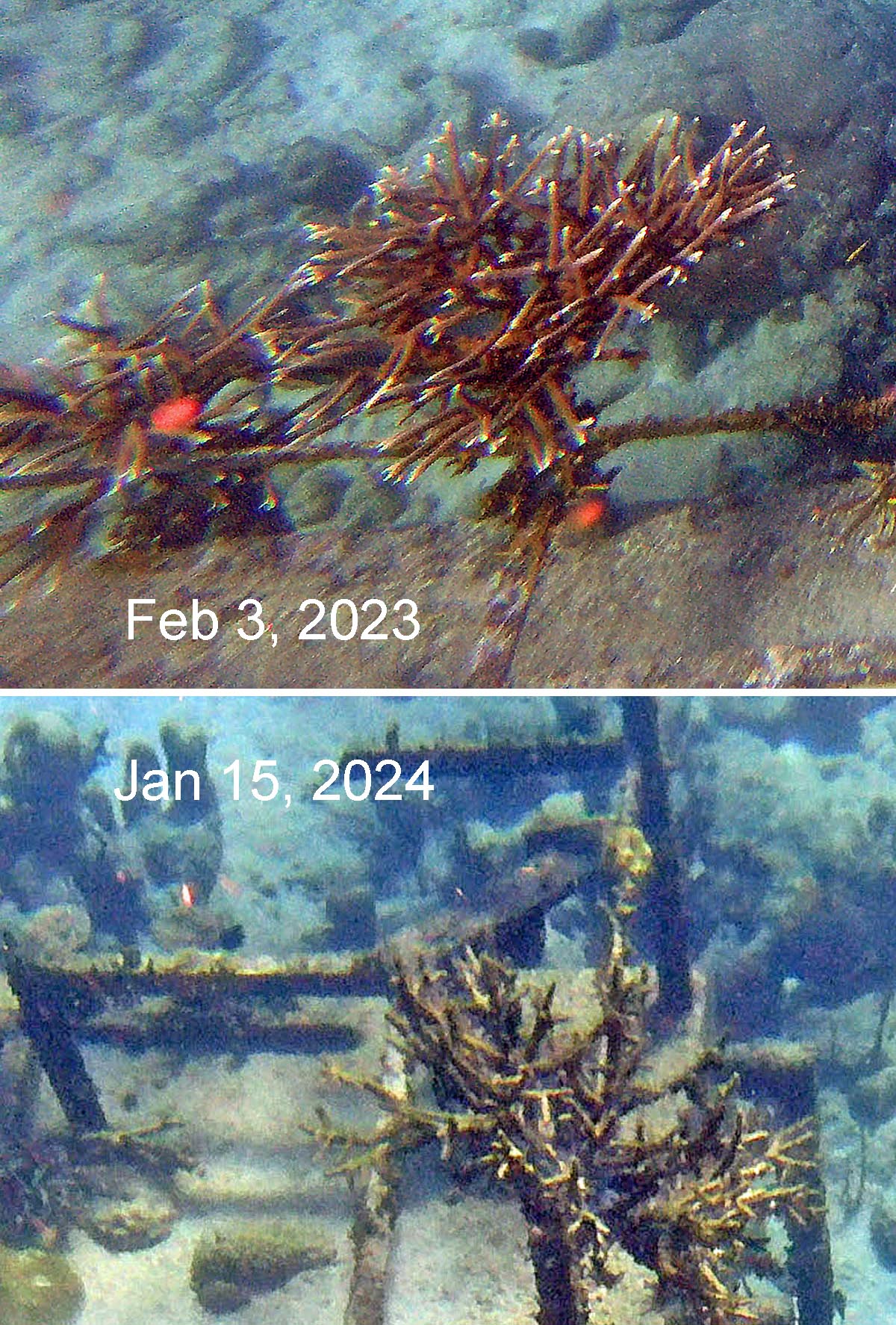
Fig. 6. Closeups from the photos above
Wreck W3
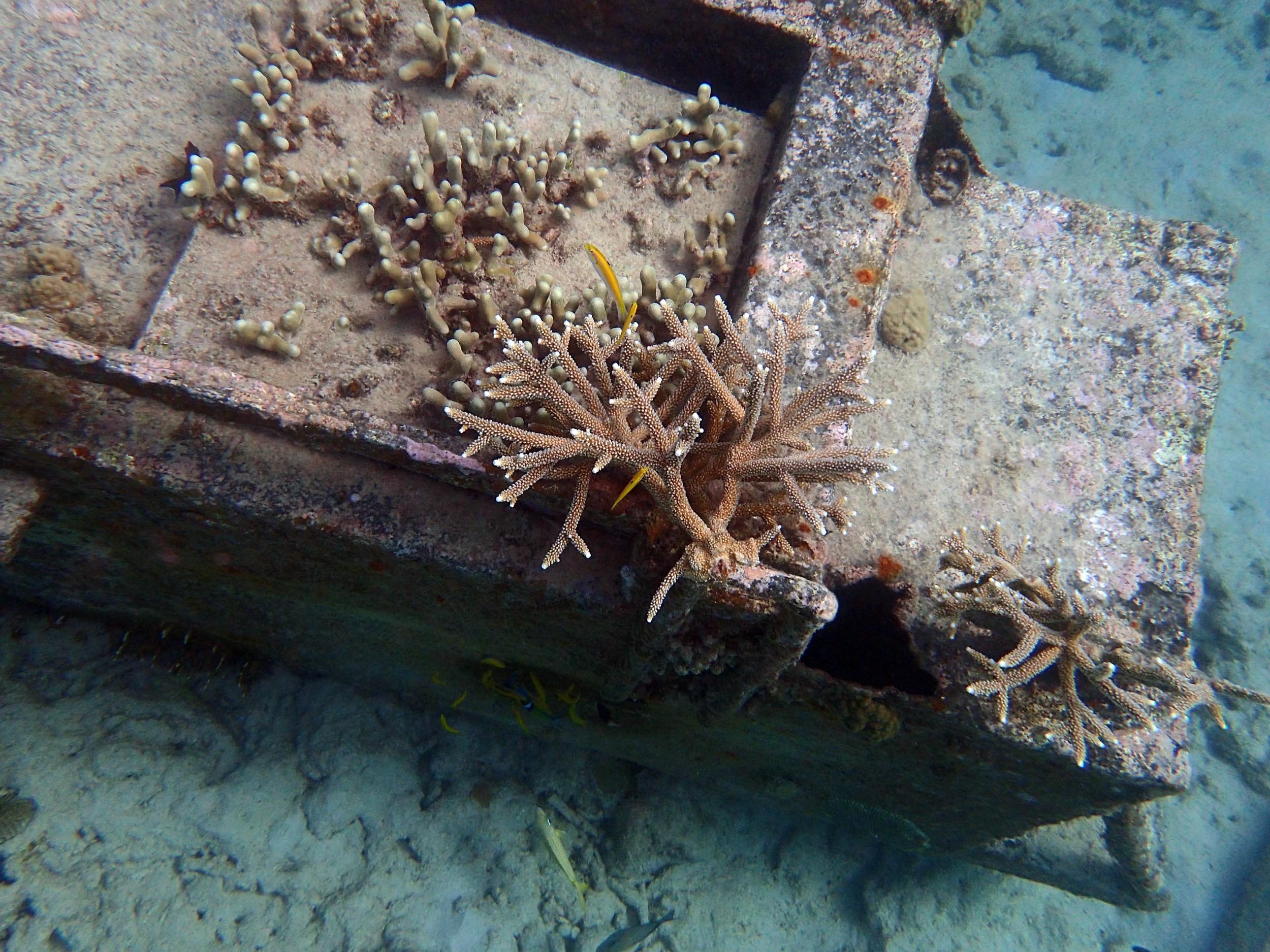
Fig 6. Porites porites and Acropora cervicornis on Wreck 3 Apr 11, 2019
Wreck W3, and adjacent bottom and to a limited extent, Wreck W2, were evidently sites of coral propagation/outplanting in the past, Acropora cervicornis and Porites porites the most common species.
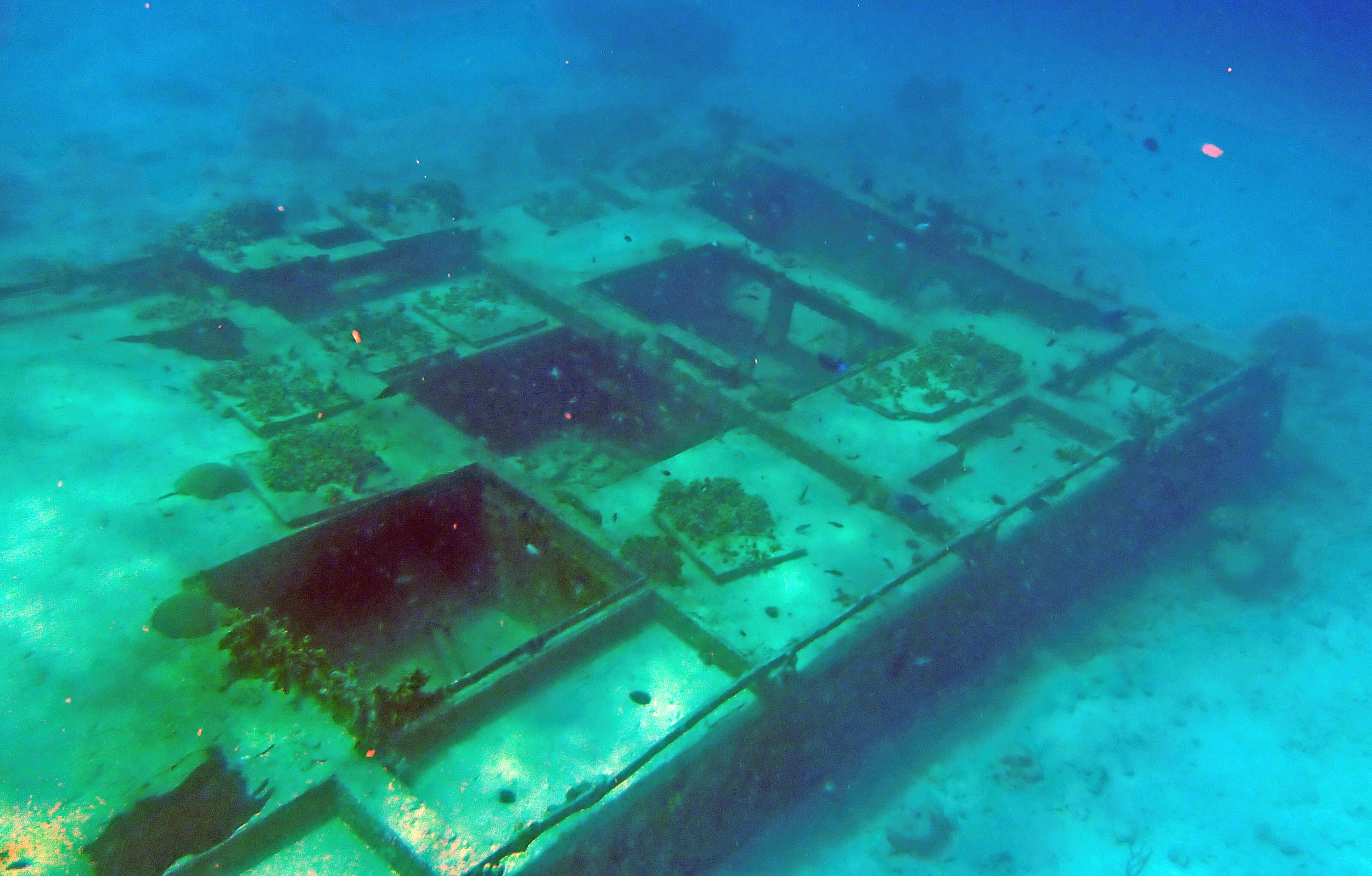
Fig 7 Wreck 3 , seaward end on Feb 6, 2020
Approximate lengths, widths and depths of the Wrecks
Lengths and widths were estimated from Google Earth Images. Depths are “Guesstimates” – depths below MLW as I remember them; I do have some depth gauge measurements in my photos somewhere, but I can’t locate those at the moment.
Also cited below are the values for lengths and depths for W1 and W2 given in the Reef Smart Barbados Guide; the lengths differ substantially from my estimates based on the Google Earth images. I plan to make some on-site measurements of these wrecks in Feb/Mar 2027.
| Method or Source: Variable |
Google Earth or Guesstimate (depth) |
Reef Smart |
| Wreck # 1 | ||
| Length | 24 m | 15 m |
| Width | 10 m | – |
| Orientation | 113 deg | – |
| Depth to deck | 3-5 m | 3.5-3.6 m |
| Wreck # 2 | ||
| Length | 14 m | 10 m |
| Width | 4.5 m | – |
| Orientation | 49.5 deg | – |
| Depth to deck | 4-5 m | 3.5 m |
| Wreck # 3 | ||
| Length | 14 m | – |
| Width | 3.5 m | – |
| Orientation | 82 deg | – |
| Depth to deck | 2-3 m | – |