
NAVIGATION
This page is a sub-page of ObsFR-I/ The Acroporoids / A. prolifera / (This Page)
on the website Barbados Fringing Reefs and Seagrass Beds (www.versicolor.ca/barbados).
Go to ObsFR-I to view a list of all pages and subpages under ObsI
The Acropora prolifera “Mother Colony” – or perhaps better “Mother Colony Complex” is an area of approximately 40 sq meters at the beginning of the Reef Crest zone (re: John Lewis, 1960) at Vauxhall Reef, It consists of a complex of Acropora prolifera (the “Fused Staghorn Coral), Palythoa caribeana (a colonial zooanthid), and Millepora species (stinging coral, poss 2 species here).
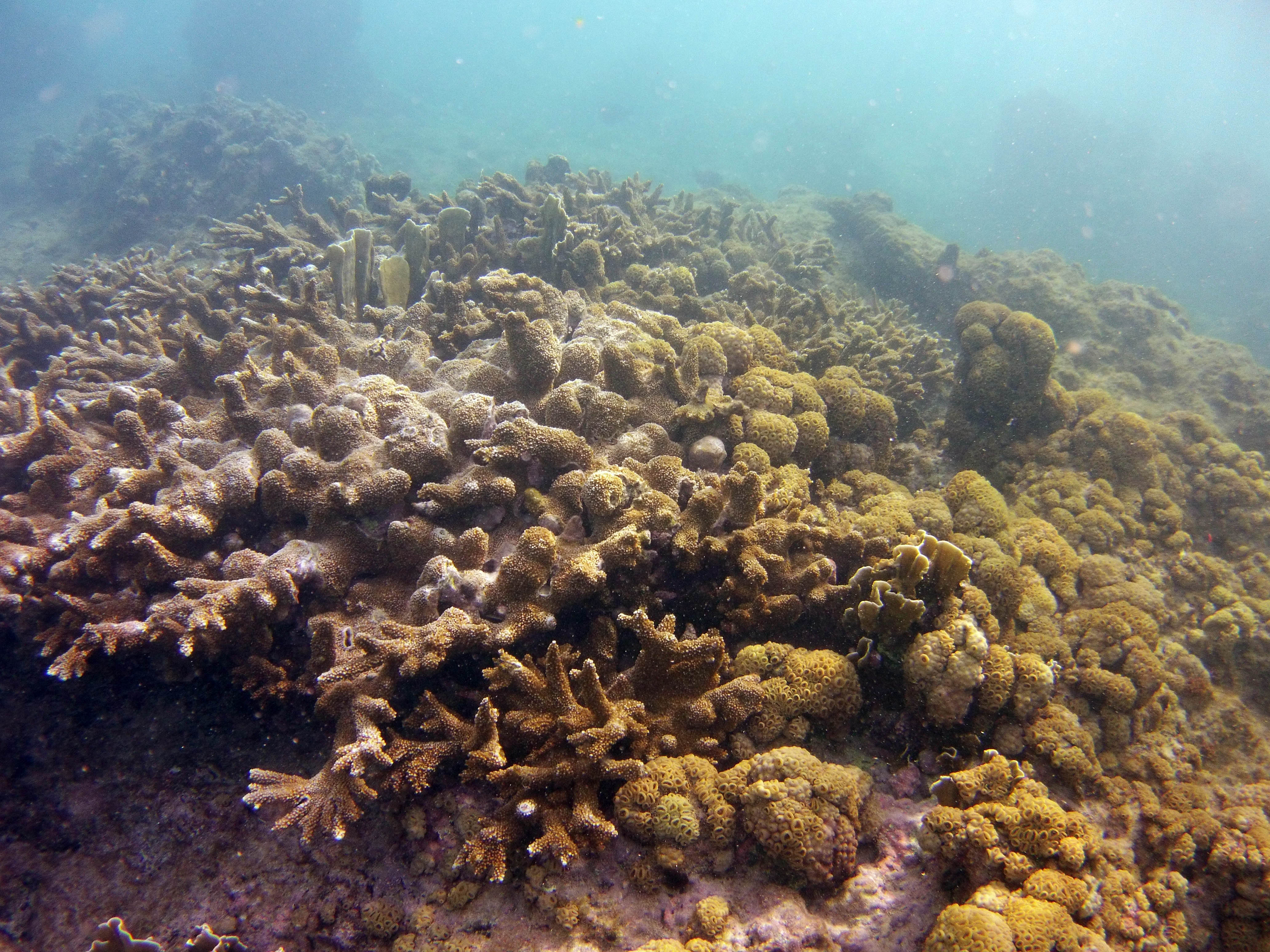
The “Mother Colony” observed on Mar 18, 2015.
Click on image for larger versions
View more pics on iNaturalist, observation 19967147
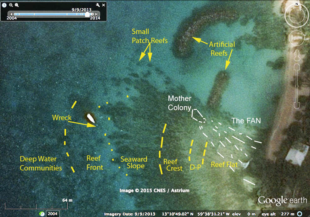
Reef Zonation at Vauxhall (from Lewis, 1960), and approx. distribution of A. prolifera
It is the most seaward location of A. prolifera at this site. In general, the A. prolfera colonies which collectively make up the “Mother Colony” have a very heavy set structure, with some newer younger branching colonies, all heavily fused together. There are scattered individual colonies in a fan-like sweep towards the shore and toward the south, i.e. though the D-P (Diploria -Palythora) and Reef Flat zones of Lewis 1960.
My assumption/hypothesis is that the original, founder hybrid between A. palmata and A. cervicornis (both of which occur further seaward on the Vauxhall Reef) first got established or took hold at this location – hence the “Mother Colony” descriptor – and that new, independent colonies have developed landward and southward through fragmentation and scattering by wave motion.
I have attempted to document the sites of occurrence and approx. sizes of individual colonies of A. prolifera in this area every year since 2015 when I first observed them, except in 2021 and 2022 when we did not visit Barbados (re: Covid); and in 2016, the survey came to an abrupt end when my key equipment got swept out to sea. I am still in the process of posting these observations to an iNaturalist Project: – Acropora prolifera on Barbados fringing reef
On the location of the Mother Colony
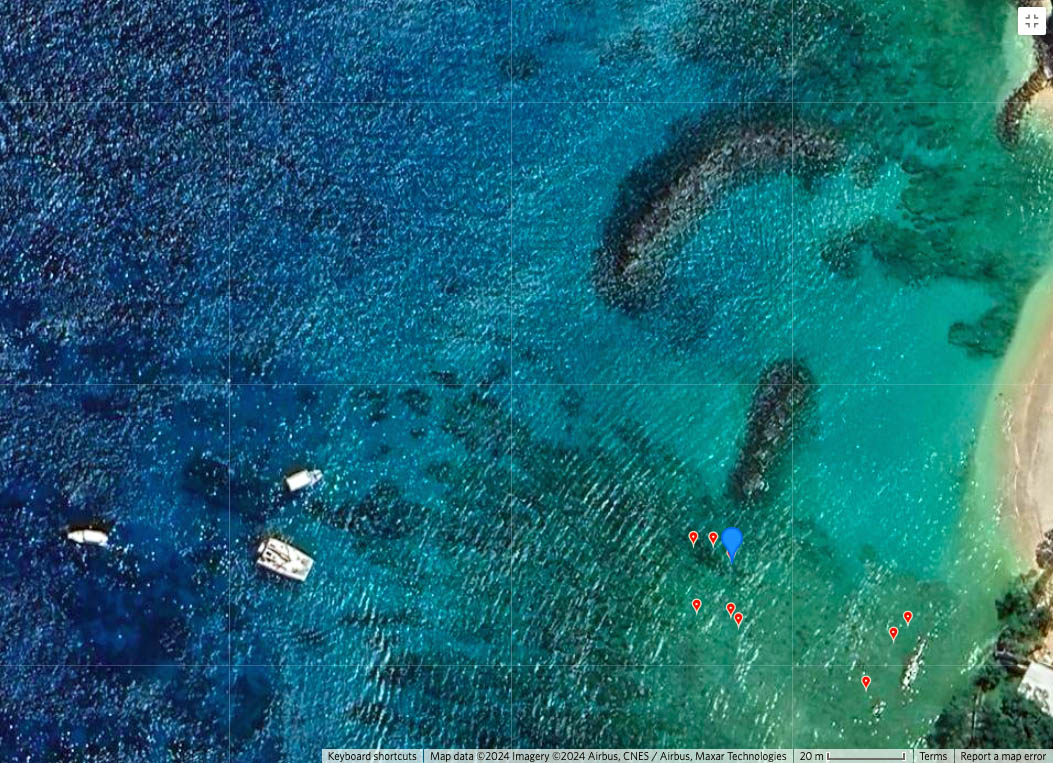
Blue bubble shows GIS location of iNaturalist Observation 198152986 (Mar 30, 2023).Click on image for larger version
I have been relying on interpretation of Google Earth images in combination with GPS locations recorded on an Olympus Tough TG4, and later an Olympus Tough TG6 to locate colonies. The Olympus GPS observations are ‘dicey’ depending on weather etc., and can take inordinate time to “lock” (e.g. see online comment). In other, land based studies I have found the location can be off by 10-15 meters. In combination with the Mother Colony being located in a generally very turbulent area, that has made determining the precise location challenging. Only in a set of photos taken on March 30, 2023 under very clear, relatively calm conditions, did I finally feel confident that I had located it accurately (see iNaturalist Observation 198152986)’; the GPS location corresponded to a distinct triangular dark spot on Google Earth.
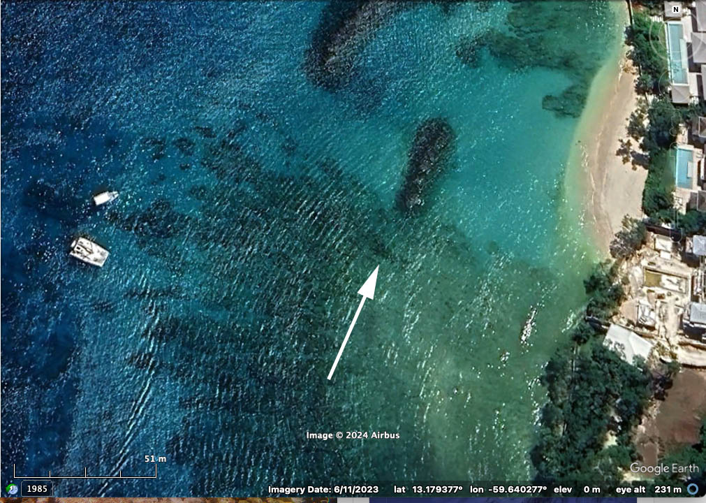
Arrow points to darkened triangular area of the Mother Colony. The N/NE edge drops about 2 meters from the top of the colony to a hard/sand-covered bottom/channel between the breakwater and the Mother Colony

Area of Mother Colony, 40.94 sq meters, estimated in Google Earth

Google Earth image showing residual waves breaking over the Mother Colony (a—b), main wave front moves inshore

View across Mother Colony towards N/NE and breakwater, Mar 30, 2023
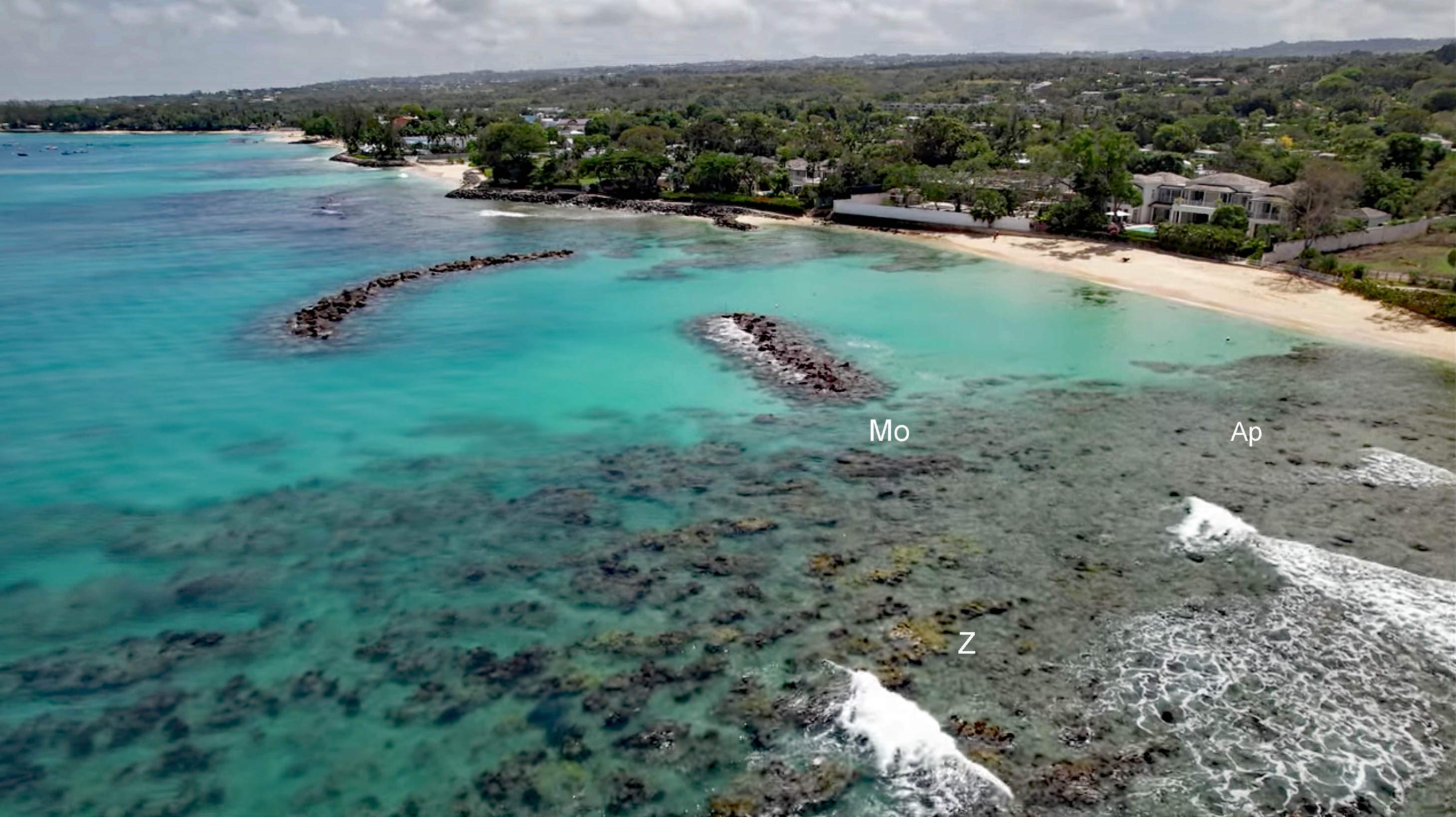
Drone image showing A prolifera Mother Colony (Mo); individual colonies (Ap, examples); Z:yellow zooanthid-covered coral prometories. Image is a screen capture from drone video on YouTube by the Wandering Bajans, May 7, 2022.