
NAVIGATION
This page is a sub-page of About, a top-level page on
the website Barbados Fringing Reefs and Seagrass Beds
Natural History Perspectives of a Visiter
Go to About for a list of other subpages in this section of the website.
|
ON THE STATE OF SEAGRASS BEDS IN BARBADOS IN 2002 From A National Biodiversity Strategy & Action Plan for Barbados (2002) : “Seagrass areas, commonly known as seagrass beds or meadows, are distributed along the coast in shallow water where sunlight penetration is adequate to facilitate photosynthesis. Delcan (1994b), reported seagrass beds along the west coast at Shermans, Six Men’s Bay, Speightstown and Brighton; along the southwest coast at Bridgetown, Hastings, Rockley, Worthing, St.Lawrence, Dover, Maxwell, Welches, Oistins, Enterprise and Atlantic Shores of Barbados; and along the east coast at Bath and Conset Bay. “There is evidence that the quality of the local coastal marine water is deteriorating due to increased sedimentation, eutrophication and sewage pathogens, localised increases in temperature, decreases in salinity, and perhaps increases in toxins (Delcan, 1994a). There is also evidence to suggest that grazing by fish and sea urchins is an important mechanism for recycling nutrients within the beds. Heavy fishing pressure that results in the removal of these animals can therefore also negatively affect the vibrancy seagrass beds. Physical damage in coupled with poor water quality will negatively impact on the vibrancy of seagrass beds. It is therefore probable that the local seagrasses are being impacted negatively by many coastal activities and land based sources of pollution and urgent attention must be given to ways of minimizing these impacts” |
—–
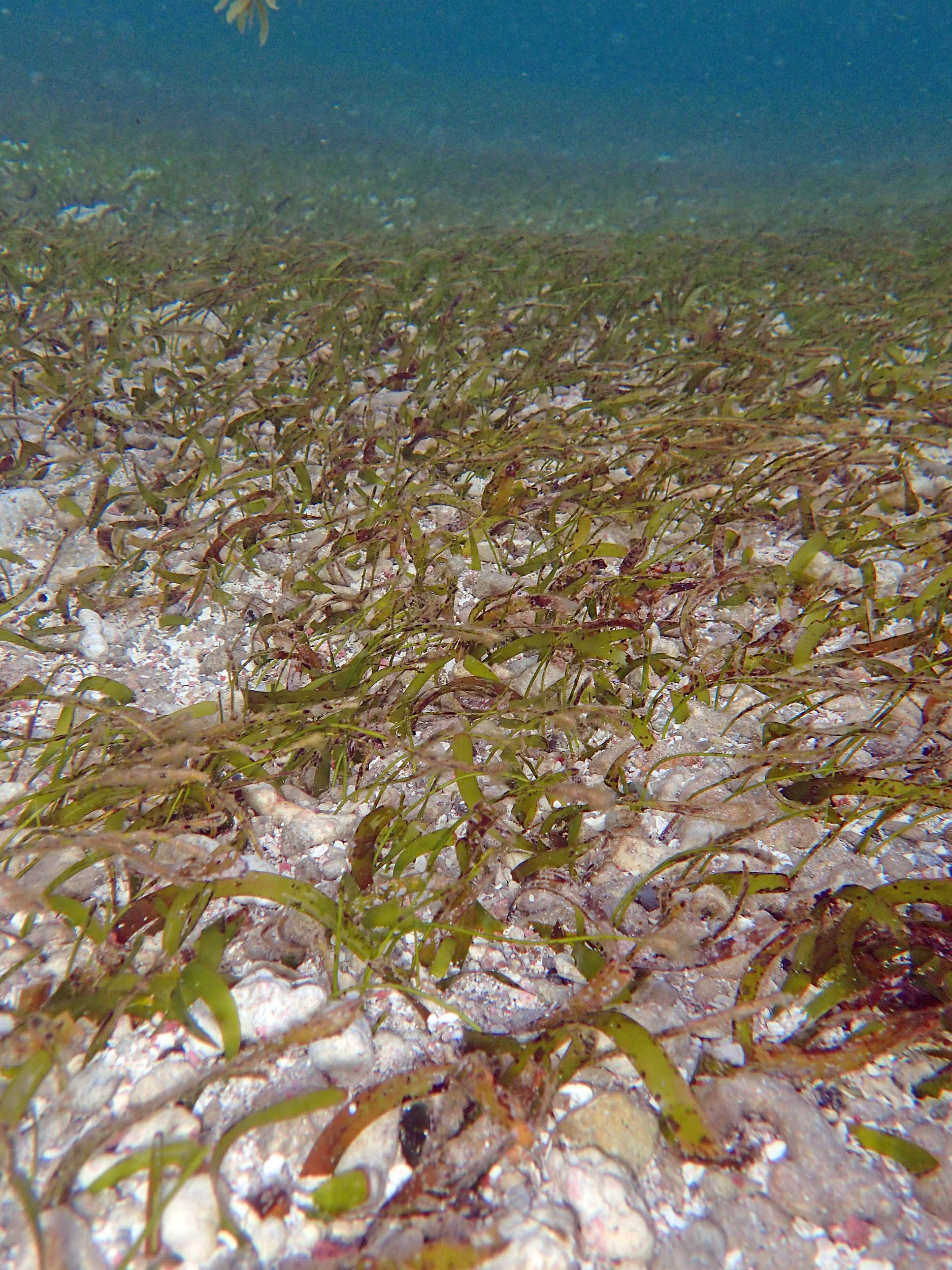
Seagrass (Thalassia testudinum & Syringodium filiforme) at Bath in 2015. Regrettably, in 2025 there was barely a blade of seagrass remaining atBath.
Most of what I have to offer on these pages are not recent observations of seagrasses at Barbados, but historical observations over the period 1969 to 2015. (In contrast the Observations on Fringing Reefs reported on this website are mostly from 2015 onward.) These historical observations are mostly on the largest seagrass bed (or set of seagrass beds) in Barbados which occurred at Bath on the east coast; and on a smaller but very significant seagrass bed on the south of Coast of Barbados in the area of St. Lawrence Gap/Graeme Hall swamp.
The lack of more recent observations is in part because post-2025, there is very little left of seagrass beds in Barbados. As a “guesstimate”, perhaps 1/20th of the area of seagrass in 1969 remains. Some of the factors lading to that decline are cited above.
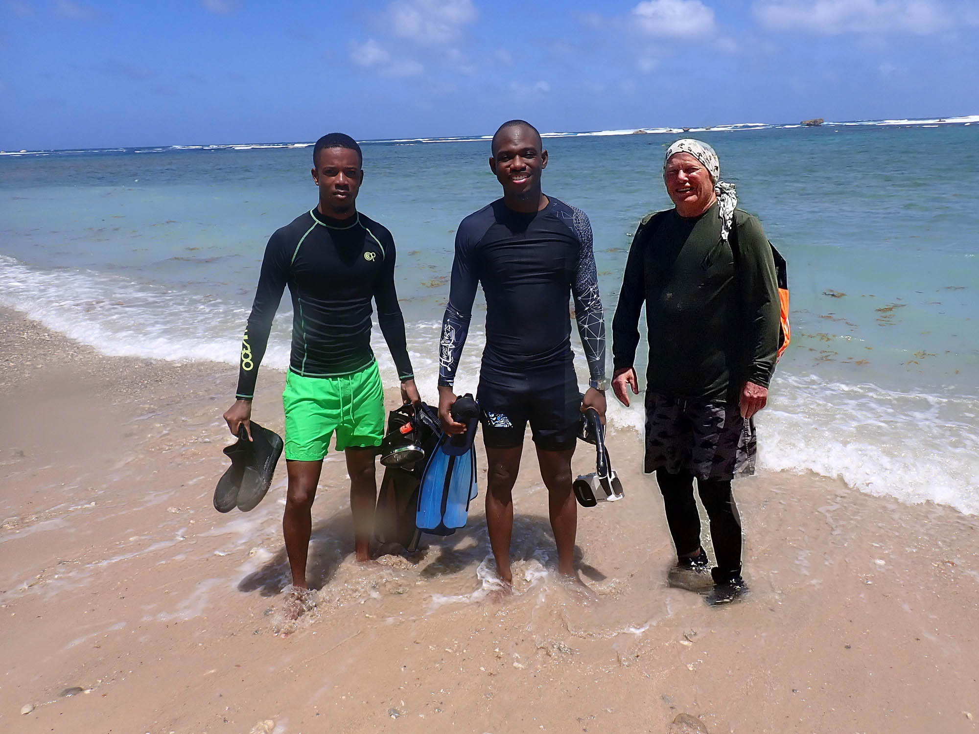
Bath 2025… With my CORALL buddies, Elon (centre) and Akeem (left)
As it turns out, these observations are also ongoing to some extent. After I conducted formal surveys of two seagrass beds in Barbados in 2015 and around the island of Carriacou in 2016 – a followup of observations I had conducted 1969 – my spouse Nina always with me, we realized we were essentially back home. We began our married life together in Barbados in 1967 and we wanted to return in those early winter months; it was good for us.
As well I had become fascinated with the Vauxhall fringing reef on the west coast. So we returned in the early months of 2017, 2018, 2019 and 2020 (2020 ending with an early exit due to Covid), 2023, 2024 and 2025. Each year we would try to make at least one visit to Bath where we had spent so much time during my PhD studies of seagrass (1967-70).
So there are ongoing observations, albeit, semi-formal and strictly descriptive, to report. My last visit to Bath, facilitated and accompanied by Elon Cadogan of CORALL, occurred in 2025, 58 years after 1967.
View my Seagrass Observations via the top level pages