
NAVIGATION
This page is a sub-page of Vauxhall Reef & Environs 2024.
Vauxhall Reef & Environs 2024 is a sub-page of ObsII a top-level page on the website Barbados Fringing Reefs and Seagrass Beds (www.versicolor.ca/barbados).
Go to ObsII to view a list of all pages and subpages under ObsII
Mar 26, 2024.
Related: What differentiates Vauxhall Reef?
In my view and others have agreed, the Vauxhall Fringing Reef (#34) is by far the healthiest of the 8 fringing reefs in the Folkestone MPA; most are highly degraded with very low living coral cover. (Such degradation is not peculiar to Barbados: Caribbean coral reefs in general have undergone severe degradation.)
In absolute terms, I suspect Vauxhall Reef might be described as ‘moderately healthy’, at least it was when I observed it each year in the early months of 2015, 2016,2017, 2018, 2019 and 2020. I did not view the reef in 2021 and 2022. In early 2023, Stony Coral Tissue Loss Disease was just reving up, and together with extreme warming/coral bleaching in the fall of 2023, caused complete or partial coral mortality of many coral specimens of many species – view Vauxhall Reef & Environs 2024.
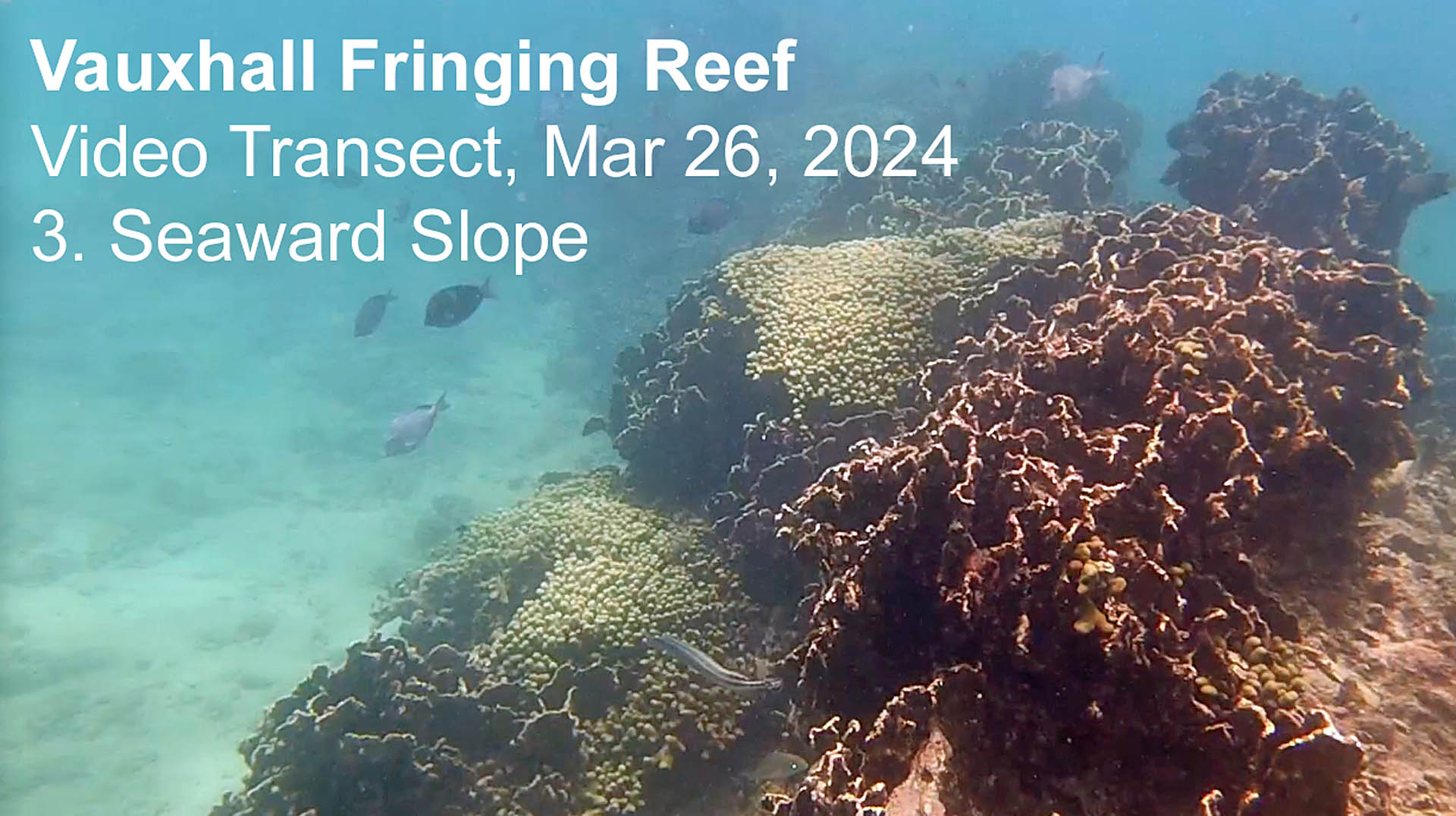
So as I view Vauxhall Reef in early 2024, it is in somewhat rough shape – but there are still impressive areas within the fringing reef, and it is still in far better shape than the other fringing reefs in the MPA. This is well recognized by the many catamaran-based snorkel tours that visit the area to view ‘The Wreck’; snorkellers are also guided to the nearby seaward slope area of the fringing reef where the spurs extend into the Reef Front zone, living coral cover is 80% plus, and there is lots of fish diversity and activity (see the Vauxhall Transect map below for the approx. area).
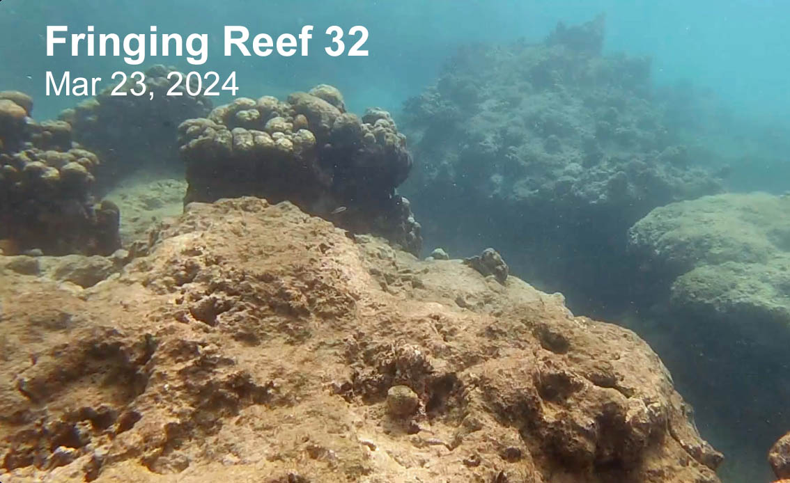
To illustrate the difference between Vauxhall #34 and more typical, highly degraded reefs, I conducted “Video Transects” across Vauxhall Reef and across two other nearby Fringing Reefs (#33 and #32) in the MPA over the period Mar 23 to 26, 2024.
View details of the Video Procedure below
There are two versions of each video:
– A YouTube version: fast loading but poorer quality
– A versicolor.ca version: slower loading but original quality retained
The version makes a difference, e.g. if you wish to ID fish or corals, def. view the Higher Quality version
The Vauxhall Reef Videos
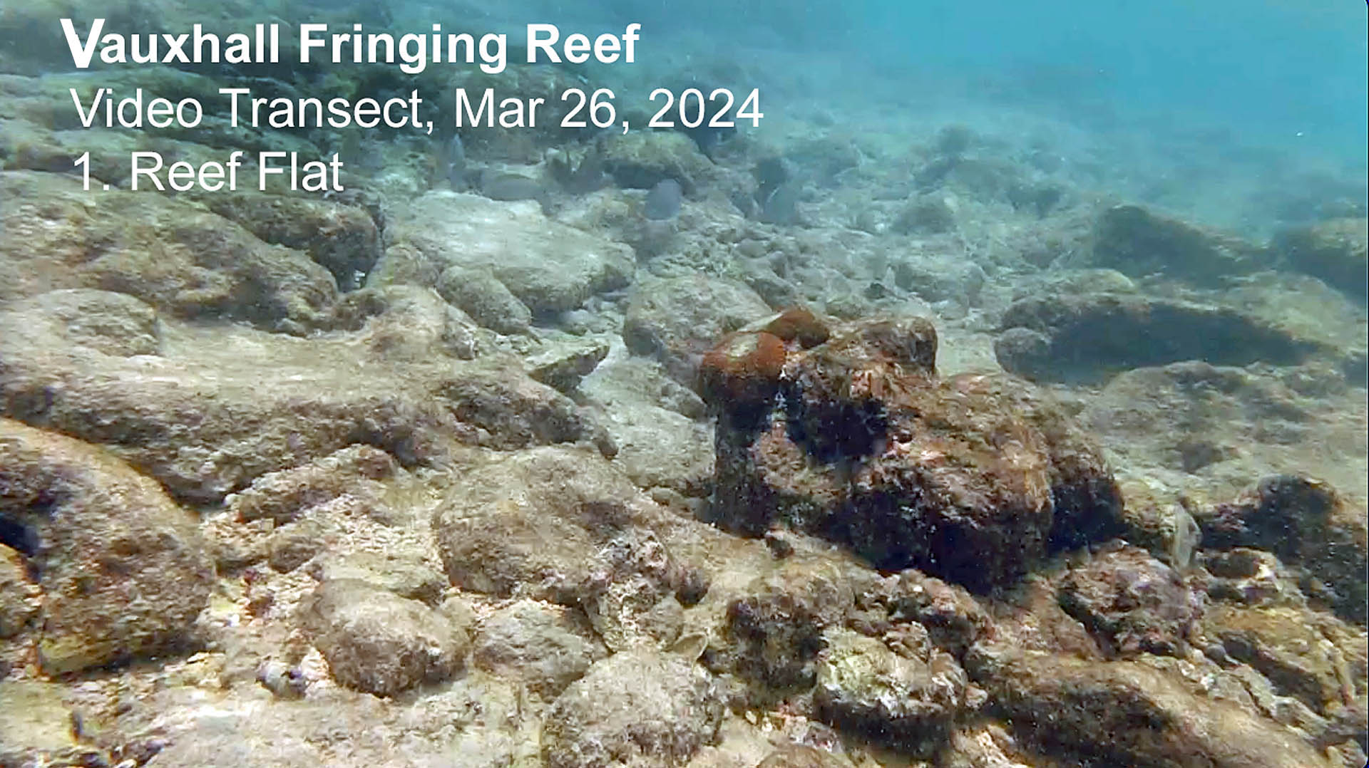
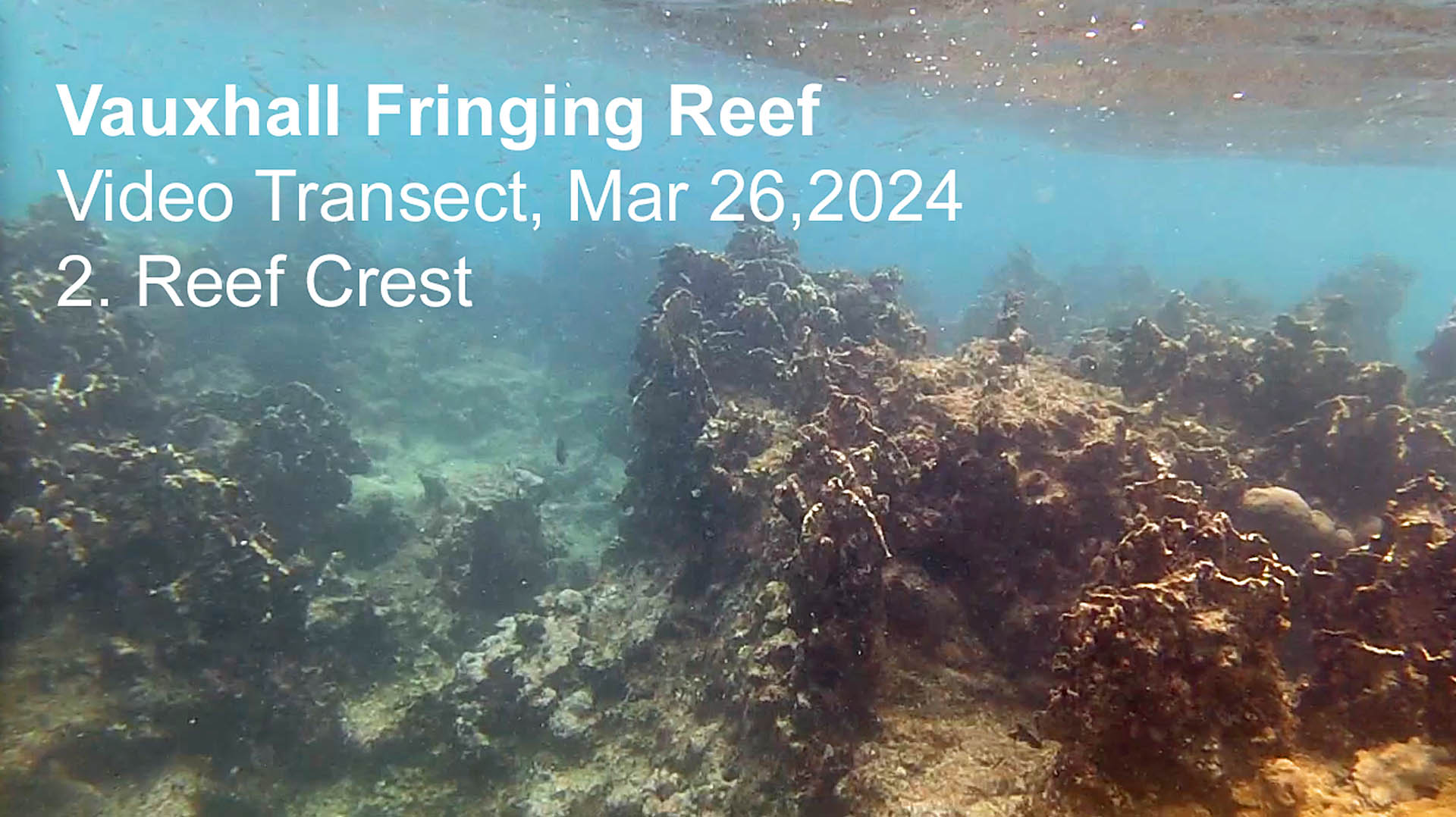
There are 3 separate videos covering the Reef Flat, the Reef Crest and the Seaward Slope at Vauxhall respectively, all on one route and the entire route is covered. Video speed was slowed down approx. 50% to reduce shake.
 Video Transect on Vauxhall Reef |
 Video Transect on Vauxhall Reef |
Video Transect on Vauxhall Reef
3: Seaward Slope
On YouTube (Lower quality)
On versicolor.ca (Higher Quality)
One may wonder, after looking at these videos, why I have called Vauxhall Reef a “Moderately Healthy Reef” – the only part that achieves or approaches that description in these videos is #3 (Seaward Slope). 2023 was a very bad year for fringing reefs in Barbados and it was followed by another very bad year. To view the “moderately healthy” Vauxhall Reef of 2015 to 2023, see videos under Healthy Fringing Reef Videos.
The Degraded Reef Videos (Reefs 32 & 33)
The videos for the highly degraded reefs (Reefs 32 and 33) are single clip videos that cover the entire span from the shoreward edge of the Reef Flat zone to the seaward edge of the Seaward Slope zone; video speeds were not slowed down.
 Video Transect on Reef 32 |
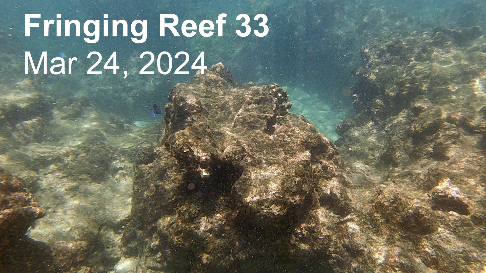 Video Transect on Reef 33 |
To add: Comments about what we see in each of 5 the videos, as the videos progress (e.g. species ID, comments about recent coral bleaching, SCTLD etc.) I will also add some videos from earlier years.
VIDEO PROCEDURES
– Degraded Reefs
The videos of the degraded reefs were taken on Mar 23 (Reef #32, 4: 30 pm approx. 1 hr after High Tide) and Mar 24 (Reef # 33; 12:30 pm approx 2 hr after Low Tide ). The sites on shore were chosen for convenience of access by reefs I knew to be in generally very degraded condition; I did not check out the particular routes before-hand. I began recording near shore and continued as I swam approx. perpendicular to shore and finally reached the Reef Front zone. I attempted to move seaward at a constant speed. The videos for Reefs 32 and 33 are single clip videos that cover the entire span from the shoreward edge of the Reef Flat zone to the seaward edge of the Seaward Slope zone; video speeds were not slowed down.
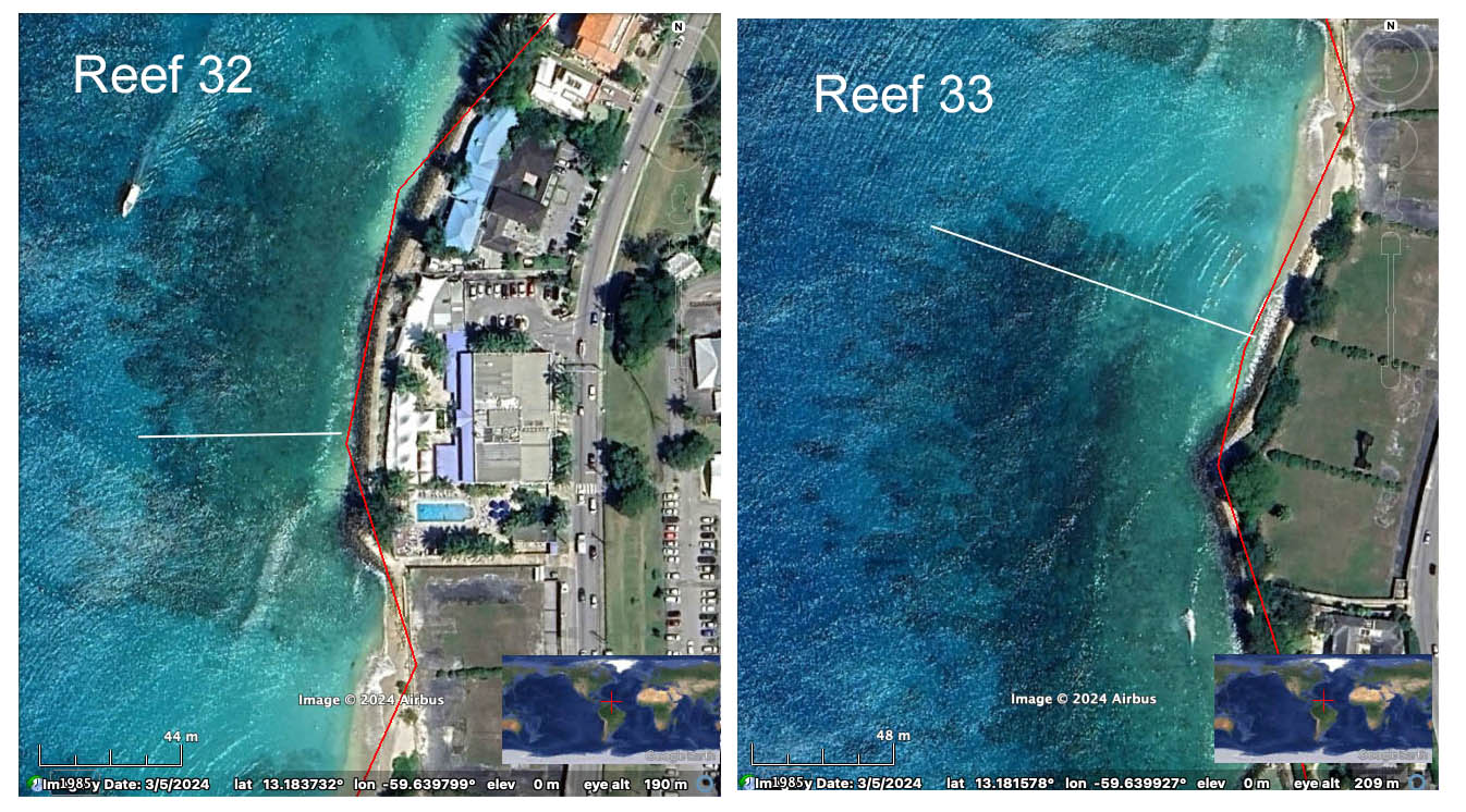
Approx. Transect Location for Reef 32 and 33 videos
– Vauxhall Reef
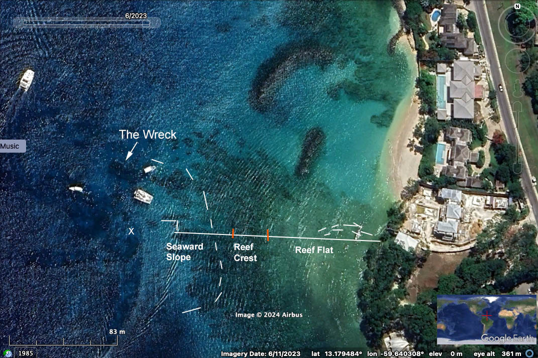
The Vauxhall Transect
Click to enlarge
Broken lines near shore are in area where I was pushed northward. Outer broken lines enclose on the seaward side the spur areas popular with snorkellers who arrive by boat to look at ‘The Wreck”. The X is the location of a mooring float (the northernmost of two floats in that area) that I swam towards.
This set of videos was taken on Mar 26, 2024 at 1;56 to 2:10 pm, approx 2.5 hrs after Low Tide. The route went between a land feature (point of change in direction of the seawall) to a permanent mooring float in the Reef Front zone) that could be recognized for repeat transects; also I knew that it would pass through features I wanted it to cover and that illustrate a “moderately healthy reef”. Winds had whipped up short-fetch waves and I struggled to get through the shallower, highly wave-disturbed Reef Flat and was pushed a little to the north initially (see markings on map). I interrupted the recording at the end of the Reef Flat portion of the route, then began a new video to cover the Reef Crest, and stopped and started again to cover the Seaward Slope, all on the same overall route; I was able to move at ‘normal speed’ through the Reef Crest and Seaward Slope. As a result of the differences in swim speed, the time interval for the Reef Flat video is exaggerated compared to the Reef Crest and Reef Slope Videos (and compared to the Reef 32 and Reef 33 videos, both obtained under relatively calm conditions).
When I reached the end of the contiguous reef, I followed the adjacent spur to the north to its end in the Reef Front zone, simply to provide a bit more coverage of the distal ends of the spurs which have very high coral cover. The snorkel boats typically take participants across these healthy spurs (as well as over ‘the Wreck’).
Video speed was slowed down approx 50% to reduce shake in the Reef Flat video; it was likewise slowed down for the Reef Crest and Seaward Slope videos so they are comparable to the Reef Flat video.