
ObsSG-Bath: Observations of Seagrasses at St. Lawrence
| Navigation Barbados Fringing Reefs & Seagrass Beds /ObsSG-SL (This Page, a top-level page) Other top-level SG Observation Pages – ObsSG – ObsSG-Bath Also view on this website: – About:Seagrass Beds in Barbados – Lit & Links/BB Seagrass |
SUBPAGES OF ObsSG-SL – Survey Methods – CARICOMP Site – Images 2016 – 1969 Description – 1969-1994 stats |
DRAFTING…
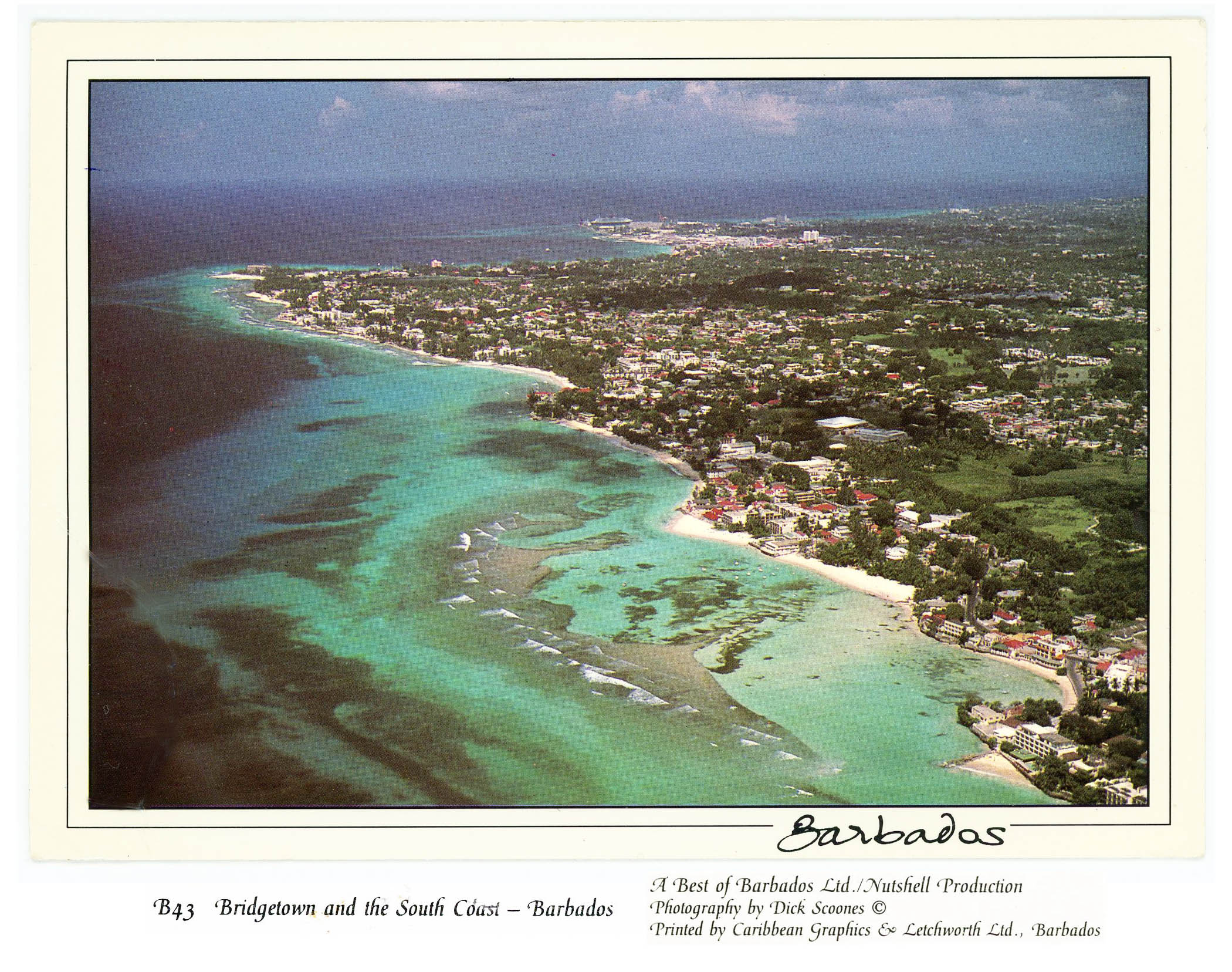
Barbados Postcard, circa 1990
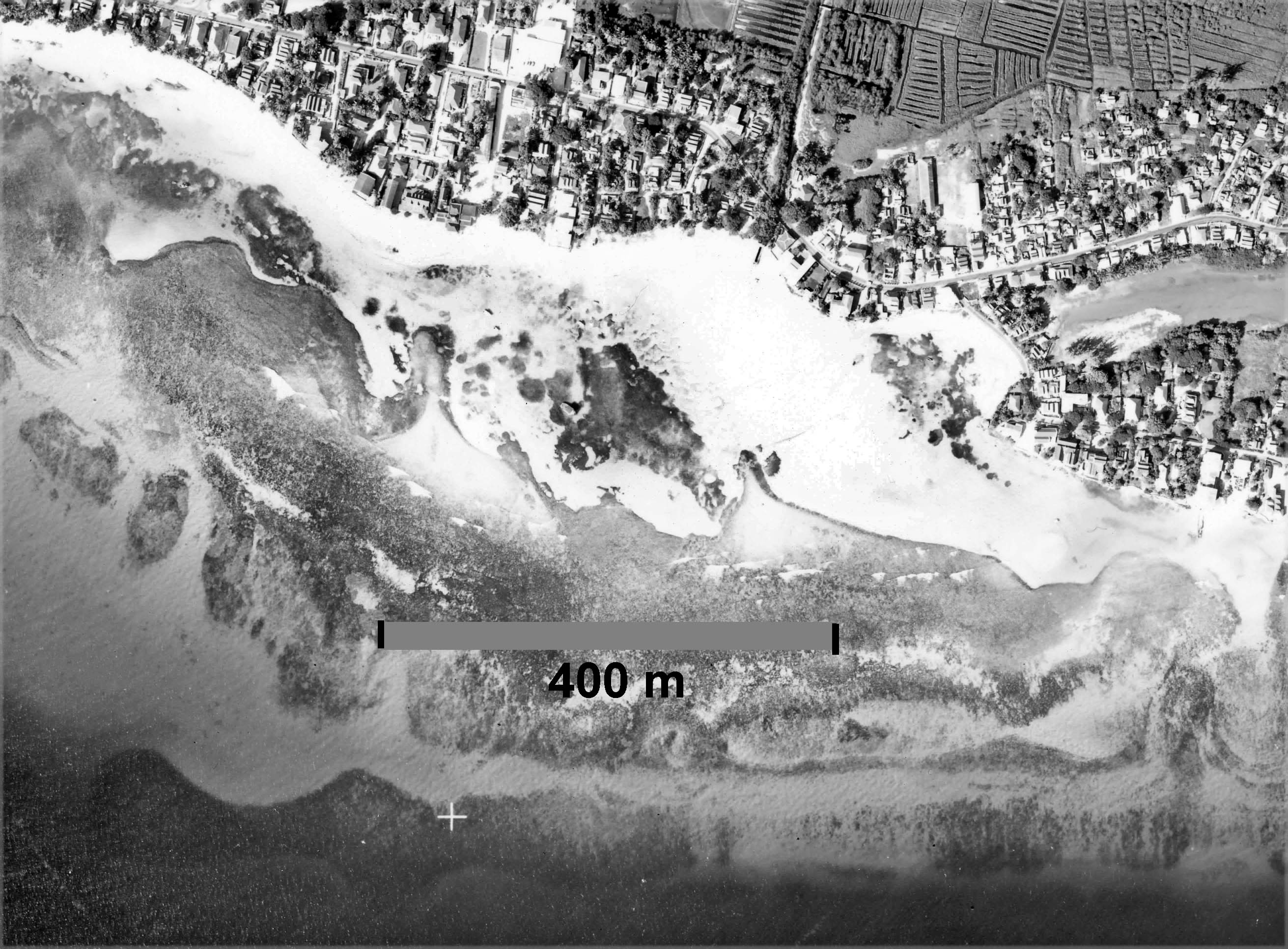
Extract from 1964 aerial photo (Hunting Surveys Ltd.) showing St. Lawrence seagrass bed & area, This image was used to prepare a base map of the area.
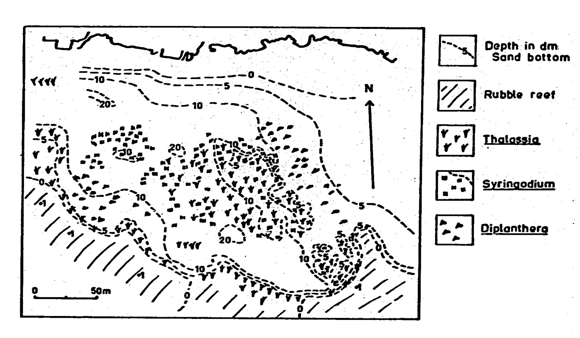
Bathymmetry and distribution of seagrasses at St. Lawrence, Barbados in 1969
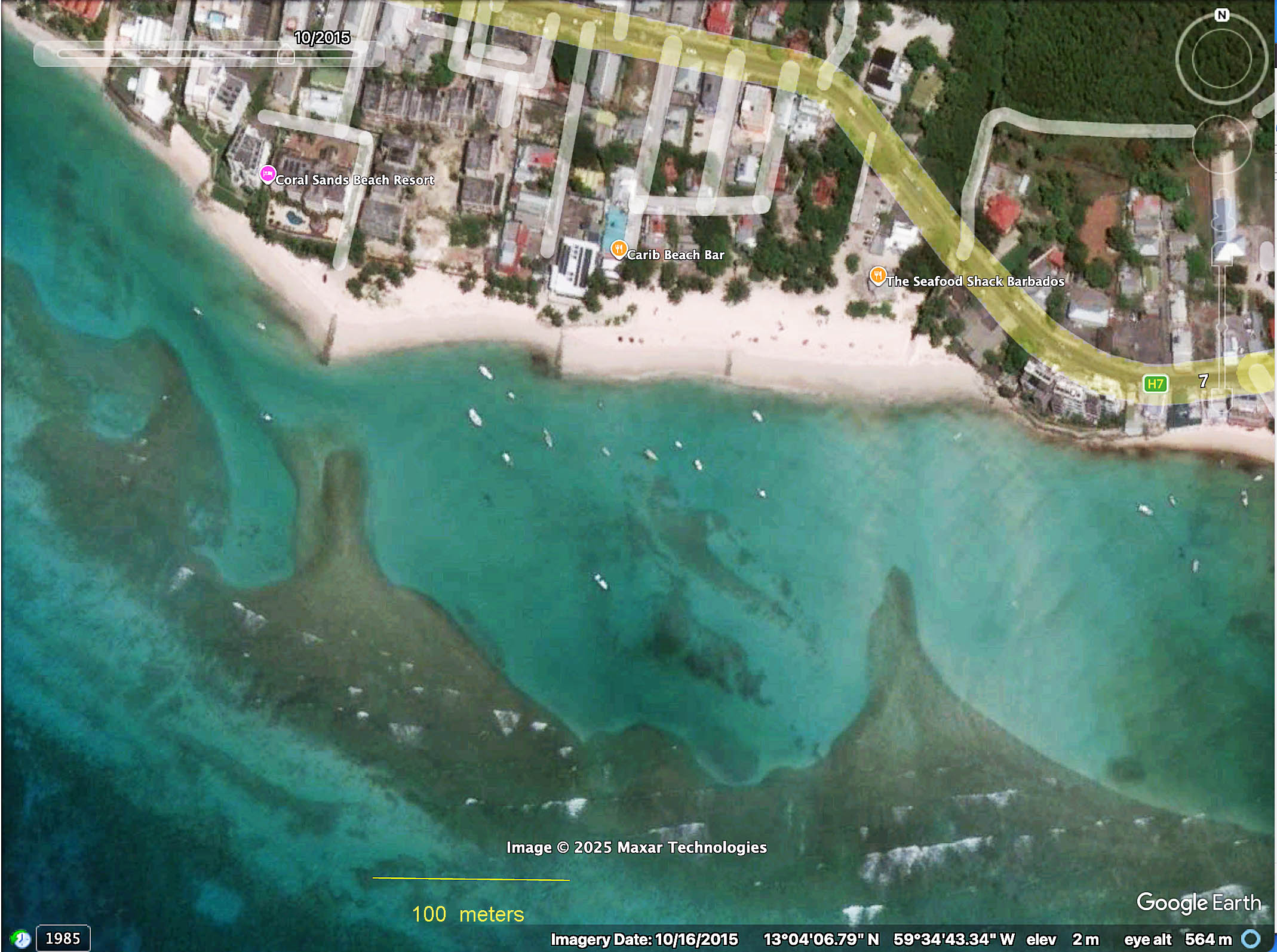
Goggle Earth image of St. Lawrence seagrass area on Oct 16, 2015. The dark areas within the lagoon where a vibrant seagrass bed existed in 1969, observed in 2016, consist of rubble and sand with only scattered seagrass. See Images 2016 for some photos.
….
 From: Barbados: A Coral Paradise From: Barbados: A Coral Paradise Angelique Brathwaite Hazel Oxenford & Ramon Roach. 2008. Miller Publishingpp 48-49 [paragraphing & bolding inserted]”Seagrass beds have faired little better than mangroves on the island. Areas where the habitat was once prolific such as Worthing Lagoon in the south and Bath in the east have either steadily or abruptly lost their grassy marine meadows over the course of the last 40 years.These fish nurseries and natural sediment sinks have all but been lost from the southern coastline, with only a few pockets of growth remaining in the St. Lawrence area.Here the demise has been witnessed since the 1960’S when the lagoon once hosted a mature seagrass meadow comprising dense mats of turtle grass and associated macroalgal species, sea eggs and conch. By the 1990’S the area of the meadow had declined considerably and the early 2000’S witnessed a drastic decline and virtual disappearance of any seagrass in this area.This was a result of a combination of deteriorating water quality and changing sediment transport patterns within this dynamic area, together with a bumper recruitment of the white sea egg which grazed the grass blades en masse an~their underground rhizomes as sand erosion exposed them.It is ironic that the sea egg, much prized as a local delicacy,decimated the last remaining beds within the lagoon, leaving bare sand in their wake. Recent studies of the lagoon however are revealing signs of recovery of seagrass and corals within the area.Thus, barring the occurrence of severe natural or man-made disturbances in the near future, there is hope that Worthing Lagoon may one day be covered in a lush seagrass meadow again. At Bath, the loss of seagrasses is less severe, as this area is much less prone to human induced impacts than the heavily developed south coast.””However, changes in water quality due to increased levels of development, land use changes and increased volumes of sediment carried to the nearshore in storm water run-off have taken their toll on the habitat.” |
The State of the “St.Lawrence Seagrass Bed” from 1994 forward has been well documented by Lotus Vermeer in the her PhD thesis, and in related studies by H.Oxenford and others/CARICOMP – see CARICOMP Site.
My own mostly unpublished observations of the area in 1968-69 which are/will be reported here add some further historical context and description of the St.Lawrence Seagrass Bed” in a more pristine state than in 1994. In turn my/our survey observations of 1994 which will also be reported here, provide info on the changes from 1969, and some further explanation of the Bratwaite and Oxenford comment above that ” By the 1990’s the area of the meadow had declined considerably”; and my/our survey observations of 2016 likewise provide more info on changes since 1994.
Lotus Vermeer in her PhD thesis* made use of the 1969 and 1994 observations and offers some detailed interpretation of them and insights into what drove significant changes between 1969 and 1994.
*Lotus Vermeer, 2000. Changes in seagrass growth and abundance of seagrasses in Barbados, West Indies, PhD thesis, Dalhousie University. See Ch 5.