
NAVIGATION
This page is a sub-page Historical Imagery, that in turn
a subpage of ObsBath, a top-level page on
the website Barbados Fringing Reefs and Seagrass Beds (www.versicolor.ca/barbados).
Go to ObsBath for a list of other subpages in this section
of the website.
Subpages of Historical Imagery:
PHOTOS & VIDEOS IN BATH SEAGRASS BEDS 1968 – 2025
| – Bath 1968-70 – Bath 1994 – Bath 2005 – Bath 2011-i – Bath 2011-ii |
– Bath 2015-i – Bath 2015-ii – Bath 2015-iii – Bath 2017 – Bath 2024/5 |
On this page:
AERIAL IMAGES AND MAPS OF SEAGRASS BEDS AT BATH
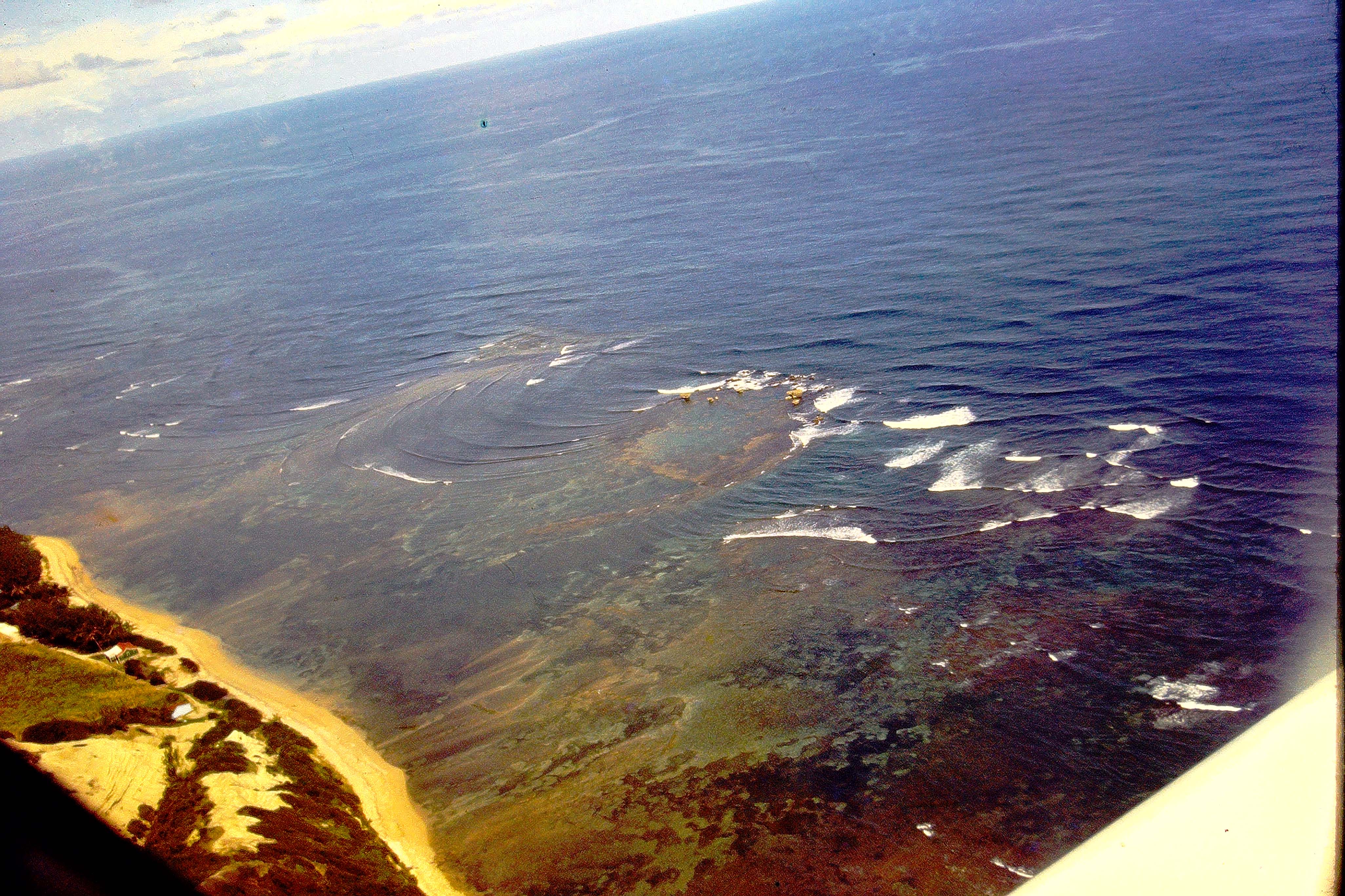
Img 1. Aerial View of Bath area in 1968. I hired a small aircraft to view seagrass beds from the air. Dark areas are seagrass beds; refer to map below.
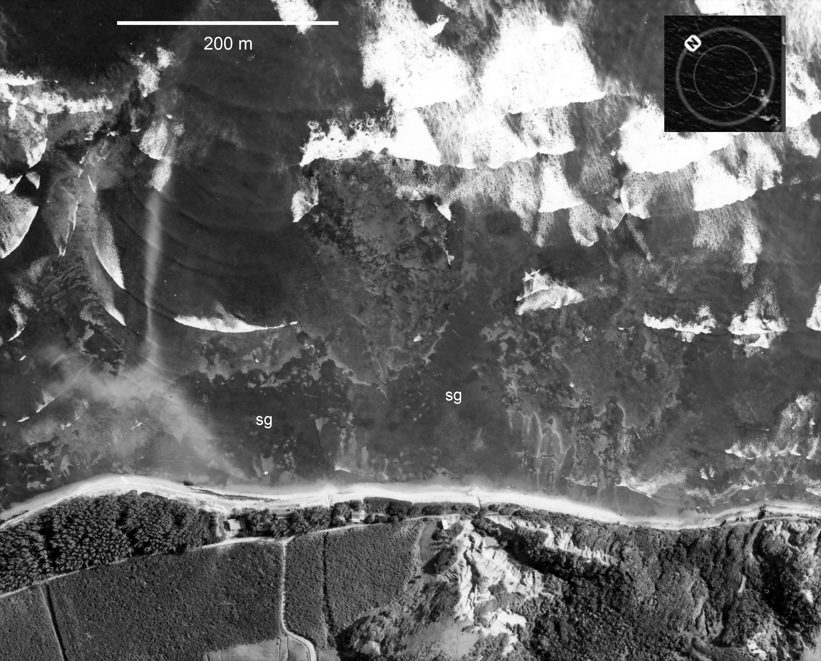
Img 2. Extract from 1964 aerial photo (HuntingSurveys Ltd.) showing Bath area, large sweeps of seagrass beds (sg). This image was used to prepare a base map of the area
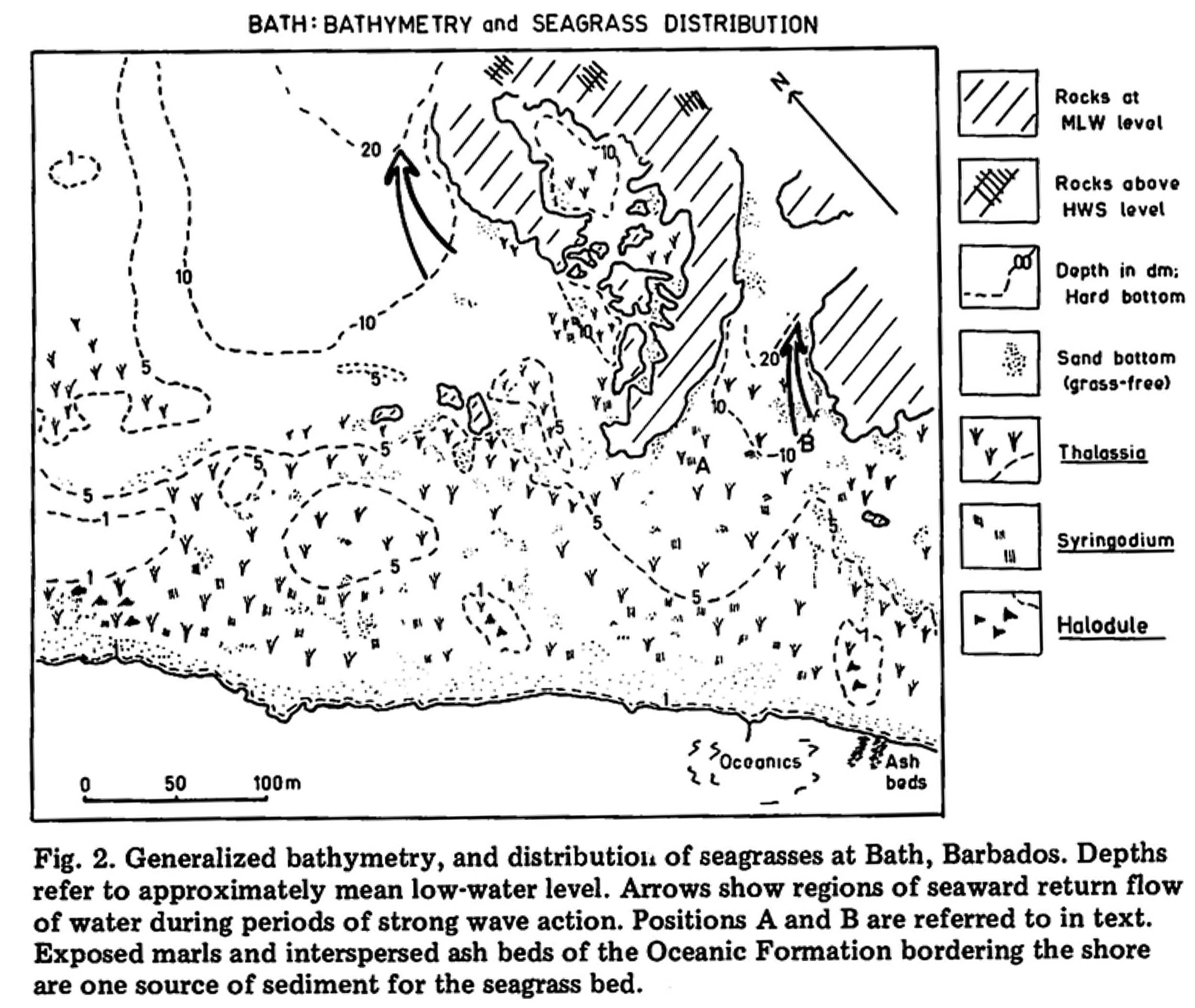
Map 1. Generalized bathmetry and distribution of seagrasses at Bath in 1968, From Patriquin 1971, 1975.

Map 2. Distribution of substrate types in seagrass beds at Bath in 1968.
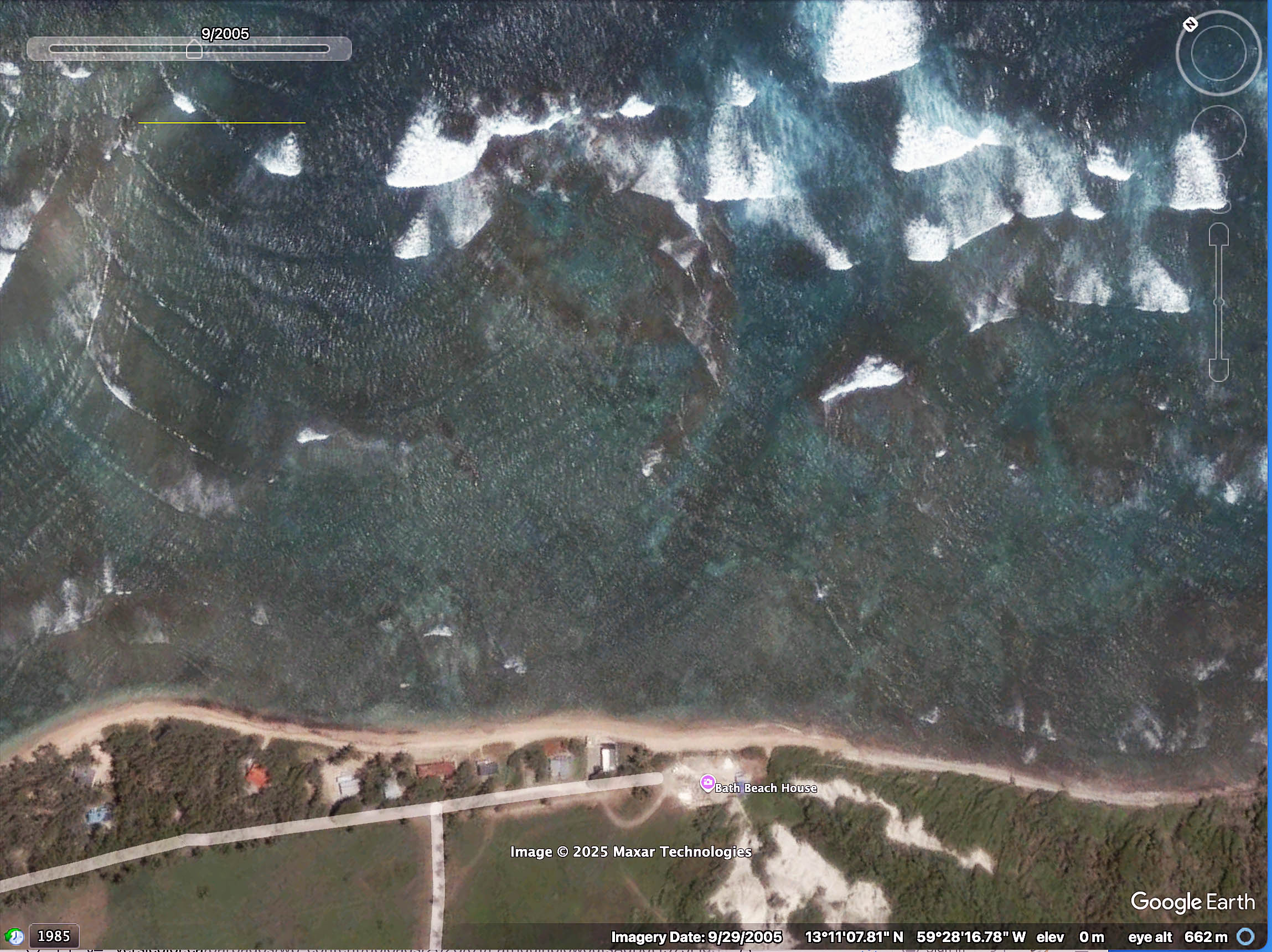
img 3. 2005 Google Earth Image
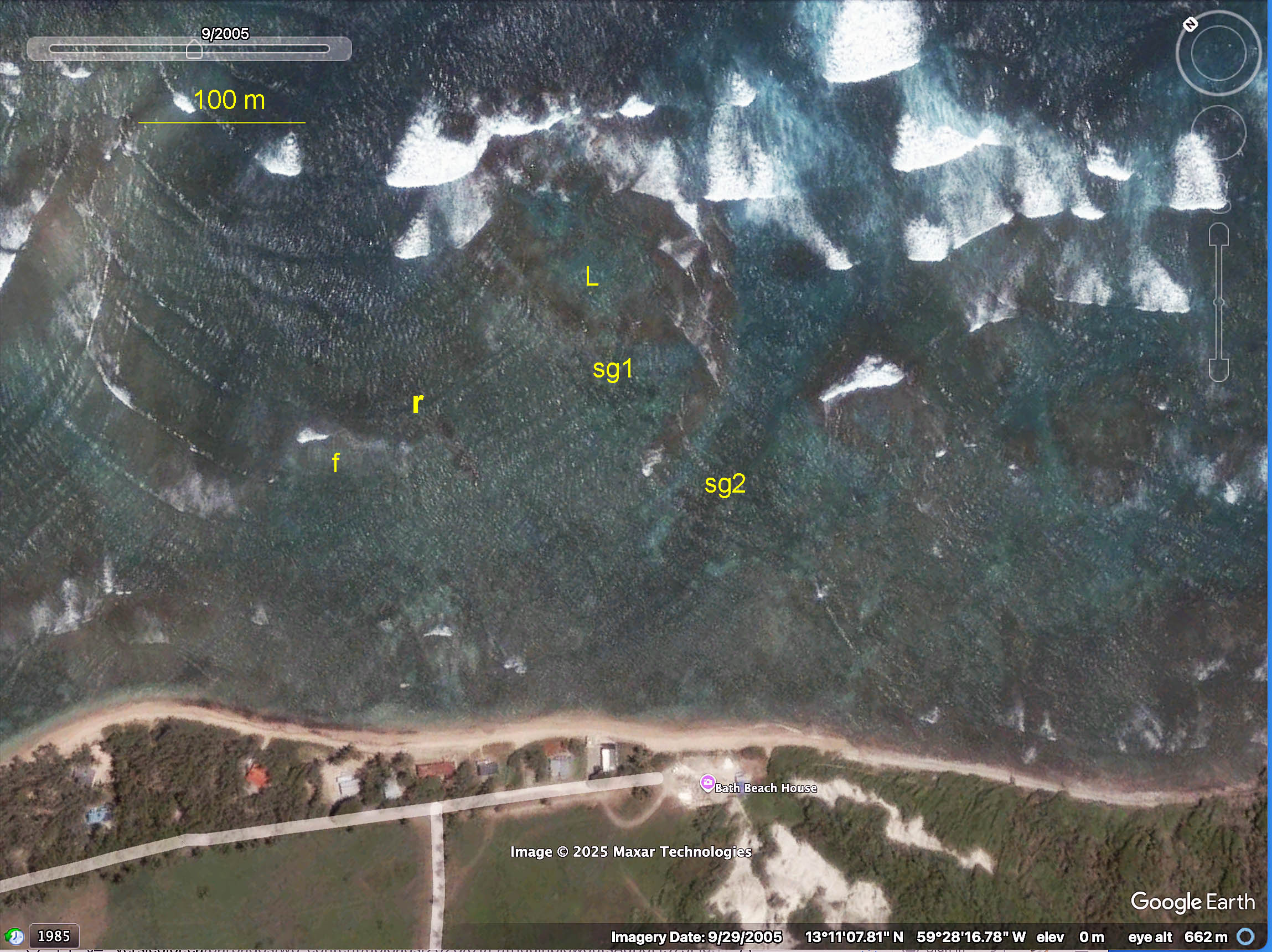
Img 4. 2005 Google Earth image with labels inserted. “r”: 3 rocks, can be seen in Maps above (Img 3 and Img 4); f: leading edge of seagrass bed, can be seen in Map 2; L: lagoon within “The Platform”; sg1: seagrass patch just leeward of Platform; sg2 distinct seagrass area, not present in 2015, 2022 Google Earth images.
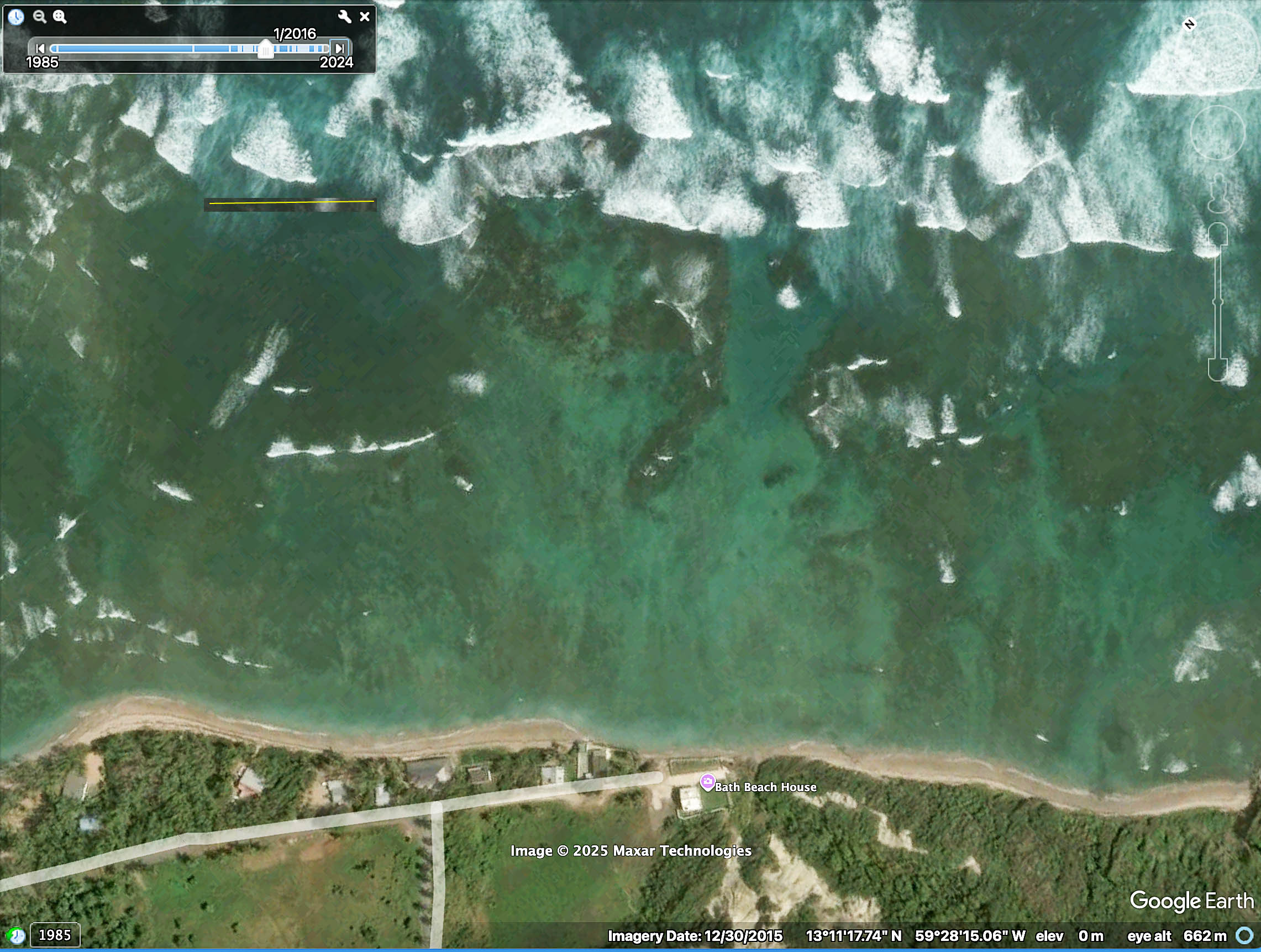
Img 5. 2015 Google Earth Image
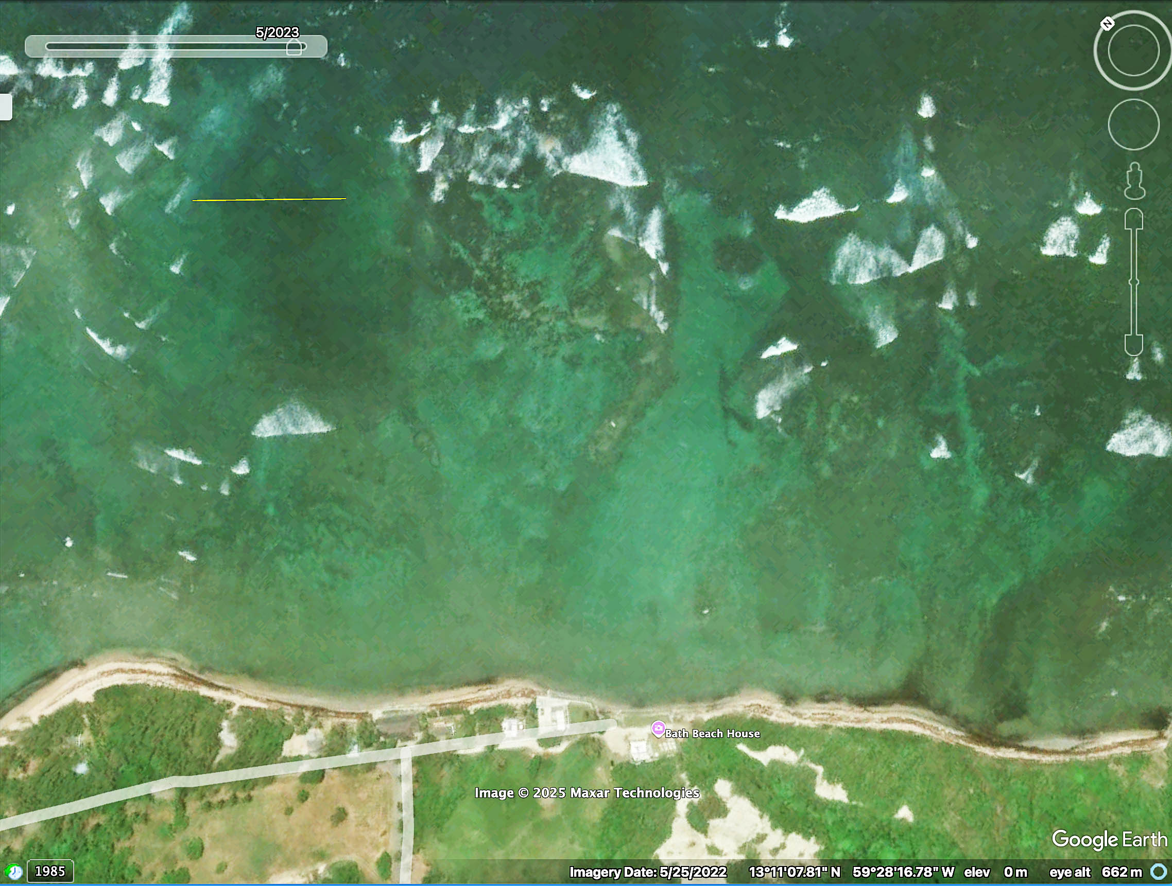
Img 6. 2022 Google Earth Image