| The pages and subpages on Moose:
MOOSE
|


Map 5 from the Halifax Green Network Plan (2018)
Identification of the Chebucto Peninsula is inserted. The map illustrates the advanced level of landscape level planning for conservation of biodiversity by Halifax (HRM, all of Halifax Co.) Click image for larger version
View the Moose page for info. about moose in NS more generally, and about the Mainland Moose in particular.
——–
Summary Historically moose in the the Bowater-Mersey St. Margarets Bay lands were considered contiguous with the population on the Chebucto Peninsula and together formed one of the four Core Population Areas recognized in 2012. The 2021 Mainland Moose Recovery Plan, however, excludes the Chebucto Peninsula from areas of Core Habitat. The reasons are a bit obscure but seem to be related to the Recovery Team’s contention “that development has led to declines in the Chebucto Peninsula region” and “a loss of connectivity across the landscape”. However, there is no evidence that the declines on the Chebucto Peninsula have been any more precipitous than in other areas of NS that are retained as Core areas. Also, these comments do not recognize the demonstrated commitment of Halifax Regional Municipality, supported by its citizenry, to addressing habit and connectivity issues, especially for the Chebucto Peninsula. Surely, the Chebucto population should continue to be treated as contiguous with the moose in the Bowater-Mersey St. Margaret’s Bay land, and part of the Core Habitat for the Mainland Moose.
From the Halifax Green Network Plan (HGNP) (bolding inserted):
“The Chebucto Peninsula is one of the Region’s most important and vulnerable natural areas. Its large undisturbed patches of wilderness, broken only by the Highway 333 loop and Highways 306 and 253, provide regionally important habitats for a wide variety of species, from endangered moose populations to rare plants. While the bulk of the interior of the Peninsula is well preserved, protected by parks and wilderness areas, ribbon development along the major highways is a concern for both local and regional landscape connectivity.”
Specific actions to address ribbon development and related wildlife connectivity issues are cited in the HGNP and the first legislative action on the HGNP was an Amendment passed on Sep 24, 2018 “to the Regional Plan’s conservation design development agreement policies to specifically reference the Important and Essential Corridors shown on Map 5)”.
On Nov 26, 2021, NS Dept of Natural Resources and Renewable (NRR or NSNRR) released the its Mainland Moose Recovery Plan following “delays, lawsuits and auditor general reports on the issue” (CBC, Nov 26, 2021). It’s referred to here as the 2021 Recovery Plan; the date is attached to distinguish it from an earlier plan released in 2007. Overall, the plan is highly commendable for the detail and quality of the content. It is supported with a few reservations by Nature Nova Scotia – view extracts from Nature NS comments on this website.
In contrast to earlier mapping and plans, The Chebucto Peninsula is not recognized as Core Mainland Moose habitat in the 2021 Recovery Plan

Significant Moose Concentration Areas (2012) Fig 2, p.12 in the 2021 Moose Recovery Plan
Click on images for larger versions
Fig 2 of the 2021 Recovery Plan (Map at right) shows that the Chebucto Peninsula and an adjacent area on the mainland encompassing most or all of the Bowater-St. Margaret’s Bay land was recognized in 2012 as one of four major moose concentration areas.
However the Chebucto Peninsula was excluded from the area designated in the 2021 Recovery Plan as Core Habitat for the Mainland Moose (2nd Map at right).

Core Habitat for Mainland Moose and modelled Mainland Moose concentration areas (2021) Fig 2, page 83 in the 2021 Moose Recovery Plan, Maps section
Grounds for including the Chebucto Peninsula in the Core Habitat area based on info. in the 2021 Recovery Plan could be seen as:
(i) the historical occurrence of moose on the Chebucto Peninsula, and prior identification of the area as Core Habitat
(ii) Habitat Suitability Index (HSI) scoring based on the 2021 forest inventory shown in Fig 4, p 85 which shows most HSI values in Class 4 on the Chebucto Peninsula (there are five classes – 1 lowest, 5 highest suitability).
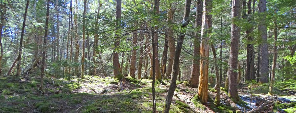
(iii) Figure 8. p 89 in the 2021 Moose Recovery Plan (“Point scores for combined 2021 and 2051 HSI values.. and road buffer density scores”) shows 50% of hexagons with score classes of 4, 5 and 6 (1 lowest HSI values, 9 highest) and overall higher than some equivalent sized areas in coastal eastern NS that are included in core habitat. It is notable as well that the Chebucto Peninsula has been recognized as having a large area of “intact forest” View Nova Scotia’s Intact Forest Landscapes: Opportunities for Conservation Planning (2010).
(iv) Occurrence of a high proportion of Crown lands and Protected Areas on the Chebucto Peninsula (Fig 3, page 84).
The main rationale for exclusion of the Chebucto Peninsula is apparently this (p.24 of the 2021 Moose Recovery Plan):
Human population increases and consumption will drive demand and need for additional housing and development, and the demand for services and industries to support this increasing population will add additional stress to habitat needs for species. There is less risk of development pressure due to the geographic isolation of currently recognized subgroups of Mainland moose in Nova Scotia, however, it [is] likely that development has led to declines in the Chebucto Peninsula region. Additionally, this development creates a loss of connectivity across the landscape, and geographic isolation may result in reduced health, loss of productivity, and potential genetic deterioration. For an already heavily fragmented region such developments may create challenges for recovery, especially with respect to smaller groups such as those in the Tobeatic and Chebucto Peninsula regions, and for connectivity among Mainland moose groups and with New Brunswick.
However, there is no evidence or other indiction that the declines in the Chebucto Moose have been any more pronounced than the declines elsewhere in the province. Further, these comments do not take into account the following:
(1) There is a high proportion of protected and Crown land on the Chebucto Peninsula, approaching 50% , with the areas of heavy settlement located largely in the northeast sector and away from areas of moose concentration. The Chebucto Peninsula is a very significant conservation area. By an estimate made in 2015, 29% of the land was in Parks and Protected Areas (versus 12-13% for the province as a whole, 15% for HRM as a whole) and an additional 12% is Crown and HRM land that remains undeveloped, i.e. 41% of land is PPAs and Crown land. There have been additions to the PPAs since 2015, on both Crown and private lands.
(2) Halifax (Halifax Regional Municipality) recognized the importance connectivity issues for wildlife early on, particularly in regard to the Chebucto Peninsula, and has made a firm commitment to address them via landscape level planning.

Chebucto Peninsula Generalized map of forested areas and essential corridors for wildlife movement .From the BLUE MOUNTAIN/BIRCH COVE ASSESSMENT STUDY 2006, Appendix B8 , conducted in conjunction with the Highway 113 EA
Concern about preserving wildlife corridors in Halifax, and in the area of the Chebucto Peninsula in particular appears to have first arisen in connection with the Environmental Assessment for Highway 113, a process initiated in 1998. (Also view 2004 Report on Moose.) The first Regional Plan (2006) noted that “Protection of isolated blocks of habitat will not adequately protect wildlife in HRM. The size and continuity of natural corridors contribute to the overall connectivity of natural landscapes, which are in turn critical to reducing losses of native species of flora and fauna caused by development practices” and produced the first “Parks and Natural Corridors Map” for the whole municipality. The 2014 Regional Plan initiated the process that led to the current Halifax Green Network Plan (2018) cited at the top of this page and to legislation that requires development agreement policies to specifically reference the Important and Essential Corridors shown on Map 5 (as cited above). The HGNP pages 49&50 cites specific actions to “Maintain and improve natural connections between the Chebucto Peninsula and Mainland Nova Scotia, as well as those within the Peninsula itself.”
The process continues inside and outside of the municipal government, e.g. view results of a Wildlife Corridor Landscape Design Charette (2021).
(3) Connectivity between the Chebucto Peninsula and the greater mainland is essential for most or all species large and small not just the Mainland Moose, i.e. there are more incentives than just concern about Mainland Moose for providing connectivity across major highways.
(4) There is a high level of interest and concern amongst residents for the Mainland Moose and widespread support for the Halifax Green Network Plan including measures to increase connectivity. Both the HGNP (2018) and the first related legislative amendment to the Regional Plan received unanimous support by Regional Council, reflecting a high level of community support (The Star, Aug 14, 2018; Halifax Sep 24, 2019 Sep 24, 2019). Protection of core habitat for Mainland Moose on the Chebucto Peninsula was uppermost amongst the reasons a group of over 35 community organizations cited for protection of the Five Bridge Lakes Wilderness Area (FBLWA) in the centre of the Chebucto Peninsula, an effort that came to fruition in 2011. Another example: WRWEO, the organization that built and manages The Bluff Trail in the FBLWA, indicated a willingness to close the trail seasonally as might be necessary to reduce stress on the moose. The St. Margaret’s Bay Stewardship Association has promoted conservation on both the Chebucto Peninsula and on the Bowater-Mersey St. Margaret’s Bay lands (both included in one of the the Core Habitat areas in 2012) and initiated the effort to “Buy back the Mersey”in 2012; more recently members of this group have been highly active in seeking protection for the Ingram River Wilderness Area which lies within the same Core Habitat area.
(5) Moose or moose signs continue to be observed on the Chebucto Peninsula. The moose are still there. Surveys conducted in 2017 and 2018 indicate there have been precipitous declines in Mainland Moose in NS in recent years, but moose are still being reported on the Chebucto Peninsula. For example, a moose was observed by Williams Lake on the Halifax south mainland in late 2016 2017, moose signs in the vicinity of Sandy Lake (Bedford) in 2017 , close to the northeast corner of St. Margaret’s Bay in late 2020 (ML, personal communication), and in Terrence Bay in May 2021
In conclusion, there are significant contradictions evident in the rationale – to the extent it can be discerned in the 2021 Recovery Plan – concerning what to include and exclude as Core Habitat for the Mainland Moose
The Recovery Team) contends that development has led to declines in moose in the Chebucto Peninsula region but there is no evidence that the declines are more pronounced there than in other areas (particularly the Tobeatic) which are still included as Core Habitat.
The HSI index values for Chebucto Peninsula overlap with values in areas still included as Core Habitat, and DNR personnel have in the past commented that the ‘Chebucto group is ‘healthy and the area provides good habitat for moose’ (Presentation to Woodens River Watershed Environmental Organization on May 6, 2009, cited in 2010 letter.)
It appears that the main reason for the exclusion of the Chebucto Peninsula from the Core Habitat area relates to concerns about connectivity.
Yet the Recovery Team
- cites similar issues in relation to smaller groups of moose in the Tobeatic, but those remain in the Core Habitat;
- cites concern about connectivity along the Chignecto Isthmus but recognizes efforts to improve connectivity in that area;
- cites the need to “Mitigate barriers/threats related to highways through the use of wildlife underpasses, overpasses, and/or other methods to provide for safe passage in key crossing locations, with an immediate focus on Highway 104 from Amherst-Truro” but do not give equivalent consideration to Highway 103 crossing the Chebucto Peninula.
In general, the Recovery Team seems not to recognize or to pre-judge the effectiveness of the demonstrated commitment of HRM and its citizens to addressing connectivity issues beginning in the early 2000s, and the related planning which is well ahead such planning by NRR.
The Recovery Team highlights the need for ‘outreach, communication and education’, but they do not seem to recognize the high awareness in Halifax (HRM) of these issues and support for conservation measures, and of moose in particular – not only on the Chebucto peninsula but in the adjacent Bowater-Mersey St. Margarets Bay lands.
Historically the Bowater-Mersey St. Margarets Bay lands were considered contiguous with the Chebucto Peninsula and together formed one of the four Core Population Areas recognized in 2012, i.e. these moose are part of one larger local group. Surely, the Chebucto population should continue to be treated as such within the larger effort to facilitate recovery of the Mainland Moose on the Nova Scotia mainland at large.
Addendum: Extracts from the Halifax Green Network Plan addressing connectivity issues related to the Chebucto Pennsula
Also view More on the Chebucto Moose on this website.
|
The Chebucto Peninsula The Chebucto Peninsula is one of the Regions most important and vulnerable natural areas. Its large undisturbed patches of wilderness, broken only by the Highway 333 loop and Highways 306 and 253, provide regionally important habitats for a wide variety of species, from endangered moose populations to rare plants. While the bulk of the interior of the Peninsula is well preserved, protected by parks and wilderness areas, ribbon development along the major highways is a concern for both local and regional landscape connectivity. The Chebucto Peninsula is largely disconnected from the mainland by Highway 103 and the associated expansion of both urban and rural settlements. This development has created a barrier to wildlife movement. The planned development of Highway 113, together with the multiple areas planned for future urban development, may eliminate the few remaining natural corridors between the peninsula and the mainland. If concerted efforts are not undertaken to mitigate and avoid impacts to landscape connectivity, the functioning of the Chebucto Peninsula for wildlife and overall ecological health will be severely compromised. Within the Chebucto Peninsula itself, wilderness connectivity has also been disrupted by road construction and development in several key areas near Provincial parks and protected areas. Old Sambro Road (Highway 333) runs north/south across the eastern portion of the Chebucto Peninsula presenting some significant barriers between natural areas. In addition, West Pennant Road (Highway 349), as well as development along East Pennant Road and Sambro Creek Road, separate Crystal Crescent Provincial Park at the southern tip of the Peninsula from the rest of the Peninsula’s natural lands (Map 9 on page 51).
4.3.3 Objectives and Actions 4.3.3.3. Maintain and improve natural connections between the Chebucto Peninsula and Mainland Nova Scotia, as well as those within the Peninsula itself. Action 32: Amend the Regional Plan and Municipal Planning Strategies to prioritize the preservation and creation of natural connections to the Chebucto Peninsula (Map 9) from the Mainland when reviewing development proposals and updating planning policies and zoning in the area. Specific connections to review and prioritize are highlighted on Map 9. Action 33: Consider the preservation and creation of natural connections to the Chebucto Peninsula when planning the development of the Ragged Lake Business Park. Action 34: Work with the Nova Scotia Department of Transportation and Infrastructure Renewal, as opportunities arise, to identify opportunities to construct wildlife crossings under Highway 103 and the planned Highway 113. |

</strong> Fig 2, p.12 in the<a href="https://novascotia.ca/natr/wildlife/biodiversity/pdf/recoveryplans/mainlandmooserecoveryplan.pdf"> 2021 Moose Recovery Plan</a><br /><em>Click on images for larger versions</em>)