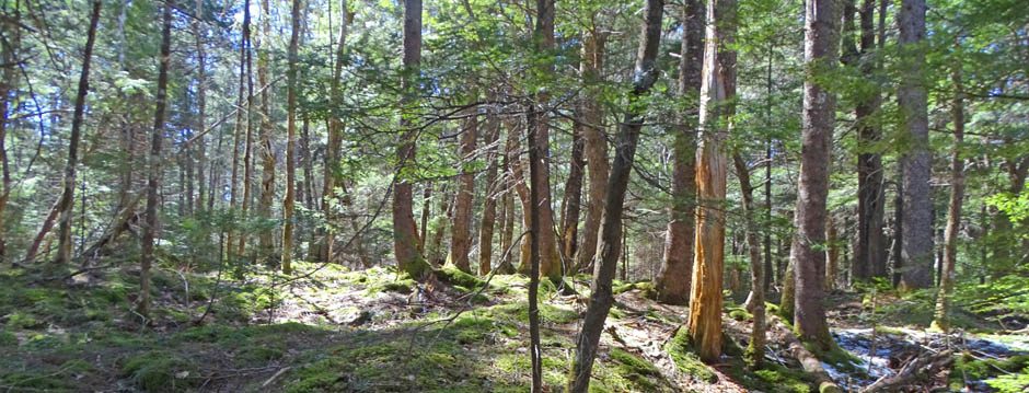
In December of 2021, as a descendant of settlers and following the lead of Community Forests International earlier in the fall of 2021, I began to refer to our forest as the “Wabanaki Forest” rather than the “Acadian Forest”.
It’s a process. In my ‘settler circles’, in particular on the board of WRWEO, we started acknowledging that Mi’kma’ki is is “unceded, unsurrendered territory” circa 2015; now such declarations at the beginning of gatherings are routine, at least in many venues.
Logically, if we accept that concept, we should also name and view our forest (and forest region) by the name applied to it by our indigenous peoples, by those who tread so gently on it, while also using it and dependent on it – something we of settler descent are just learning to do (the “treading gently” and “using” parts) and appreciate (the “dependent” part).
‘Acadian Forest” was not a universally applied name for the forest region…
Below are some of the references I am looking at as I develop this page.
Puktewei: Learning from Fire in Mi’kma’ki (Mi’kmaq Territory)
Shalan Joudry, MES thesis, Dalhousie University, 2016.
“…as I researched the ecological descriptions of our Mi’kmaw homeland and saw the map delineating the Acadian Forest Region, I noticed the striking resemblance of this area to what we in our Eastern Indigenous communities call the Wabanaki Confederacy territory. Mi’kmaw historian Daniel Paul explains that through time, strong political alliances were formed by similar and neighbouring peoples. East of the Iroquois nations, the peoples who made up the Wabanaki group were of Algonquin families of close geography and cultural family (Assembly of Nova Scotia Mi’kmaq Chiefs, 2007, p. 12; Paul, 2006, p. 12; Speck, 1915)
Places and their names matter to people whose identity is rooted in a particular area. As Kovach (2009, p. 61) writes, “Place links present with past and our personal self with kinship groups. What we know flows through us from the ‘echo of generations,’ and our knowledges cannot be universalized because they arise from our experience with our places. This is why name-place stories matter: they are repositories of science, they tell of relationships, they reveal history, and they hold our identity…
5.6 RE-PRESENTING THE WAPANE’KATI FOREST REGION
When I look again at the maps identifying the distribution of the current Acadian Forest range and the lands of the Wapane’kati (known as the Wabanaki Confederacy), I am again struck by the similarities in the boundaries (see Figure 9).”
A river runs through it: an archaeological survey of the Upper Mersey River and Allains River in southwest Nova Scotia
By Benjamin C. Pentz. MA thesis, Archaeology Unit, Department of Anthropology, Faculty of Arts, Memorial University of Newfoundland October 2008
Abstract: New archaeological evidence from the Mersey and Allains Rivers in southwest Nova Scotia has enabled historic use of this traditional Mi’kmaq canoe-route to be extended back into the pre-Contact Period. The 2006 Upper Mersey/Allains River Corridor Archaeological Survey has bridged a gap in the archaeological record by building on previous investigations from the southern half of the Mersey River, and limited work on the Allains River. A continuous line of pre-Contact sites now extends through the interior of southwest Nova Scotia, linking the Bay of Fundy and the Atlantic coast. The association of these sites with modern portage trails and the presence of imported Bay of Fundy lithics across the route confirm these waterways formed a travel corridor during the Middle-Late Woodland Period (ca 2,000-450 BP). Additional evidence also indicates most of the route has been used for at least 5,000 years. The results of this survey have provided the basis for more wide ranging discussions of landuse and seasonal settlement patterns of the Mi’kmaq and their ancestors in the region.
Mi’kmaw Theses Online
Cape Breton University/Indigenous Affairs/ Mi’kmaq Resource Centre
Settler Nomenclature for the region
The Hemlock–White Pine–Northern Hardwood Region of Eastern North America
G. E. Nichols Source: Ecology , Jul., 1935, Vol. 16, No. 3 (Jul., 1935), pp. 403-422
A forest Classification for Canada
Kings Printer, Ottawa. I believe this is the first use of ‘The Acadian Forest Region”. It applied only to land within Canada. View Map | View Extract from Doc
The Acadian forest: Historical condition and human impacts
by J. Loo2 and N. Ives. 2003. , THE FORESTRY CHRONICLE VOL. 79, NO. 3 “The Acadian Forest Region comprises the three Maritime Provinces of Canada, each of which has a distinct history resulting in different patterns of land ownership, land use, and impacts on the forest. The region encompasses a high degree of physiographic and biological diversity, being situated where the warm, moist influence of the Gulf Stream from the south collides with the cold Labrador Current and the boreal forest gradually gives way to mostly deciduous forest. Natural forest types in the Acadian Forest Region include rich tolerant hardwood, similar to the deciduous forests to the south; spruce–fir forest, similar to boreal forest to the north; and an array of coniferous, deciduous, and mixed intermediate types. Red spruce (Picea rubens Sarg.), yellow birch (Betula alleghaniensis Britt.), sugar maple (Acer saccharum Marsh.) and balsam fir (Abies balsamea (L.) Mill.) are considered characteristic of the Acadian Forest Region. Except for one quantitative study in one county of New Brunswick, and another study on Prince Edward Island, most knowledge of the historical forest condition has been gleaned from early descriptions by explorers, surveyors, and settlers of the Maritimes region. Although some regions have been affected much more than others, little, if any forested area has escaped human influence over the past four centuries. A general result of human activities has been a shift in successional status and age distribution, with increased frequency of relatively young, often even-aged, early successional forest types including balsam fir, white spruce (Picea glauca (Moench) Voss), red maple (Acer rubrum L.), white birch (Betula papyrifera Marsh.), and trembling aspen (Populus tremuloides Michx.). Both the abundance and age of late-successional species such as sugar maple, red spruce, eastern hemlock (Tsuga canadensis L. Carrière), yellow birch, cedar (Thuja occidentalis L.), and beech (Fagus grandifolia Ehrh.) have declined.