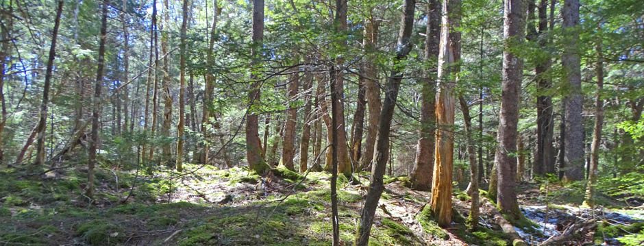
Forest Harvest Allocation Maps
These maps show locations of forest harvests on crown lands planned or conducted since September 30, 2014. When a new allocation is made, an Allocation Map is posted and is open for comment for 20 days. You can subscribe to receive notification of new allocations.* A Map Viewer launched in the spring of 2016 shows allocations for the whole province, and replaces the pdf-based harvest operation maps that the DNR launched in 2014. Unfortunately, there is no equivalent for private lands, which reflects the lack of any significant regulation or monitoring of cutting on private lands in Nova Scotia. *Examples
Once posted, the comment period is open for 40 days.
Note: Existing Parks and Protected Areas can be viewed as a layer on this map but not areas proposed that have not yet been protected. See Interactive map of Parks and Protected Areas (also listed below) to view those areas.
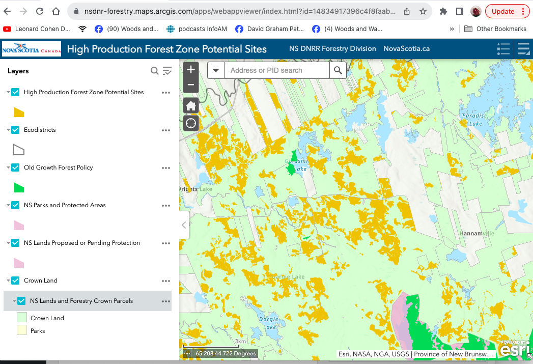
High Production Forest Zone Potential Sites
Newest Interactive Map, launched Feb 2023.
Calculating areas on HPF Maps
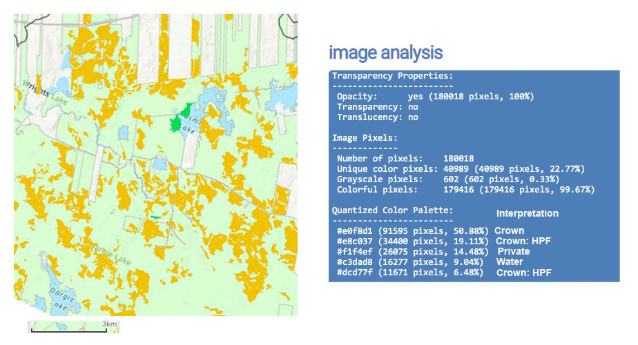
Color pallettes and estimates of % cover for a section* of the HPF Zone Potential Sites Map. *Goldsmith Lake & Environs
Click on image for larger version
I have made use of an online tool available at https://onlinetools.com/image/analyze-image to estimate areas of differently colured polygons.
An example: For this approx 100 sq kilometer area in the area of Goldsmith Lake in Annapolis Co, where Citizen Scientists have identified several stands of Old Growth forest and proposals have been made to formally significant areas (see NN on Old Forests) I estimated the area occupied by candidate HPF sites as 25.6%of the total area, 33% of Crown Land. The dark green area (Old Growth Forest Policy) required 10 color pallettes to be included and came in at 0.6% of total area, or 0.78% of the Crown land.
Pre-Treatment Assessment Reference Viewer
Currently (Apr 3, 2018) this provides Wind Exposure 2017; and FEC Soil Type Layers.
To view the Arc GIS version (for which you need user/pwd), go to this link
Nova Scotia Landscape Map Viewer
Convenient for viewing Crown lands, Protected Areas, Ecological land Classification and a lot more. This is a key tool for keeping track of forest management history, extent etc. It takes a while or quite a while to figure it out (at least it did for me; ongoing!). See Codes. Some of the codes I was able to find only in a Photo Interpretation Specifications.
View Help Page for the Provincial Landscape Viewer. Also ELC – Ecological Land Classification for some of the codes; another page with codes including tree species: Forest Inventory – Current Forest Data (Web Version- 2016)
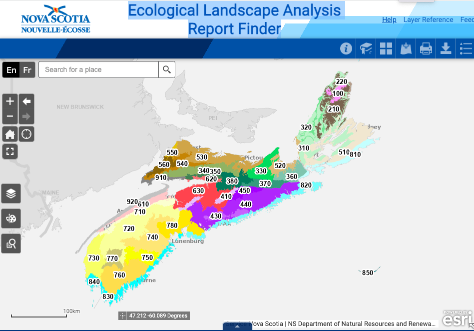 Ecological Landscape Analysis Report Finder
From the Help Document: The Ecological Landscape Analysis Report Finder web site provides users the ability to easily find and download information on an EcoDistrict. Simply click on the screen and follow the links in the pop-up dialog box to view and download PDF reports on the EcoDistrict.
Ta’n Weji-sqalia’tiek Mi’kmaw Place Names
“In 2010, Ta’n Weji-sqalia’tiek Mi’kmaw Place Names Digital Atlas and Website Project (formerly Pjila’si Mi’kma’ki: Mi’kmaw Place Names Digital Atlas and Website Project) was launched to document approximately 13,000 years of Mi’kmaw presence within Mi’kma’ki, the place of the Mi’kmaq, and to raise public awareness of this ancient history…To date, the research team has recorded approximately 1,500 place names collected through interviews with Mi’kmaw Elders and other knowledge holders…”