
Bath seagrass beds as mapped in 1969
“Seagrasses at Bath, including Thalassia testudinum, Syringodium filiforme and Halodule sp., lie partially in the lee of algal- and coral-encrusted rocks lying about 300 m offshore (Fig. 2).
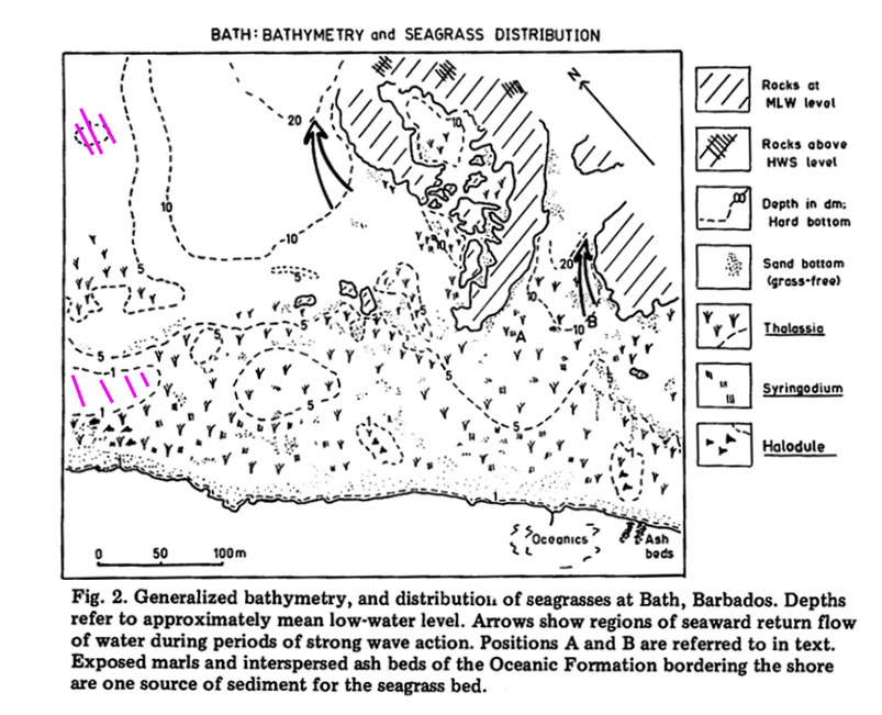
Generalized bathymmetry, and distribution of seagrasses at Bath as mapped in 1969. Note that the depth contours are in decimeters, so “1”=10 cm. “5” = 50 cm etc. The purple slashes are in hard rock areas exposed at lowest tides; these areas were popular in the past for harvesting “seamoss” (Gracilaria debilis).
“The seagrass bed has a complex topography and distribution of sediments as a result of the irregular topography of the bedrock, the complex wave regime, and prolific biogenic production of sediment of clay to cobble size. Mean tidal range is approx.O.7 m, and the diurnal range, 1.1 m (Lewis, 1960). The seagrass bed is shallow, and conditions are generally turbulent except for a few hours at low water. There are weak (0-21 cm/sec) currents associated with an overall northwesterly flow of water across the bed.
“In regions of strong seaward return flow of water (Fig. 2), currents reach speeds of 45 em/sec and greater. Waves over the seagrass bed are generally of the order of 30-60 em height at high water, and break over the entire seagrass bed area. During winter months when the east coast of Barbados is frequently subject to large swells, waves over the seagrass bed may reach heights of 1 m and greater, and longshore currents may reach speeds in excess of 60 em/sec.”