
Maps, GPX
Trail Map
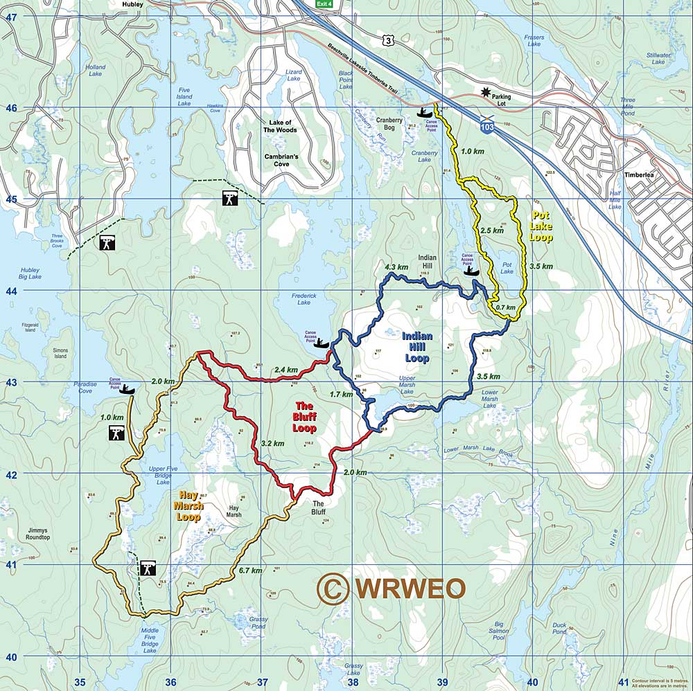 Trail Map. Click on image
 for larger version.  Alternative Map. Click on image for larger version. |
Click here for printable version. (9.5 x 7" at 200 dpi) Plan your excursion according to what you can cover comfortably during daylight hours, but carry enough to survive overnight in case of an emergency, also a cell phone. Click here for printable version of the alternative map. (12.5 x 12.5" at 200 dpi) |
Distances
Note that these distances will not correspond exactly with GPS readings since GPS readings do not take into account changes in elevation. |
Interactive Google Map
GPX Bluff Trail Data
full-bluff-trail
The Bluff Trail: Portages on and near the Bluff Trail
I have one of the portages represented as a route instead of a track and will try and get that fixed soon. - Paul Berry