Purcell's
Backlands
Links &
Recent News
About this site
Click Here for Recent News
(Latest: Oct 30, 2013)
|  |

|
This site is now archived.
PLEASE GO TO backlandscoalition.ca
for more recent news, information and perspectives
-David P, Feb. 10, 2014
NEWS: City sinks Purcells Cove water plan "Council voted [On Oct 29, 2013] 13-1 to table a feasibility study on servicing, which for all intents and purposes killed the notion."
LINKS
Latest addition: 24 Oct. 2013
- Our HRM Alliance Hotspots: Williams Lake, Purcell's Cove and the "Backlands"
The Alliance has identified five development HotSpots in HRM (including the Purcell's Cove Road Backlands) which exemplify how their Greenbelting Solution would help preserve natural areas, save the Municipality money and maintain recreational and cultural uses. This page provides an overview of the issues affecting the Purcell's Backlands.
 Williams Lake Conservation Company Williams Lake Conservation Company
This community-based organization maintains the dam at the outlet of Williams Lake and monitors important environmental variables affecting the Williams Lake watershed which includes Colpitt Lake. The impending development of the McCurdy Estate Lands to the south and east of Williams Lake is a major concern. They also have a Facebook Page.
- Purcell's Cove Neighbourhood Committee
"The Purcell's Cove Neighbourhood Committee (PCNC) exists to promote community development in our neighbourhood. This website gives us a way to share information."
- McIntosh Run Watershed Association
The upper part of the MacIntosh Run begins at the outflow from Long lake and goes through residential neighbourhoods. The lower part goes through the backlands and flows into the sea at Herring Cove. The Association has built an active transportation trail alongside the upper part of the run. They envisage extending the trail the entire length of the run, including a wilderness trail which would be "a rugged trail across the backlands to Herring Cove; the trail will be varied, in some places climbing along bedrock ridges, and in other places hugging the river's edge."
- Nova Scotia Public Lands Coalition: Proposed Herring Cove Backlands Wilderness Area
The Nova Scotia Public Lands Coalition proposed a Wilderness Area consisting of two parcels of public land. The smaller parcel, about 500 hectares, is nestled between the Herring Cove and Purcell's Cove roads just outside the city of Halifax [The "Purcell's Cove Road Backlands"]. The larger property, approximately 2,800 hectares, sits just west of the Herring Cove Rd.
- HRM: Planning and Engineering-Feasibility Study Final report July 2013
For several years, the core threat to the integrity of the Purcell's Backlands was the proposal for extension of sewage and water along Purcell's Cove Road. "In 2011, Halifax Regional Council requested staff to initiate a Planning and Engineering Study to determine the feasibility and costs associated with extending central sewer and water services along the Purcell's Cove Road to and including the community of Purcell's Cove." An HRM website now removed (Oct 30, 2013) archived relevant HRM documents from May 28, 2012 onwards. On Oct 29, 2013, "Council voted 13-1 to table a feasibility study on servicing, which for all intents and purposes killed the notion." See the News Page for some of the recent history of this issue. "Throughout this public consultation process, citizens across HRM have expressed their overwhelming desire to preserve the Backlands of Purcell's Cove and Williams Lake, so that there will be no loss of habitat in this critical watershed area."
- Purcell's Cove Backlands on Facebook
This peaceful wilderness area is located between Purcell's Cove Road and Herring Cove Road, from Williams Lake across to the Cove itself. For many generations, citizens of Halifax have enjoyed swimming, mountain biking and hiking in these Backlands....
- Geoffrey Grantham
Geoffrey lives in the Purcell's Cove area and has painted many of the landscapes in the backlands.
This site includes images of some of his wonderful work. He had a showing of Images from the Purcell's Cove Backlands at the Swoon Gallery in September, 2012.
- Geoffrey's Piggy Mountain Report
Geoffrey's essay on his hike to Piggy's Mountain, the highest point in The Backlands.
 Save Williams Lake - Video Save Williams Lake - Video
"Williams Lake Backlands is a beautiful nature area close to Halifax which is threatened by development. This video outlines a few of the values found there". Produced by Dal graduate students Danielle St Louis, Rory Henderson & Tori Ball, released Dec. 3, 2012. (5 minutes)
- A trail plan for the Wildlands: an area bounded by Herring Cove Road, Purcells Cove Road, and Williams Lake Road in Halifax, Nova Scotiaby Kevin Gerhardt Gray. Halifax, N.S. : Dalhousie University, 2005. 143 pp. Available as electronic resource from Dal Killam Library.
- Purcells Cove Conservation Lands
Page on the Halifax Field Naturalists (HFN) website. The PCCL, administered by the Nova Scotia Nature Trust, are the only formally protected lands in the Purcell's Backlands.
- Species List for the Purcell's Cove Conservation Lands: 2012 Update
The Halifax Field Naturalists conduct an annual biodiverity inventory for this protected area in collaboration with the Nova Scotia Nature Trust.
See also:
- Williams Lake Wildlands Birding Project
This document, posted on the Williams Lake Conservation Company website, is a 2012 report by Fulton Lavender of birds in the Williams Lake area. Forty-one species, including loons were confirmed to breed in the area, another 8 are likely; th�e o�b�s�e�r�v�a�t�i�o�n�s� s�u�g�g�e�s�t� a� b�u�s�y m�i�g�r�a�t�i�n�g c�o�r�r�i�d�o�r. He notes "I�t� �i�s� �m�o�s�t� �n�o�t�e�w�o�r�t�h�y� �t�h�a�t� �t�h�e� �h�i�s�t�o�r�i�c�a�l� �e�x�i�s�t�e�n�c�e� �o�f� �t�h�e� �W�h�i�ppor�w�i�l�l�,� �C�h�u�c�k�w�i�l�l�'s �W�i�d�o�w� �a�n�d� N�i�g�h�t�h�a�w�k� s�i�g�n�i�f�i�e�s� a� u�n�i�q�u�e� o�c�c�u�r�r�e�n�c�e�. T�h�e�s�e� g�o�a�t�s�u�c�k�ers� o�r� C�a�p�r�i�m�u�l�g�i�d�a�e� s�i�g�n�i�f�y� a� v�e�r�y� s�p�e�c�i�a�l� a�r�e�a� a�s� t�h�e�r�e� i�s� n�o� o�t�h�e�r� i�n� E�a�s�t�e�r�n� C�a�n�a�d�a�.�" �
- Backland Gardens (photos)
�The glacially scraped landscape of the Purcell's Backlands presents a mosic of habitats and species hard to match, especially in their beauty and serenity. On a not too sultry summer day (Aug 3rd, 2013), Nova Scotian nature nuts Nick H. and David P bushwhacked their way across the landscape in search of a Jack Pine swamp they had seen earlier in the year. (Jack Pine is unusual in a wetland setting.) �(�Photos by D�a�v�i�d� �P�.��)�
- Heathy Hues (photos)
Fall scenes from the backlands by Williams Lake (Oct 22, 2013)
- Summer Day on Lower Mac Run (photos)
A� �b�i�t� �b�e�y�o�n�d� �Y�o�r�k� �R�e�d�o�u�b�t� �h�e�a�d�i�n�g� �t�o�w�a�r�d�s� �H�e�r�r�i�n�g� �C�o�v�e� �o�n� �P�u�r�c�e�l�l�'�s� �C�o�v�e� �R�o�a�d� �t�h�e�r�e� �i�s� �a� �"�F�i�r�e� �R�o�a�d�"� �o�n� �t�h�e� �r�i�g�h�t� �t�h�a�t� �g�o�e�s� �i�n�t�o� �c�r�o�w�n� �l�a�n�d� �a�n�d� �t�h�e� �P�i�n�e� �I�s�l�a�n�d� �P�o�n�d�s�.� �I� �h�a�v�e� �h�i�k�e�d� �t�h�e�r�e� �o�f�t�e�n�,� �t�h�r�o�u�g�h� �s�p�e�c�t�a�c�u�l�a�r� �b�a�r�r�e�n�s�,� �b�o�t�h� �b�e�f�o�r�e� �a�n�d� �a�f�t�e�r� �t�h�e� �f�i�r�e� �o�f� �2�0�0�9�,� �o�n�c�e� �o�n� �t�h�e� �l�a�k�e�s� �i�n� �w�i�n�t�e�r�.� On Aug.7, 2013, �I� �w�e�n�t� �t�h�e�r�e� �w�i�t�h� �m�y� �n�e�w�l�y� �a�c�q�u�i�r�e�d� �F�a�s�t�T�r�a�c�k� �k�a�y�a�k� �t�o� �r�e�a�l�i�z�e� �a� �l�i�t�t�l�e� �d�a�y� �d�r�e�a�m�:� �d�o�i�n�g� �i�t� �b�y� �w�a�t�e�r�.� �I� �e�n�j�o�y�e�d� �s�o�m�e� �b�e�a�u�t�i�f�u�l� �w�e�t�l�a�n�d�s� �a�n�d� �r�e�f�r�e�s�h�i�n�g�,� �b�r�o�w�n� �(�b�u�t� �c�l�e�a�n�)� �w�a�t�e�r�.� �(�Photos by D�a�v�i�d� �P�.��)�
- Piggy Mountain
Photos on Oct 15, 2013 include a 360o panorama. �(�Photos by D�a�v�i�d� �P�.��)�
- Williams Lake, at the Wildland-Urban Interface
Panoramic view of Williams Lake from the Backlands on Oct 4, 2013
(Photos by David P)�
- Regeneration of Forest and Barrens after the Spryfield Fire of April 30, 2009

Serene Mediterranian Landscape (jack pine/huckleberry) on Halifax south mainland: ripe for burning, not building!
Click on photo for larger image.
|
|
A set of photos illustrates the regeneration of vegetation over 16 months after an intense fire swept through forest and barrens in the vicinity of Spryfield, Nova Scotia on April 30, 2009. The fire destroyed twelve homes. The photos are from two areas: the Purcell's Cove Conservation Lands, and on crown land in the vicinity of Lower Mud Pond. This landscape is particularly fire-susceptible and supports a unique plant community adapted to recurrent fires.
|
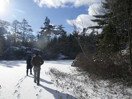 | Photos on January 22nd and 24th, 2013.
A wonderful place to enjoy winter! |
- A Tail of Two Trails
Report on two hikes into Purcell's Cove Backlands (PCCL, Aug. 25 and Williams-Colpitt Lakes, June 1, 2012) for the Halifax Field Naturalist
- Landscape Panorama from a high point in the Williams-Colpitt Lakes Backlands
This 360 degree panoramic view gives a sense of the extent of this pocket of wilderness, also of it's situation within a larger urban area and of creeping encroachment by concrete and asphalt. Photos on Aug. 25, 2012.
- Landscape in Transition
A panoramic 360 degree view of a landscape in the process of transition from a wild to a domesticated state. Assembled from photographs taken on Nov. 1, 2011 above Colpitt Lake on Halifax mainland south.

- Pine Island Ponds Loop canoe trip: the report
A report by Dusan Soudec of Canoe-Kayak Nova Scotia on this canoe route through the lower MacIntosh Run (Aug 14, 2010)
- Protected Areas & Parks on the Chebucto Peninsula
Map on the WRWEO website shows Protected Areas, Parks, Crown Land (including Crown Land in the Purcell's Backlands) on The Chebucto Peninsula and potential connectivity between these areas.
More links to be added (maps, photos from Lower Mac. Run, News items…)
- David P. Sep. 16, 2012.
|
