 |
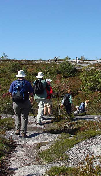
When we enter the Five Bridge Lakes Wilderness Area (FBLWA) , perhaps via the Bluff Trail or the Old St. Margarets's Bay Road, or paddling a lake, we encounter a varied landscape of lakes, streams, rivers, drumlins, erratics, mixed, deciduous and coniferous forest, bushland, rocky barrens, swamps, fens and bogs. The description of this landscape and the interpretation of "how it came to be" is the business of "natural history". This set of web pages provides a brief overview of the natural history of landscapes of the FBLWA.
The Five Bridge Lakes Wilderness Area lies about 20 kilometers west of downtown Halifax, Nova Scotia. It encompasses almost 10,000 hectares of crown land located in the centre of the Chebucto peninsula between highways 103 and 333. Efforts have been made since the mid-1990's to protect parts or all of the crown lands in the FBLWA. These efforts came to fruition in October of 2009, when the Minister of Environment for Nova Scotia declared the Five Bridge Lakes Wilderness Area to be a Candidate Wilderness Area under the Nova Scotia's Wilderness Protection Act. The final designation occured in October of 2011.
The photographs and diagrams in this set of web pages were initially assembled for a presentation at the AGM of the Woodens River Watershed Environmental Organization in February of 2010.
I thank Richmond Campbell, Ralph Weadon, Beth McGee, Nick Hill and Dr. Ian Spooner at Acadia University for contributing in various ways to my understanding and appreciation of the Five Bridge Lakes Wilderness Area. Any errors are mine. Comments and corrections welcomed. Please send those to davidgpatriquinATyahoo.ca. Please put "FBLWA Landscapes" in the subject line.
- David Patriquin
Use of the Materials :
Please see Creative Commons License
| | 1
3
4
5
6
7
8
9
10
11
12
13
14
15
16
17
18
19
20
21
22
23
24
25
26
27
28
29
30
31
32
|

