|
Home | Why Protect | Photos | Panorama
Frederick Lake Peninsula: Photos illustrating
Click on Photos for Larger Versions |
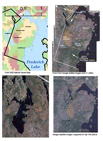 | Panel shows: Top Left: Natural Values and crown land bounday (NSE Map) Top Right: Google Satellite Image (Oct 31, 2005) with major vegetation features indicated Bottom Left: Smaller scale view showing all of Frederick Lake and limited housing currently Bottom Right: Waypoints for April 13, 2010 observations |
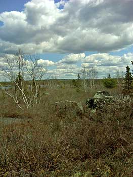
The Fen

 |
Top Left: Fen viewed from WP 007 (on crown land) looking SE towards the Oak Drumlin (on private land) Bottom Left: Fen viewed from WP 028 (near its southern extremity) looking NW Below: DNR data . 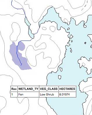
|
The Oak Drumlin
 On the oak drumlin, Apr. 13, 2010 (fog in background). |
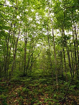 On the oak drumlin, July 28, 2011 | See More Photos on July 28, 2011 |

|
Looking towards Oak Drumlin from Barrens area to the northeast of the drumlin. Note low boggy area,
GPS Latitude : N 44 deg 39' 8.52" GPS Longitude : W 63 deg 47' 29.52" (44.652367,-63.791533) Close to WP 018 on map GPS Altitude : 93.61953885 m GPS Img Direction Ref : True North GPS Img Direction : 276.5358476 |
View towards The Bluff Trail from eastern side of drumlin
 |
Looking across
Frederick Lake towards Indian Hill GPS Latitude : N 44 deg 39' 8.72" GPS Longitude : W 63 deg 47' 28.29" (44.652422,-63.791192) Close to WP 018 on map GPS Altitude : 96.80889517 m GPS Img Direction Ref : True North GPS Img Direction : 62.49576632 |
Fir/Black Spruce/Red Maple Swamp
 |
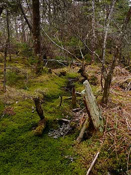
| Left: About 50 m in from the fen, water appears to be moving over a large area below Sphagnum moss Right: beginnings of open water flowing towards Frederick Lake |
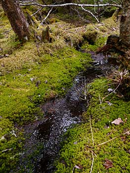 |

| Both: Larger open streams Right: WP 026 on map GPS Latitude Ref : North GPS Latitude : W 44 deg 38' 50.07" GPS Longitude : N 63 deg 47' 40.04" GPS Altitude : 88.15872349 m GPS Img Direction Ref : True North GPS Img Direction : 119.96415 |

Large trees (> 12 inches dbh) were common in the Fir/Spruce/Maple Swamp, also snags, fallen dead.
Portage Route


Looking north (left photo) and east (right photo, with portage sign) from the lower of the two ponds (small lakes) in the waterway flowing from Frederick into Indian Hill Lake. This pond is on the private poperty.

Second part of the portage route, here on crown land.
Shoreline
Photos on April 22, 2010
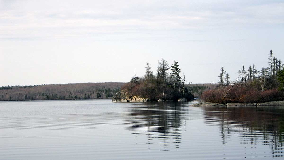
Looking south along headland of Frederick Lake Peninsula
as you come out of Cambrian Cove
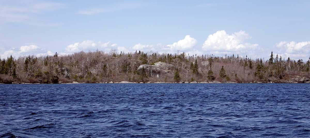
Frederick Lake Peninsula shoreline