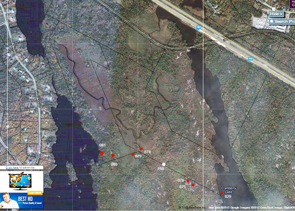
Dusan Soudec of Canoe Kayak Nova Scotia provided the following waypoints and observations:
WP 029 -- 44 39.349 N, 63 46.120 W Crown boundary marker on western shore of Cranberry Lake, feet away from landing.WP#50 was taken on Nov. 21, 2011 at the location of a short boardwalk (see Maps & Photos Page).WP 075 -- 44 39.373 N , 63 46.262W Portage reaches illegal ATV trail along ridge. It then follows it to the right, i.e. northward.
WP 076 -- 44 39.390N, 63 46.288W Flat unnamed summit and great lookoff. Portage passes by and descends around steep cliff to the right of summit and enters hardwood forest..
WP 078 -- 44 39.494N, 63 46.516W. Crown boundary marker, portage veers to the left and continues through woods. It follows the boundary line closely on both sides of marker.
WP 079 -- 44 39.481N, 63 46.563W. Portage reaches open area of an arm of Cranberry Bog. Significant wet spot, makeshift bridge. Portage cuts across bog towards Frederick Lake.
WP 080 - 44 deg 39.481'N, 63 deg 46.663' W. Portage climbs out of bog and onto low granite ridge which forms the eastern shoreline of Frederick Lake. At this point it joins a footpath along the ridge and follows it briefly to the right, i.e. north. it the veers off to the left towards the Frederick Lake landing. Excellent huckleberry grounds in this area!
WP 081 -- 44 39.491N, 63 46.724W. Excellent landing and end of portage on scenic Frederick Lake.