About WRWEO
WRWEO (pronounced "ree-oh") is an organization of volunteers who have been carrying out action projects to protect and improve human and natural environments throughout the Woodens River watershed since 1995.
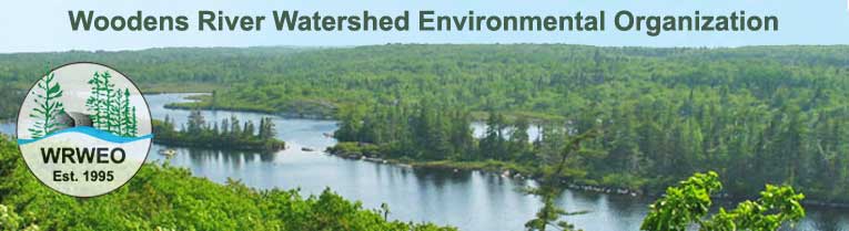
This watershed includes all land, habitations and streams that drain into the Woodens River system. The headwaters lie in the region of the Hubley exit (exit 4) on Highway 103, twenty kilometers west of peninsular Halifax. From there, a set of 19 connected lakes flow southwest across the Chebucto Peninsula into the Woodens River and finally into St. Margaret's Bay at Woodens Cove in Seabright, a distance of approximately 20 kilometers. The total area of the watershed is approximately 65 square kilometers. It includes large tracts of close-to-pristine wilderness, as well as recent and older settlements. (View Map.)
)
Our community-based watershed management approach has involved:
- sponsoring public events higlighting conservation issues related to the Woodens River watershed
- negotiating with developers and government
- constructing and maintaining a set of wilderness hiking trails (32 km in total)
- studying & contributing to scientific information about the area
- remedial work
- cooperating with related organizations.
The Bluff Wilderness Hiking Trail was rated as one of the 8 best urban escapes in Canada by Explore: Canada's Outdoor Magazine (May '08).
We invite visitors to the website to explore our watershed and to consider supporting our efforts to protect it. Annual membership fees are only $10, but those funds are important to us and a large membership speaks for the cause. There are many other ways you can participate, e.g., join an event, write an article, contribute some photos, join a committee…
Please explore this website to learn more about our watershed and our efforts to protect it.