The Dyke-Walled Mill Pond
Possible Aboiteaux on the Triangular Shaped Mill Pond

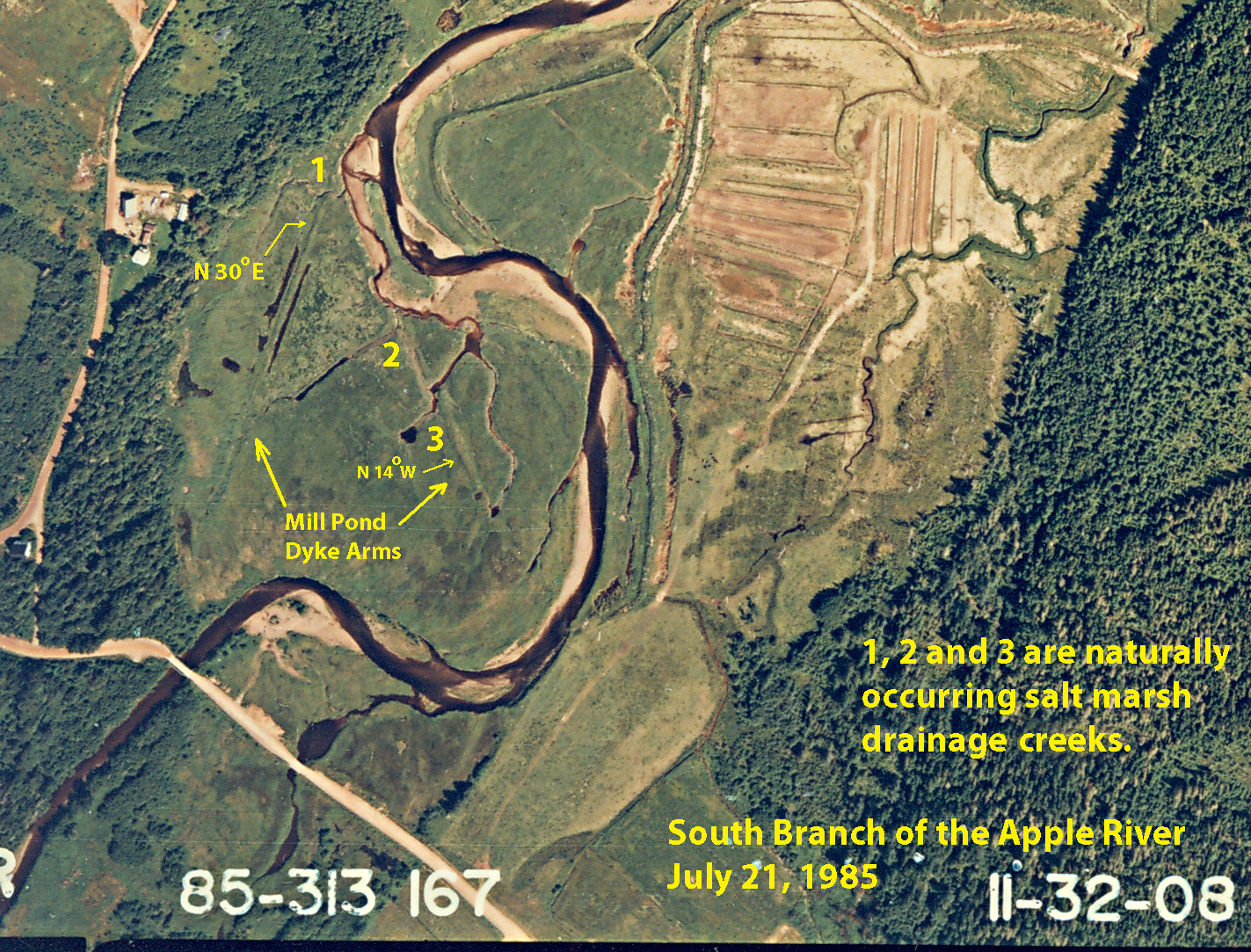
Fig.1
|

Fig.2
|
As mentioned in the section “Coastal Landscape, Mill Owner's Rights and Public Rights of Free Passage on a River”, a mill owner had the right to
construct a mill on a waterway as long as the mill’s permanent dam did “not interfere with the rights of others to use the streams for
lawful purposes.” “Since 1786 the use of streams for floating purposes had been declared to be a public right” (See A History of Water Power Legislation and Administration in Nova Scotia located in Department of the Interior's Water Resources Branch records (RG 89, volume 528), Library and Archives Canada).
The Elderkin family, who built and owned the water powered sawmill on the South Branch of the Apple River solved the Public Right of Free Passage
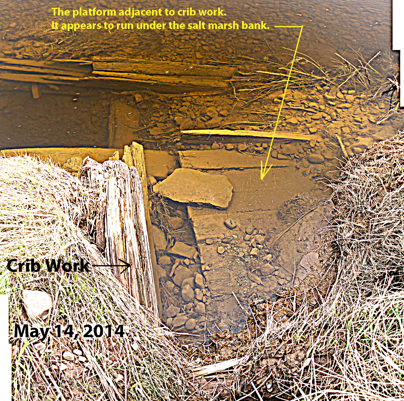
on a River by placing the mill’s permanent dam on a salt marsh adjacent to the river (select the above thumbnail). As well, the Elderkin family would use the river for floating
purposes because they owned most of the South Branch’s heavily forested river valley. This river valley would most likely be the source of the logs for the mill.
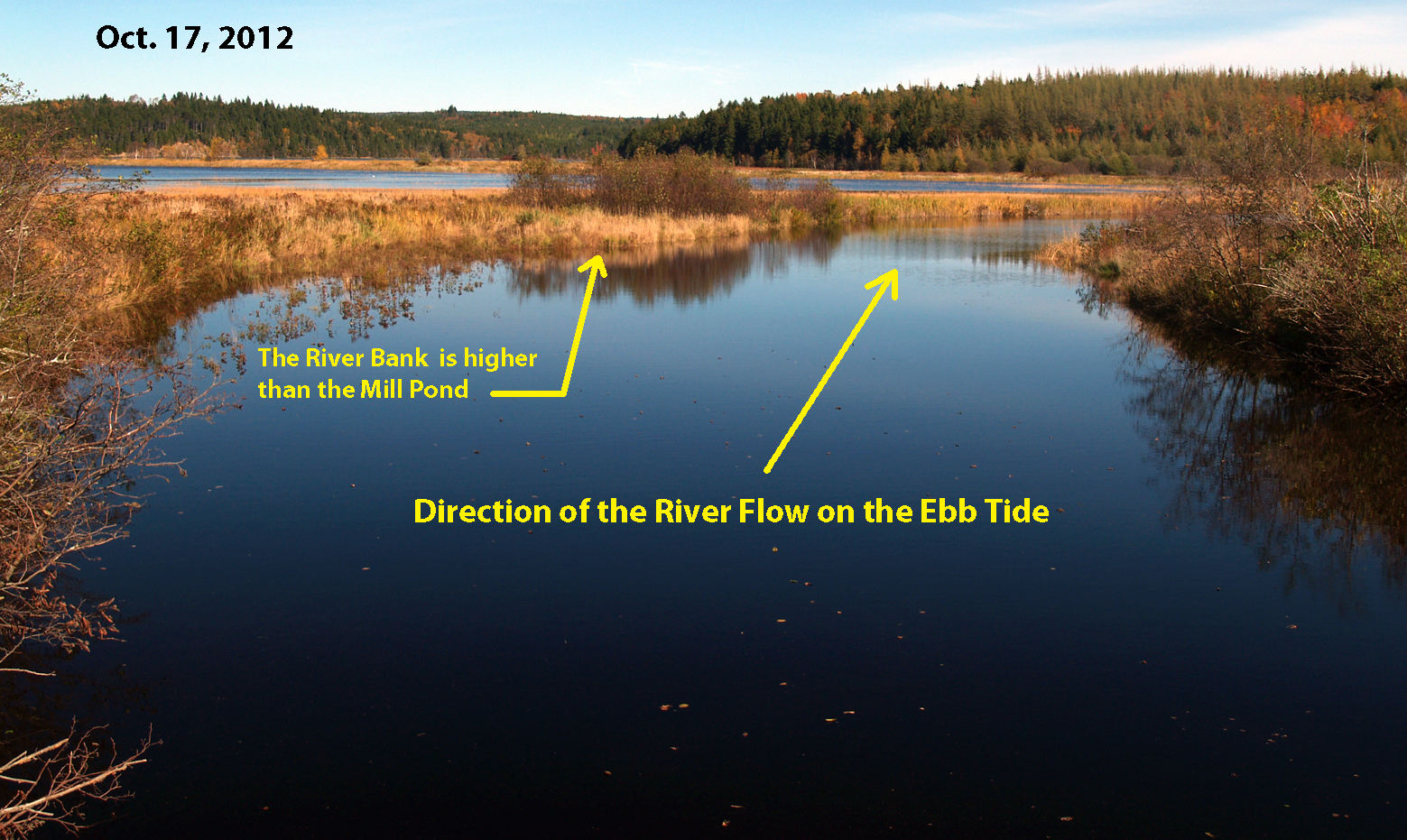
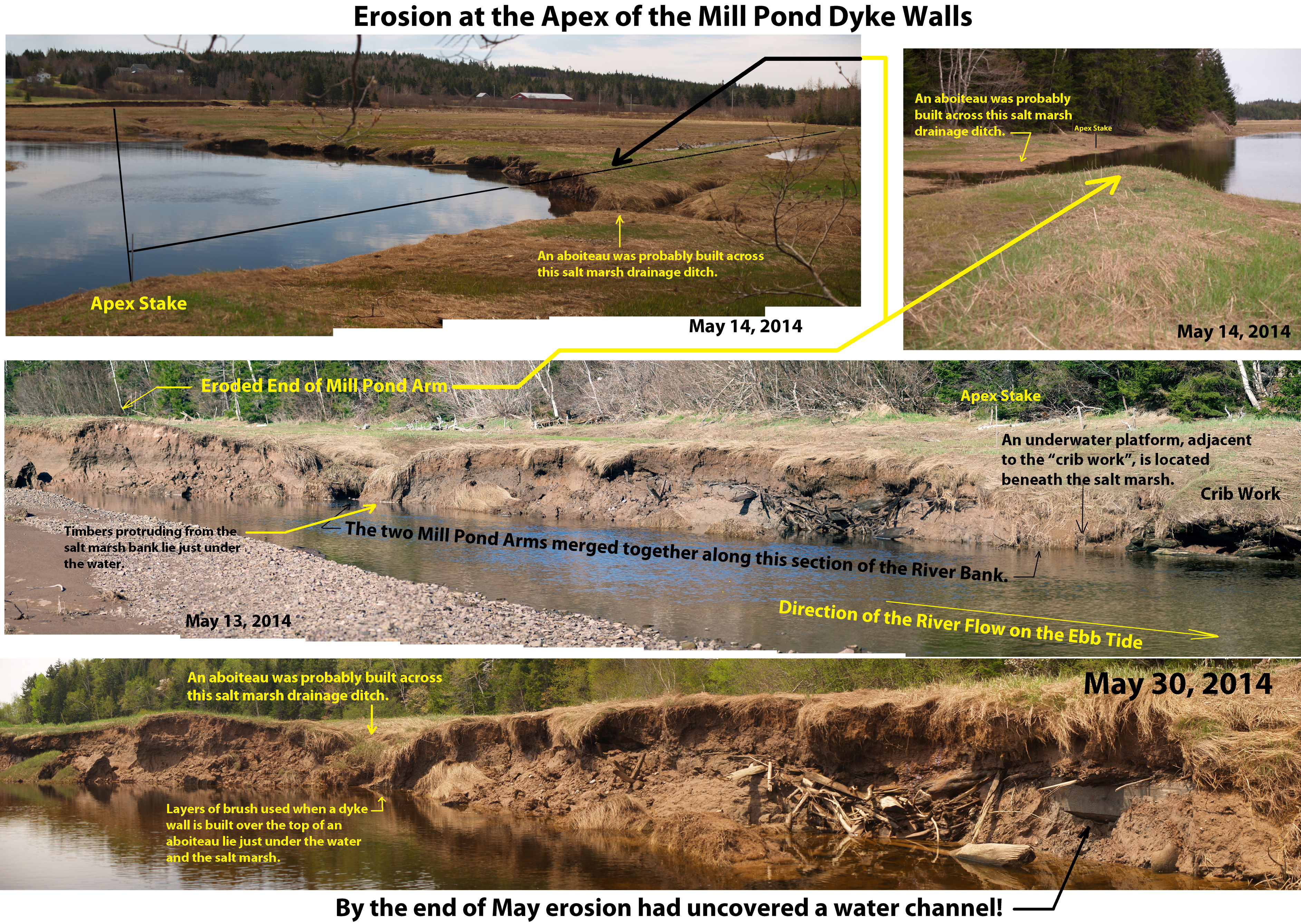
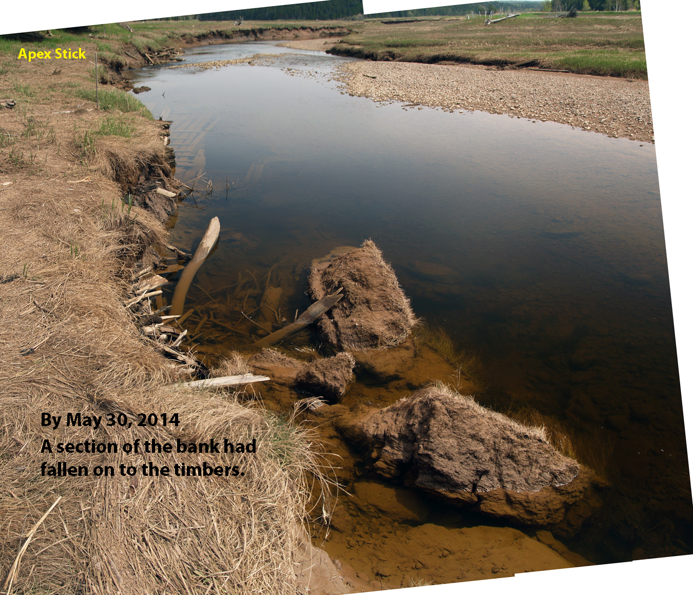
The mill pond, shown by selecting the above thumbnail in Fig.1, is triangular in shape and consists of two dyke walls that converge to form an Apex at number 1 marked on the
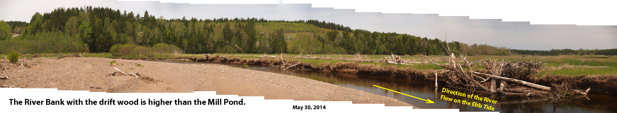
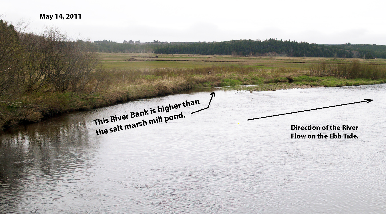
photograph. The broad bottom of the triangle is actually a ridge of upland that is significantly higher than the salt marsh and therefore forms a natural containment wall for
the mill pond.
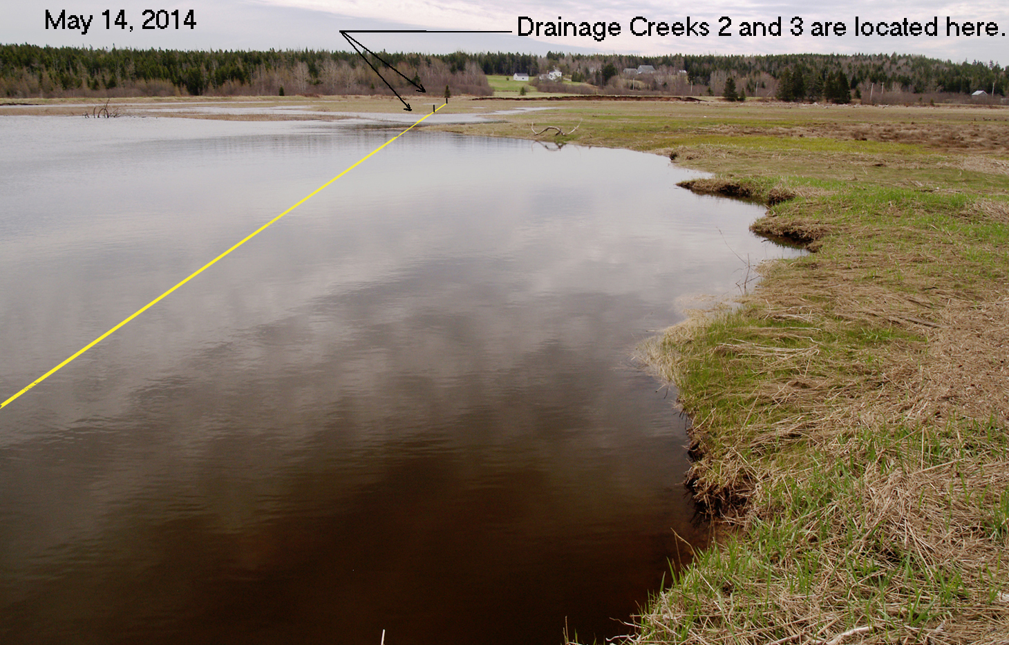
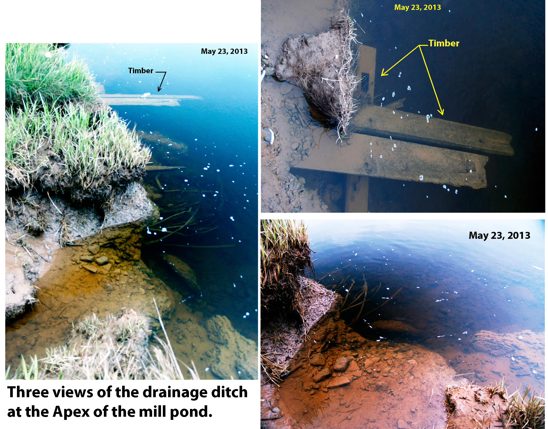
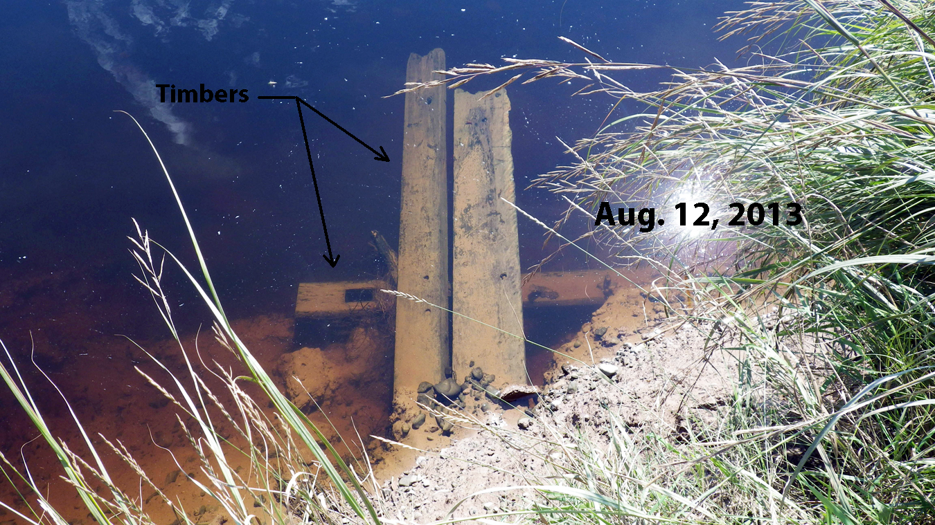
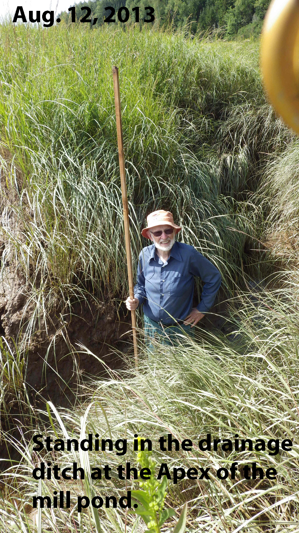
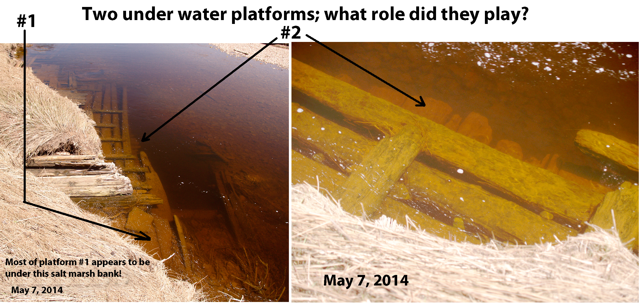
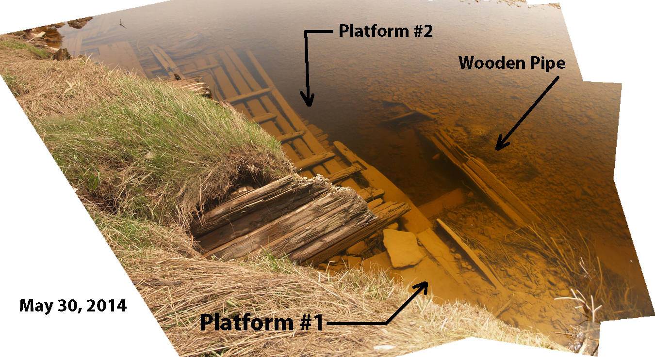
The thumbnail in Fig.1 shows three naturally occurring salt marsh drainage creeks, marked 1, 2, and 3, crossing the mill dam. It is possible that an aboiteau, to keep
the tide from flooding the
marsh to the left of the mill pond, was built across creek 1. It is also possible that a reverse aboiteau was constructed across creeks 2 and 3. These two conduits
with
their one way valves would allow a rising tide to flood the mill pond and then prevent the mill pond from draining when the tide was on the ebb.
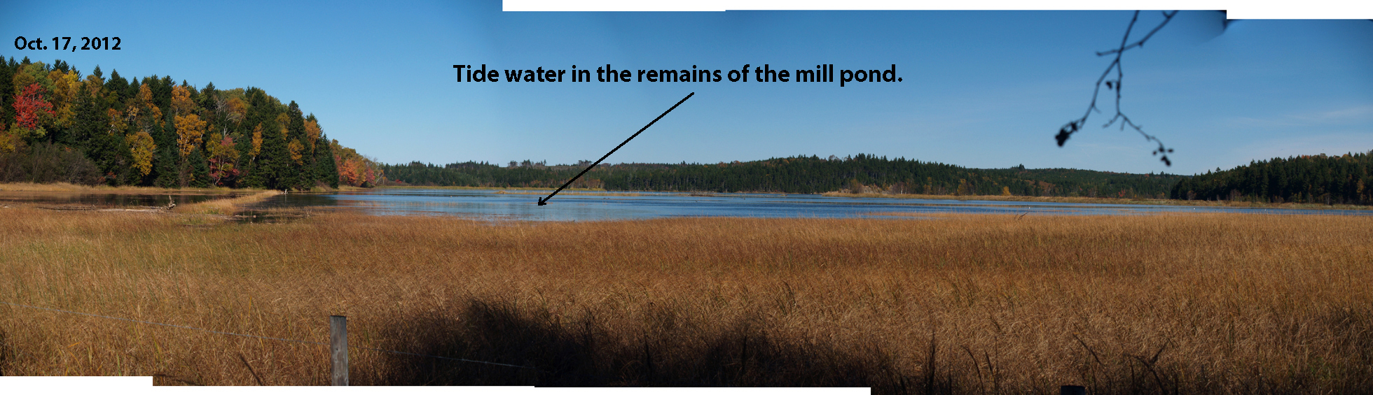
Today, the salt marsh on which the mill pond is built is only flooded by spring tides and spring tides only occur on a few days each month. Each flood tide brings
silt that is deposited on the marsh and as a result the marsh grows vertically upward. This process can only continue when sea level is rising and data from tide
gauges show that recently sea level in the Bay of Fundy has been rising about 30 cm every one hundred years. Therefore, the original depth of the mill pond is
unknown and possibly it received tide water for a few days each month from spring tides and river water, delivered by means of a sluice, during neap tides.
|