
| Yellow arrows are wildlife corridors between wild lands within the peninsula. Red arrows are wildlife corridors between the peninsula lands and the greater mainland. These corridors are somewhat arbitrarily identified examples of the kinds of connections that need to be established and protected to maximize the long-term species carryng capacity of all wild lands on the Chebucto Peninsula. One-hundred meter wide protected riparian zones along all waterways would also be appropriate, providing corridors for terrestrial flora and fauna and protecting the waterways themselves which are corridors for aquatic biotia. ("Wild Lands" include Crown land, Protected Wilderness Areas, Provincial and Municipal Parks & lands protected through the Nova Scotia Nature Trust.) Note that a large chunk of the "Proposed Five Bridge Lakes Wilderness Area" was designated under the Wilderness Protection Act in 2011. Corridors identified in a municipal/provincial planning process are shown in the map below |
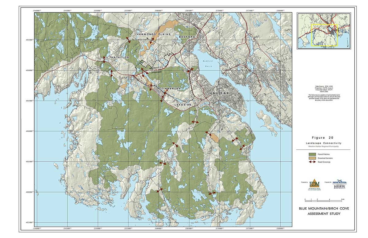
| Fig 20 in Appendix B8 of the Focus Report for the Proposed Highway 113 Class I Environmental Assessment. March 2006
http://gov.ns.ca/nse/ea/highway113.asp (accessed Mar 7, 2010)
Appendix B is the BLUE MOUNTAIN/BIRCH COVE ASSESSMENT STUDY Final Report, March 2006. Prepared for: Halifax Regional Municipality. Nova Scotia Department of Transportation and Public Works. Nova Scotia Department of Department of Natural Resources. Prepared by: EDM (Environmental Design and Management Ltd). Available at http://gov.ns.ca/nse/ea/highway113/Hwy113_app_b1.pdf (accessed Mar 7, 2010) Figure 20 is in Appendix B8 at http://gov.ns.ca/nse/ea/highway113/Hwy113_app_b8.pdf (accessed Mar 7, 2010) |