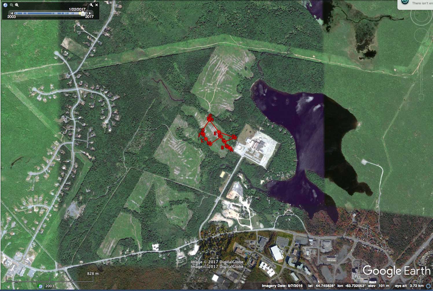
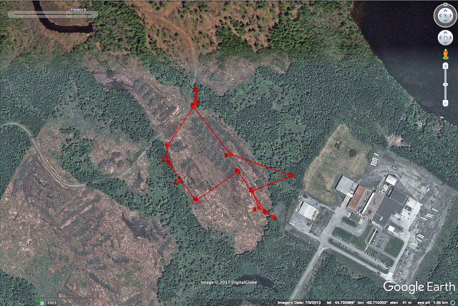
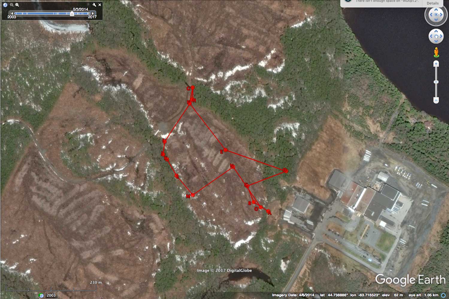
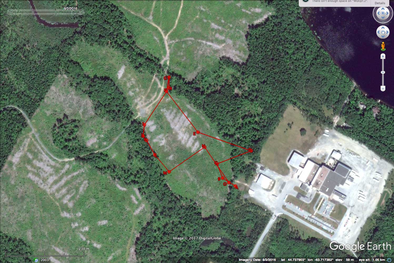
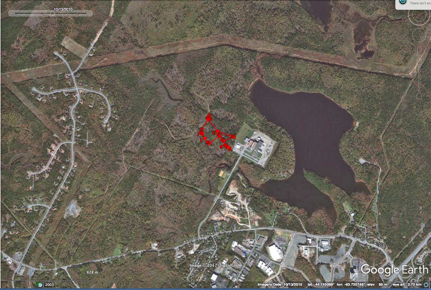
Google Earth Images showing clearcuts by
Sandy Lake 2004/5 to 2016/7
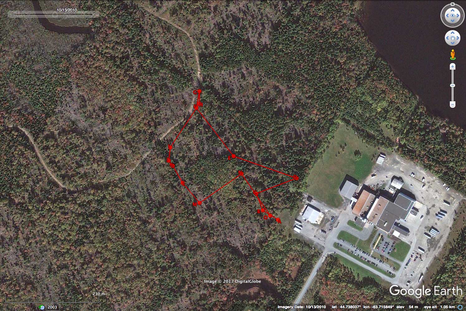
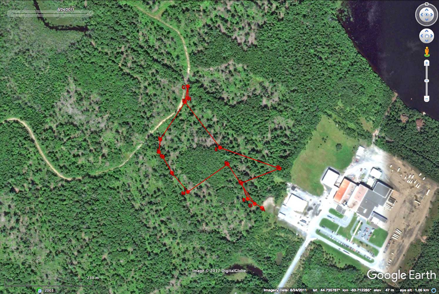
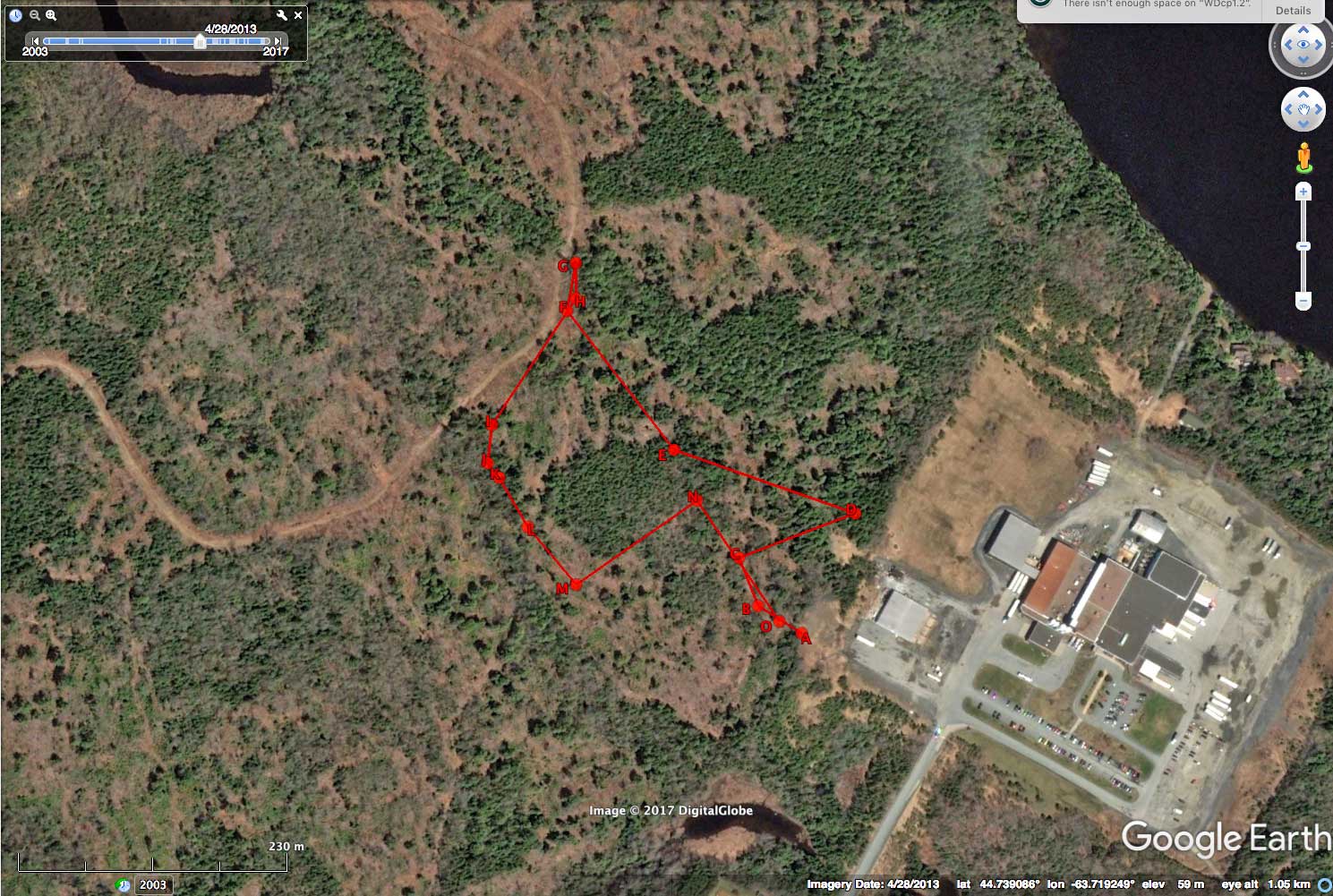
Track is route of June 21, 2017
Roads and some initial cutting occurred between 2005 and 2010.
The big cuts ocurred fairly quickly in 2013
Click on images for larger versions
Depending on browser configuration, you may have to click 2X for the full version.
2005 Sep 7

2010 Oct 13
2011 Aug 24
2013 April 28
2013 July 3
2014 April 6
2016 Aug 2
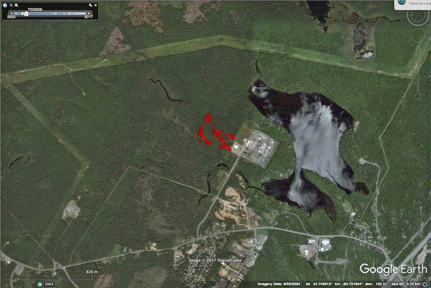
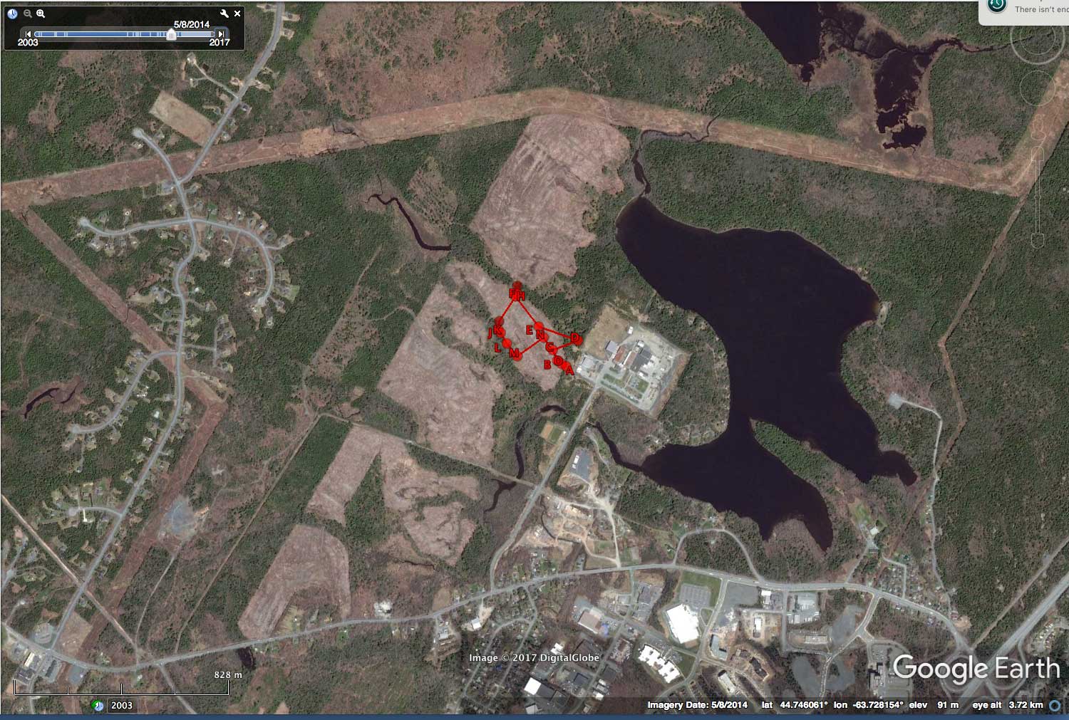
The Larger Area:
(These views also illustrate a new development in the watershed.)
2004 Sep 25
2010 Oct 13
2014 May 8
2016 Aug 7