Blue Mountain/Birch Cove Lakes
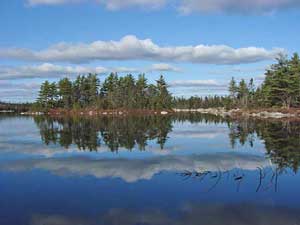
Public input is being received up to August 22, 2008. Go to the Nova Scotia Dept. Environment consultation page to see some relevant documents and to obtain a form for submitting comments. Recent History In HRM we are very fortunate to have access to quasi-wilderness areas within minutes of the downtown area. One of those is the Blue Mountain-Birch Cove Lakes Wilderness Area. For several years, the Nova Scotia Public Lands Coalition led a campaign for protection of this area. Natural features of the Blue Mountain-Birch Cove Lakes Wilderness Area cited by the Nova Scotia Public Lands Coaliton include:
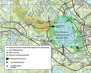
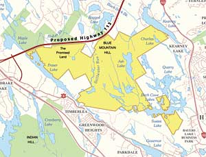
In October, 2007, the N.S. government designated crown land occupying 1350 hectares in the central and western part of the proposed park to be a "candidate wilderness area" (Map 2 at left); it included "The Promised Land" - Resource/Corridor land east of the proposed Highway 113 that had not been envisaged as formally part of the Park in HRM's initial plan (Map 1). If accepted, the wilderness area will have a high level of protection under Nova Scotia's Wilderness Areas Protection Act. While it seems very likely that the crown land will be protected, there are continuing pressures on immediately adjacent land. Developers have acquired much of the proposed park land to the east and southeast of the crown land. Until those lands are actually purchased or otherwise protected (e.g., through easements), as envisaged in the Regional Plan, development pressures will continue to threaten the ecological integrity of the area at large. Plans to build or for leaving options open to build Highway 113, an approximately 10 km stretch on the west side of the park that would connect Highways 102 and 103, also remain on the table. This highway would increase border effects on the wilderness area and could seriously interfere with movement of wildlife between the Chebucto Peninsula and the greater mainland. The N.S. Dept. of Transportation and Public Works submitted a Focus Report for Highway 113 to the Minister of Environment and Labour on March 31, 2006. After review and public input, the Minister requested (July 13, 2006) an Environmental Assessment Report by October 16, 2008; that has since been extended to October 16, 2009. |