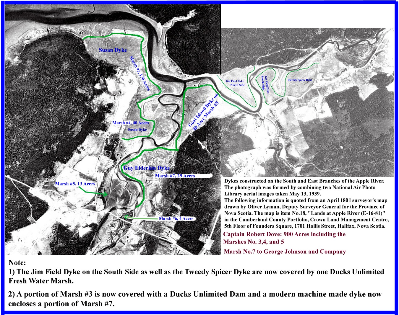
Dykes on the Apple River Marshes.
1939 Aerial Photograph of the Apple River Marshes
Large version of aerial photograph.
Source: National Air Photo Library, Ottawa
Copped 1801 Surveyor's Map: Dykelands at Apple River.
Top of map showing junction of the East and the West Branches of the Apple River.
Bottom of map (Edgett's Beach) showing Hugh Pudsey's Dyke. An 1895
deed uses the terminology
"Cranberry Dyke on the Pudsey Marsh".
The dyke at Edgetts Beach today.
Dyke on the North Side of the East Branch of the Apple River.