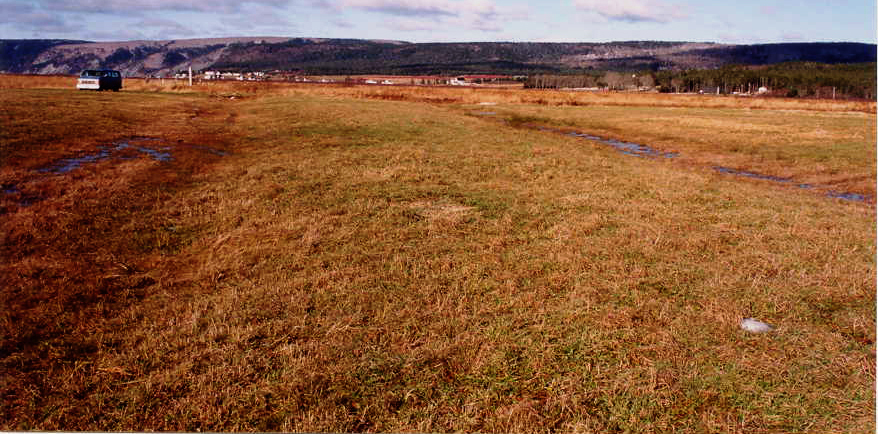
For dykeland agricultural to be successful effective drainage methods must be used. The Acadians improved the drainage of flat sections of their dykelands by using a special plowing procedure to construct a landform called dales (Bleakney 2004, p.78-80). Dales are long narrow rows of parallel ditches approximately 30 feet apart. The marsh between adjacent ditches is crowned to allow water to flow into the ditches that flank the crown (see Fig.1).
Sherman Bleakney, in a private communication, believes that the presence of dale and dale ditches “implies crops, not hay. In dykeland agricultural research dale and dale ditches are therefore important landscape features to be located. This can be done by walking over the surface of a dyke- enclosed the salt marsh or by carefully examining aerial photographs for parallel lines.
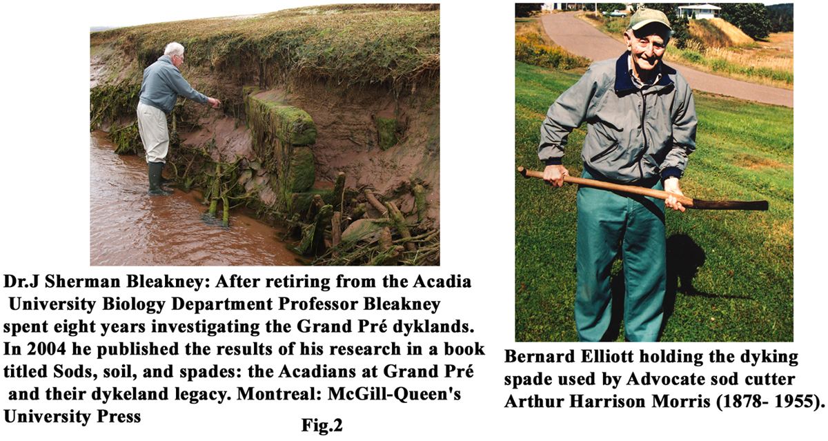
When Bernard Elliott was asked if a particular drainage method was used on the Advocate marsh he replied; yes we used dales. He also stated that "we used a special marsh plow for creating the dales. It was a Frost and Wood #6 plow and was much larger and heaver than a regular farm plow. One could bolt on a special knife to extend the cutting range and when this plow cut through the roots of black rush (Juncus gerardii ) a snapping noise occurred.” Sherman Bleakney provided the following comment on Mr. Elliott’s special marsh plow.
"The plow information is very interesting, and is news to me. No one I interviewed mentioned anything about special plows, nor about attaching a special KNIFE BLADE. The knife reference is not unexpected as the dykeing sod spade also is a knife, so your new fact ties in well with the problems of attempting to plow through the root matrix of a newly enclosed parcel of tidal marsh grasses. Congratulations for discovering this gem of historic information".
Hatvany, Matthew G. (2002). The Origins of the Acadian Aboiteau: An Environmental-Historical Geography of the Northeast. Historical Geography 30, Also available at http://www.historical-geography.net/volume_30_2002/hatvany.pdf.
Hatvany, Matthew George. 2003. Marshlands : four centuries of environmental change on the shores of the St. Lawrence, Aboiteaux of Kamouraska. Sainte-Foy, Quebec : Presses de l'Université Laval.
Rippon, Stephen. 2000. The transformation of coastal wetlands : exploitation and management of marshland landscapes in North West Europe during the Roman and medieval periods, British Academy postdoctoral fellowship monograph. Oxford ; New York: Oxford University Press.
Rippon, Stephen, Nigel Cameron, and Council for British Archaeology. 2006. Landscape, community and colonisation : the north Somerset levels during the 1st to 2nd millennia AD. York: Council for British Archaeology.
Sebold, Kimberly R. (1992) FROM MARSH TO FARM: The Landscape Transformation of Coastal New Jersey. National Park Service, [cited 7 July 2010. Available from http://www.nps.gov/history/history/online_books/nj3/contents.htm.