Maps
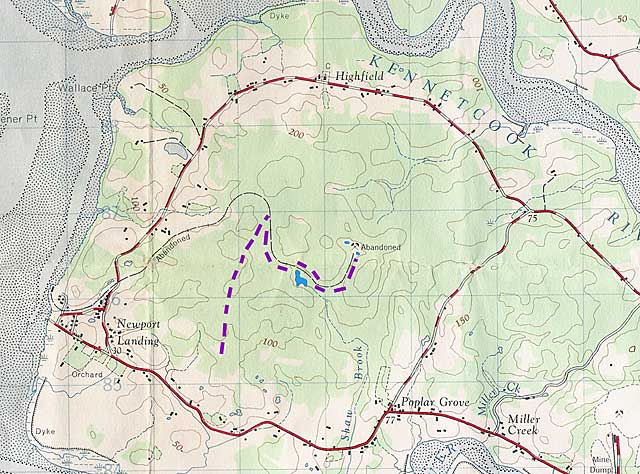
Avon Peninsula on 1:50000 scale map.
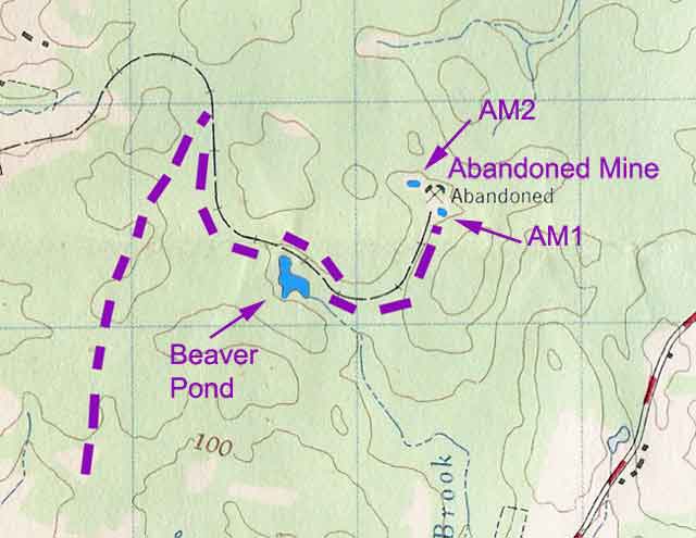
Close-up of hike route. The location of the trail up to the rail bed is aproximate.
The "Old Old Mine" is the mine that was abandoned about 85 years ago.
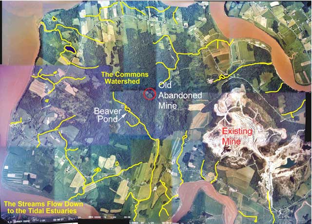
Composite aerial view showing showing locations of streams. (From the APWPS website)
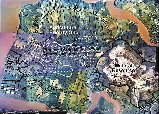
Composite aerial view with an overlay of the proposed mine and spill area. (From the APWPS website)